
Thomaston in Marengo County, Alabama — The American South (East South Central)
Thomaston Cemetery
Marengo County
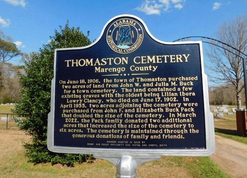
Photographed by Jimmy Emerson, March 22, 2025
1. Thomaston Cemetery Marker
Erected 2023 by Alabama Historical Commission, Bobby and Peggy Pritchett and Wayne and Cheryl Smith.
Topics. This historical marker is listed in this topic list: Cemeteries & Burial Sites. A significant historical date for this entry is June 18, 1906.
Location. 32° 16.43′ N, 87° 36.864′ W. Marker is in Thomaston, Alabama, in Marengo County. It is at the intersection of Persimmon Place and County Road 53, on the right when traveling north on Persimmon Place. Touch for map. Marker is at or near this postal address: 598 Persimmon Place, Thomaston AL 36783,
this page online

Regionally, this marker is in the American South, specifically in the Deep South, and in the Black Belt. Globally, it is in North America, a Gulf of Mexico state, the Western Hemisphere, the Western World, and the Anglosphere. Historically, it finds itself in what was once New Spain, the territory of the Mississippian Culture, one of the Confederate States of America, and the Antebellum South.
Other nearby markers. At least 8 other markers are within 8 miles of this marker, measured as the crow flies: C.S. Golden House (approx. half a mile away); Thomaston Baptist Church (approx. 0.7 miles away); History of the Town of Thomaston (approx. 0.9 miles away); Thomaston Colored Institute (approx. 0.9 miles away); Holt Cemetery (approx. 3.3 miles away); Bethel Baptist Church & Cemetery (approx. 4.7 miles away); Bethel Hill Missionary Baptist Church (approx. 5 miles away); Paulling Place Cemetery (approx. 7½ miles away). Touch for a list and map of all markers in Thomaston.

Photographed by Jimmy Emerson, July 15, 2026
2. Thomaston Cemetery & Marker
Credits. This page was last revised on July 16, 2026. It was originally submitted on November 9, 2025, by Jimmy Emerson of Dalton, Georgia. This page has been viewed 63 times since then and 27 times this year. Photos: 1. submitted on November 9, 2025, by Jimmy Emerson of Dalton, Georgia. 2. submitted on July 15, 2026, by Jimmy Emerson of Dalton, Georgia. • James Hulse was the editor who published this page.
