Canal Park in Duluth in Saint Louis County, Minnesota — The American Midwest (Upper Plains)
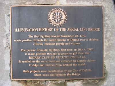
Illumination History of the Aerial Lift Bridge
Inscription.
The first lighting was on November 20, 1970, made possible through the contributions of Duluth school children, citizens, business people and visitors.
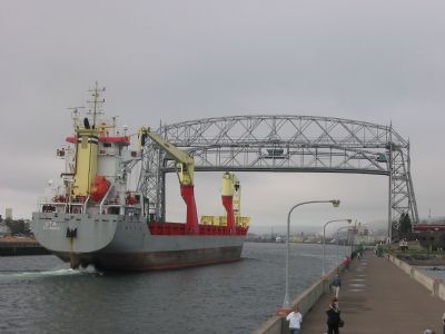
The present dramatic lighting, first seen on July 4, 1987, is made possible through a generous gift from the Rotary Club of Duluth, Club # 25. It symbolizes the warm welcome extended by Duluth citizens to ships and visitors from around the world.
Both projects were coordinated by the City of Duluth, which owns and operates the Bridge.
Topics and series. This historical marker is listed in these topic lists: Bridges & Viaducts • Notable Events. In addition, it is included in the Rotary International series list. A significant historical month for this entry is July 1977.
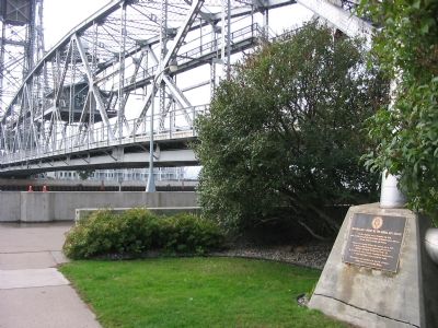
Location. 46° 46.773′ N, 92° 5.581′ W. Marker is in Duluth, Minnesota, in Saint Louis County. It is in Canal Park. Marker can be reached from South Lake Avenue, on the left when traveling south. Marker is at the north side of the Aerial Lift Bridge. Touch for map. Marker is in this post office area: Duluth MN 55802, United States of America. Touch for directions.
Other nearby markers. At least 8 other markers are within walking distance of this marker. Daniel De Gresolon, Sieur Du Lhut (a few steps from this marker); Canal (within shouting distance of this marker); Dedicated to Davis Helberg (about 300 feet away, measured in a direct line); Northwoods Sailors (about 300 feet away); United States Merchant Marine / U.S. Navy Armed Guard (about 300 feet away); Float Copper (about 300 feet away); Edgar A. Culbertson (about 400 feet away); Modern Ship Propeller (about 400 feet away). Touch for a list and map of all markers in Duluth.
Credits. This page was last revised on February 12, 2023. It was originally submitted on October 9, 2007, by Keith L of Wisconsin Rapids, Wisconsin. This page has been viewed 2,259 times since then and 50 times this year. Photos: 1, 2, 3. submitted on October 9, 2007, by Keith L of Wisconsin Rapids, Wisconsin. • J. J. Prats was the editor who published this page.


