Near Spotsylvania Courthouse in Spotsylvania County, Virginia — The American South (Mid-Atlantic)
Pressing the Attack
The Battle of Chancellorsville
| — | Fredericksburg and Spotsylvania National Military Park | — |
Photographed by Craig Swain, November 10, 2007
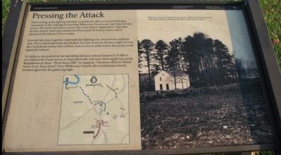
1. Pressing the Attack Marker
That evening, as the fighting subsided, Confederate officers reassembled their commands in the clearing surrounding Wilderness Church, one-half mile in front of you. The attack had taken a heavy toll on the army's organization. Units had become mixed. Some men wandered off in search of food or water; others plundered abandoned Union camps.
It would take time to get his corps back into fighting trim, but Jackson could not wait. The Confederate army was divided. Decisive action by Hooker might yet turn the Confederate victory into a defeat. Jackson had to strike before the enemy could regain his balance.
As darkness descended on the battlefield, Jackson ordered General A.P. Hill to slice behind the Union forces at Chancellorsville and sever their supply line across Rappahannock River. "Press them, Hill!" he snapped, "Cut them off from United States Ford! Press them!" From Wilderness Church, the Confederates moved forward again into the gathering night.
Erected by National Park Service, U.S. Department of the Interior.
Topics. This historical marker is listed in this topic list: War, US Civil.
Location. 38° 18.928′ N,
this page online

Regionally, this marker is in the Washington Metropolitan Area, in Northern Virginia, and in the Piedmont. It is also in the American South, specifically in the Upper South, in the Mid-Atlantic, and on the Eastern Seaboard. Globally, it is in the North Atlantic Region, North America, the Western Hemisphere, the Western World, and the Anglosphere. Historically, it finds itself in what was once the territory of the Mississippian Culture, one of the original Thirteen Colonies, one of the Confederate States of America, and the Antebellum South.
Other nearby markers. At least 8 other markers are within 2 miles of this marker, measured as the crow flies: Recipe for Union Disaster
Photographed by Craig Swain, November 10, 2007
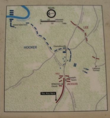
2. Flank Attack Map
Another marker is no longer nearby. The Flying Dutchmen (was here, next to this marker but has been replaced with another marker now near it).
More about this marker. The lower left of the marker displays a map of the tactical situation in the later afternoon of May 2, 1863. On the right side is a photo of "Wilderness Church as it appeared after the war. Jackson's troops reorganized in the church clearing following their attack on the Eleventh Corps.
Regarding Pressing the Attack. This is one of several markers for the Battle of Chancellorsville along the Jackson's Flank March and Attack trail. See the Jackson's Flank March and Attack Virtual Tour by Markers
Photographed by Craig Swain, November 10, 2007
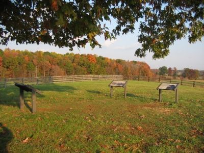
3. Three Markers at the Jackson's Flank Attack Tour Stop
Also see . . .
1. Battle of Chancellorsville. National Park Service website entry (Submitted on December 2, 2007, by Craig Swain of Leesburg, Virginia.)
2. Jackson's Flank March and Attack Virtual Tour by Markers. This virtual tour covers the optional Jackson Flank Trail route of the driving tour and concludes at Jackson's Flank Attack (stop 8) of the driving tour, tracing the route of Jackson's march to deliver the decisive attack of the battle. (Submitted on December 8, 2007, by Craig Swain of Leesburg, Virginia.)
Photographed by Craig Swain, November 10, 2007
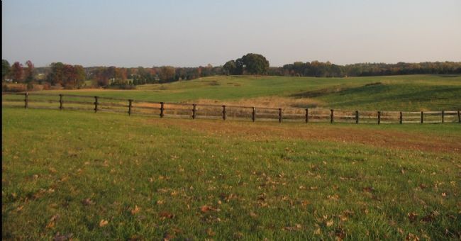
4. From the Marker Looking East
As indicated on the marker, to the east is the Wilderness Church. Jackson's forces had pressed through this clearing during the initial phases of the flank attack.
Credits. This page was last revised on November 11, 2025. It was originally submitted on December 2, 2007, by Craig Swain of Leesburg, Virginia. This page has been viewed 1,777 times since then and 44 times this year. Last updated on November 11, 2025, by Mike McKeown of Baltimore, Maryland. Photos: 1, 2, 3, 4. submitted on December 2, 2007, by Craig Swain of Leesburg, Virginia. • Bernard Fisher was the editor who published this page.
