Near Golden in Jefferson County, Colorado — The American Mountains (Southwest)
Play in the Wind
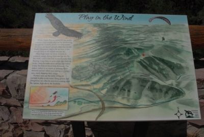
Photographed by Charles T. Harrell, July 3, 2011
1. Play in the Wind Marker
Windy Saddle Park is named for the nearly constant wind currents that can be felt blowing through the foothills. Winds traveling across the plains are forced upward when they hit the Rocky Mountains, and as the air rises, it has enough force to lift objects into the sky.
Many large birds use these currents to conserve energy. Being lifted into the sky by this wind, called a thermal, is much easier than flapping wings that can span eight feet from tip to tip. Using thermals saves energy and make it easy for birds to travel long distances. The turkey vulture is an expert at utilizing these thermals and are often seen soaring over this area, rarely flapping their wings. Humans now use the same lifting air currents to play in the wind. Hang gliders and paragliders can often be seen here soaring with the raptors, high above the foothills.
[Caption:]
When air moving across the plains hits these mountains, it is forced upward, causing strong updrafts that carry birds and enable humans to feel the wonder of flight.
Erected by Jefferson County Open Space.
Topics. This historical marker is listed in these topic
this page online
Location. Marker has been permanently removed. It was located near 39° 44.196′ N, 105° 14.726′ W. Marker was near Golden, Colorado, in Jefferson County. It was on Lariat Loop Road, on the right when traveling south. Marker is at overlook. Touch for map. Marker was at or near this postal address: 1277 Lookout Mountain Rd, Golden CO 80401, United States of America.
We have been informed that this marker is no longer there and will not be replaced. This page is an archival view of what was.
Regionally, this marker was in the Front Range. It was also in the American Mountain West. Globally, it was in North America, the Rocky Mountains, the Western Hemisphere, the Western World, and the Anglosphere. Historically, it found itself in what was once the Louisiana Purchase.

Other nearby markers. At least 8 other markers are within walking distance of this location: Windy Saddle Park / Connecting to the Past (here, next to this marker); Our Changing Landscape-From Sea Floor to Mountain Top (approx. 0.4 miles away); What You Can See From Here Today (approx. 0.4 miles away); Who Was Buffalo Bill? (approx. 0.4 miles away); Lariat Loop Byway: Buffalo Bill Museum (approx. 0.4 miles away); Lariat Loop Byway: Denver Mountain Parks (approx. 0.4 miles away); Buffalo Bill's Grave — Frequently Asked Questions (approx. half a mile away); Buffalo Bill's Grave — Why is Buffalo Bill Buried Here? (approx. half a mile away). Touch for a list and map of all markers in Golden.
Other markers no longer nearby. Recreation: Past to Present (was here, next to this marker but has been permanently removed); Water Carves Canyons (was here, next to this marker but has been permanently removed); In Memory of Charles E. Kirk (was approx. half a mile away but has been confirmed missing).
Additional commentary.
1. About the marker
At the time that this signage was included in HMdb.org, the site admitted markers that exclusively interpreted nature or natural history. In general, this is no longer the case.
— Submitted November 13, 2025, by Devry Becker Jones of Washington, District of Columbia.
Credits. This page was last revised on November 13, 2025. It was originally submitted on August 16, 2011, by Charles T. Harrell of Woodford, Virginia. This page has been viewed 831 times since then and 18 times this year. Last updated on November 11, 2025, by Leslie Eudy of Golden, Colorado. Photo 1. submitted on August 16, 2011, by Charles T. Harrell of Woodford, Virginia. • Devry Becker Jones was the editor who published this page.
