Manzanar National Historic Site near Independence in Inyo County, California — The American West (Pacific Coastal)
The Town of Manzanar
Photographed by Craig Baker, October 30, 2025
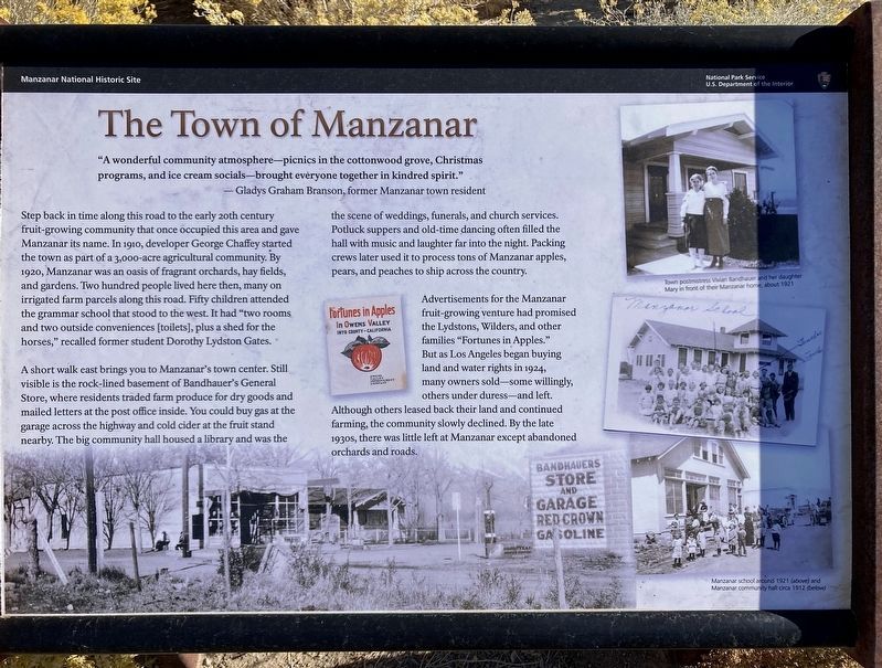
1. Town of Manzanar Marker
"A wonderful community atmosphere - picnics in the cottonwood grove, Christmas programs, and ice cream socials - brought everyone together in kindred spirit."
— Gladys Graham Branson, former Manzanar town resident.
Step back in time along this road to the early 20th century fruit-growing community that once occupied this area and gave Manzanar its name. In 1910, developer George Chaffey started the town as part of a 3,000-acre agricultural community. By 1920, Manzanar was an oasis of fragrant orchards, hay fields, and gardens. Two hundred people lived here then, many on irrigated farm parcels along this road. Fifty children attended the grammar school that stood to the west. It had "two rooms and two outside conveniences [toilets], plus a shed for the horses," recalled former student Dorothy Lydston Gates.
A short walk east brings you to Manzanar's town center. Still visible is the rock-lined basement of Bandhauer's General Store, where residents traded farm produce for dry goods and mailed letters at the post office inside. You could buy gas at the garage across the highway and cold
this page online
Advertisements for the Manzanar fruit-growing venture had promised the Lydstons, Wilders, and other families "Fortunes in Apples." But as Los Angeles began buying land and water rights in 1924, many owners sold - some willingly, others under duress - and left. Although others leased back their land and continued farming, the community slowly declined. By the late 1930s, there was little left at Manzanar except abandoned orchards and roads.
Erected by National Park Service.
Topics. This historical marker is listed in these topic lists: Agriculture • Settlements & Settlers. A significant historical year for this entry is 1910.
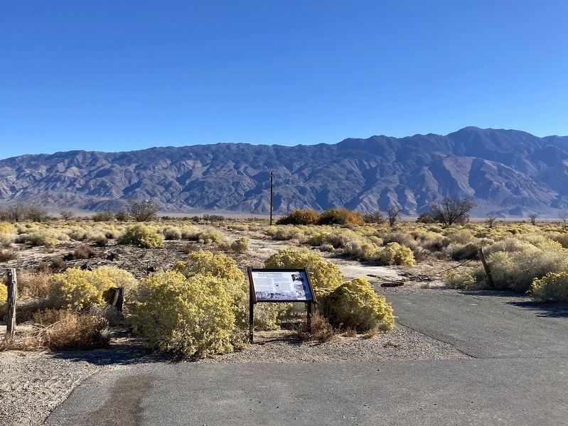
Location. 36° 43.98′ N, 118° 9.175′ W. Marker is near Independence, California, in Inyo County. It is in Manzanar National Historic Site.
Photographed by Craig Baker, October 30, 2025
2. Town of Manzanar Marker

Regionally, this marker is in California’s Sierra Nevada. It is also in the American Mountain West. Globally, it is in North America, on the Ring of Fire, on the Pacific Rim, in the Western Hemisphere, in the Western World, and in the Anglosphere. Historically, it finds itself in what was once New Spain and also Mexico’s Alta California.
Other nearby markers. At least 8 other markers are within walking distance of this marker: Shepherd Ranch (approx. ¼ mile away); Manzanar Baseball Field (approx. ¼ mile away); The Reward Mine (approx. 0.3 miles away); Icon of Confinement (approx. 0.3 miles away); "That's What You Call Survival" (approx. 0.4 miles away); Ginkgo (approx. 0.4 miles away); Mess Halls of Manzanar (approx. 0.4 miles away); "Waiting in a Breadline" (approx. 0.4 miles away). Touch for a list and map of all markers in Independence.
Regarding The Town of Manzanar. The rock-lined basement of Bandhauer's General Store is no longer visible, due to storm damage.
Credits. This page was last revised on May 15, 2026. It was originally submitted on November 12, 2025, by Craig Baker of Sylmar, California. This page has been viewed 75 times since then and 36 times this year. Photos: 1, 2. submitted on November 12, 2025, by Craig Baker of Sylmar, California.
