Luxor, Luxor Governorate, Egypt — مصر (Northeast Africa)
Avenue of Sphinxes/ طريق الكباش
Photographed by James Hulse, October 10, 2024
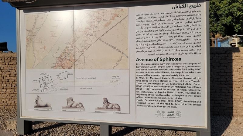
1. Avenue of Sphinxes/ طريق الكباش Marker
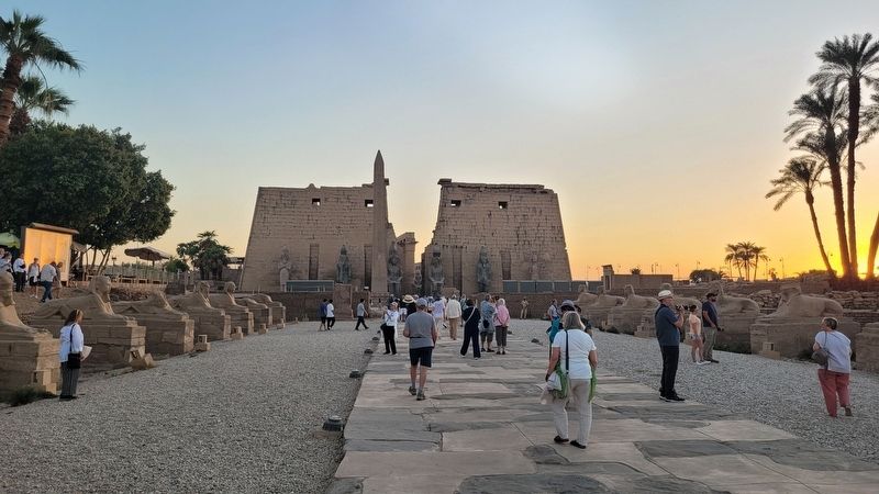
 It is the processional way that connects the temples of Karnak with Luxor Temple. With a length of 2,700 meters and about 76 meters in width, this road is flanked by 1,060 statues of Rams, Criosphinxes, Androsphinxes which are separated by a space of approximately 4 meters.
In 1949, Dr. Mohamed Zakaria Ghoneim discovered the first group of these statues in front of Luxor Temple. Then the excavations of Dr. Mohammed Abdel Qader (1960-1958), as well as those of Dr. Mahmoud Abdel Razek (1964-1961) revealed 78 statues of them. Moreover, Dr. Mohammed al-Saghier (2000 - 1984) revealed the beginning of the road from the tenth Pylon to the Temple of Mut, as well as some parts in its middle.
Finally, Dr. Mansour Boraik (2011 - 2006) discovered and restored the rest of the road to determine the official processional route through the ages.
طريق الكباش
هو طريق الإحتفالات الذي يربط معابد الكرنك بمعبد الأقصر وتحيط بجانبيه مجموعة من التماثيل على هيئة الكبش الكامل وتماثيل لأبي الهول برأس كبش أو برأس آدمية. يبلغ طول هذا الطريق حوالي ۲۷۰۰ متر، وعرضه حوالي ٧٦ متر، ويحيط بجانبيه ١٠٦٠ تمثال والتي يفصل ما بين كل منها مسافة 4 أمتار تقريباً.
في عام ١٩٤٩ قام الدكتور محمد زكريا غنيم بالكشف عن أول مجموعة من هذه التماثيل أمام معبد الأقصر، ثم كشفت حفائر الدكتور محمد عبد القادر (۱۹۵۸) - ١٩٦٠) وكذلك حفائر الدكتور محمود عبد الرازق ( ١٩٦١ - ١٩٦٤ ) عن ٧٨ تمثال منها، وكشفت حفائر الدكتور محمد الصغير ( ١٩٨٤) - ٢٠٠٠ ) عن بداية الطريق من الصرحالعاشر وحتى معبد موت وكذلك بعض الأجزاء في منتصفه، ثم قام الدكتور منصور بريك (٢٠٠٦ - ٢٠١١ ) بالكشف عن باقي الطريق وصيانته لتحديد طريق المواكب الرسمي عبر العصور.
هو طريق الإحتفالات الذي يربط معابد الكرنك بمعبد الأقصر وتحيط بجانبيه مجموعة من التماثيل على هيئة الكبش الكامل وتماثيل لأبي الهول برأس كبش أو برأس آدمية. يبلغ طول هذا الطريق حوالي ۲۷۰۰ متر، وعرضه حوالي ٧٦ متر، ويحيط بجانبيه ١٠٦٠ تمثال والتي يفصل ما بين كل منها مسافة 4 أمتار تقريباً.
في عام ١٩٤٩ قام الدكتور محمد زكريا غنيم بالكشف عن أول مجموعة من هذه التماثيل أمام معبد الأقصر، ثم كشفت حفائر الدكتور محمد عبد القادر (۱۹۵۸) - ١٩٦٠) وكذلك حفائر الدكتور محمود عبد الرازق ( ١٩٦١ - ١٩٦٤ ) عن ٧٨ تمثال منها، وكشفت حفائر الدكتور محمد الصغير ( ١٩٨٤) - ٢٠٠٠ ) عن بداية الطريق من الصرحالعاشر وحتى معبد موت وكذلك بعض الأجزاء في منتصفه، ثم قام الدكتور منصور بريك (٢٠٠٦ - ٢٠١١ ) بالكشف عن باقي الطريق وصيانته لتحديد طريق المواكب الرسمي عبر العصور.
Erected by Ministry of Tourism & Antiquity.
Topics. This historical marker is listed in this topic list: Anthropology & Archaeology. A significant historical year for this entry is 1949.
Location. 25° 42.039′ N, 32° 38.414′ E. Marker is in Luxor, Luxor Governorate. It is on Mabad Al Oksor just north of Al Mahata. The marker is located at the front entrance of the Luxor Temple. Touch for map. Marker is at or near this postal address: Mabad Al Oksor, Luxor, Luxor Governorate 13625-01, Egypt. Touch for directions.

Regionally, it is in Africa, specifically in North Africa, in the Middle East, on the Red Sea, and in a coastal Mediterranean country. Historically, it finds itself in what was once the Byzantine Empire, the Ottoman Empire, a British colony, and the Roman Empire.
Other nearby markers. At least 8 other markers are within walking distance of this marker: Hatshepsut (a few steps from this marker); Amenhotep III (a few steps from this marker); Tutankhamun (a few steps from this marker); Ramses II (a few steps from this marker); Pinedjem I (a few steps from this marker); Nectanebo I (a few steps from this marker); Ancient Luxor / مدينة الاقصر (within shouting distance of this marker); Luxor Temple / معبد الأقصر (within shouting distance of this marker). Touch for a list and map of all markers in Luxor.
this page online
Photographed by James Hulse, October 10, 2024
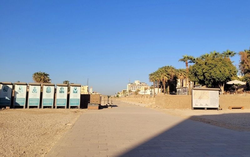
2. The entrance to the Avenue of Sphinxes and Marker
Photographed by James Hulse, October 10, 2024
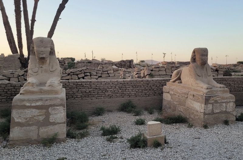
3. Two Sphinxes along the Avenue
Photographed by James Hulse, October 10, 2024
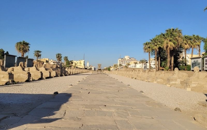
4. The view looking down the Avenue of Sphinxes
Photographed by James Hulse, October 10, 2024
5. The view of the First Pylon of Luxor from the Avenue of the Sphinxes
Credits. This page was last revised on November 13, 2025. It was originally submitted on November 12, 2025, by James Hulse of Medina, Texas. This page has been viewed 85 times since then and 44 times this year. Photos: 1, 2, 3, 4, 5. submitted on November 13, 2025, by James Hulse of Medina, Texas.
