
Near Fort Calhoun in Washington County, Nebraska — The American Midwest (Upper Plains)
Essential Friends and Allies

Photographed by Barry Swackhamer, July 16, 2025
1. Essential Friends and Allies Marker
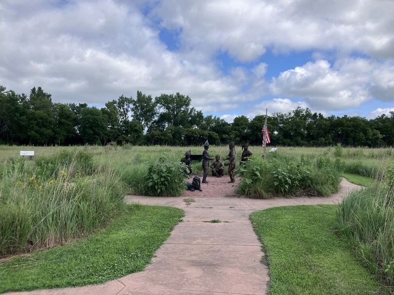
Caption: Left to right: Nez Perce Indian, Mandan Bison Dancer, Sacagawea in Hidatsa dress. Teton Sioux Indian and Oto Indian.
The Lewis and Clark Expedition began in 1803 and ended in 1806. During those years, Lewis and Clark passed through territories of more than 50 Indian tribes, and held an official meeting, called a "Council," with 13 of them. The American explorers hoped to make a good impression with the tribes and open the west for American business.
Captains Lewis and Clark first met with the Oto and Missouri Indians, encouraging them to make peace with neighboring tribes and trade with St. Louis businesses. An alliance with the Teton Sioux tribe was essential because they controlled much of the region's fur trade.
The Corp of Discovery spent its first winter near the Mandan and Hidatsa villages, in what is now North Dakota. Mandans provided food that helped the Expedition survive the winter of 1804. From a Hidatsa village, Sacagawea, a young Indian woman, her husband, Toussaint Charbonneau, and her chid, joined the Expedition. Their presence was an advantage; Indian tribes knew Lewis and Clark came in peace because they had a young woman and an infant with them. West of the Rocky Mountains, the Nez Perce helped Lewis and Clark
this page online
Each encounter with an Indian tribe was a new experience. Some tribes had heard rumors of new white people arriving in the area and they planned to welcome the visitors. Others were taken by surprise and showed understandable fear of white strangers with guns. Some saw the Americans as potential allies; others were suspicious. Some tribes had traded with Europeans for 100 years or more; others had never seen a white person before.
Peace medals that Lewis and Clark presented as gifts to the Indians symbolized the future future the Americans hoped for. The silver medals were stamped with the motto "Peace and Friendship,' and with images of clasped hands ad a peace pipe crossed over a tomahawk.
Topics. This historical marker is listed in these topic lists: Exploration • Indigenous Peoples and Communities. A significant historical year for this entry is 1803.
Location. 41° 27.349′ N, 96° 0.906′ W. Marker is near Fort Calhoun, Nebraska, in Washington County. It can be reached from South 7th Street near Monroe Street. Touch for map. Marker is at or near this postal
Photographed by Barry Swackhamer, July 16, 2025
2. Essential Friends and Allies Marker
The marker is to the right of the flagpole in the background.

Regionally, this marker is in Eastern Nebraska and in Greater Omaha. It is also in the American Midwest, in the Lewis & Clark Corridor, in the Corn Belt, and on the prairies. Globally, it is in North America, the Western Hemisphere, the Western World, and the Anglosphere. Historically, it finds itself in what was once the Louisiana Purchase.
Other nearby markers. At least 8 other markers are within walking distance of this marker: Creating a Council Ceremony (here, next to this marker); Cultivating Friendship and Understanding (a few steps from this marker); The People the Expedition Met Here (within shouting distance of this marker); Lewis and Clark Campsite (about 300 feet away, measured in a direct line); The Fort Storehouse (about 300 feet away); A Grinding Operation (about 500 feet away); Fort Atkinson (approx. ¼ mile away); Fort Calhoun Schools at Washington Square (approx. 0.4 miles away). Touch for a list and map of all markers in Fort Calhoun.
Credits. This page was last revised on November 13, 2025. It was originally submitted on November 13, 2025, by Barry Swackhamer of Brentwood, California. This page has been viewed 50 times since then and 18 times this year. Photos: 1, 2. submitted on November 13, 2025, by Barry Swackhamer of Brentwood, California.
