
Old Hill in Springfield in Hampden County, Massachusetts — The American Northeast (New England)
The Buckingham Cornerstone

Photographed by Conrad Ward, March 9, 2025
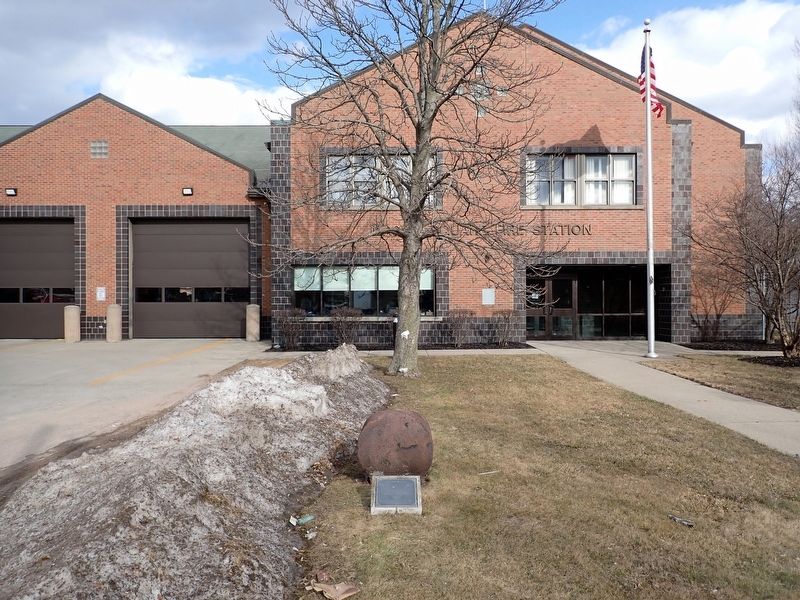
1. The Buckingham Cornerstone Marker
This stone represents the last artifact of the former Buckingham Junior High School building. The building was constructed on this site, 110 years ago, in 1891. It was named for Dr. Samuel G. Buckingham, one of the city's most influential men who served for more than fifty years as pastor of the South Congregational Church. Initially, the school was named the Samuel G. Buckingham Primary and Grammar School. In 1916, the school board adopted a grade plan that created elementary, junior high and high schools. And in 1919, Buckingham became a Junior high school.
In 1968, as part of the city's efforts to address its racial imbalance, classes at Buckingham were discontinued and the students were transferred to other schools across the city. From 1968 through 1974, the building served as the administrative offices for several programs including the Springfield Action Commission, the Concentrated Employment Program and the New Careers Program. It also housed various programs related to the "War on Poverty" of the 1960s and 1970s. It is both sitting and proper that this stone be placed at this site to memorialize
this page online
State Representative Benjamin Swan of the 12th Hampden District has organized a planning committee for the memorial comprised of:
Elaine A. Scott, Chairman • Joseph R. Kakley, Co-Chair • Morris Jones • Frances M. Gagnon • Angela Bolden • Garrett Sullivan • John G. Osborn
The committee acknowledges the cooperation and support of Mayor Michael J. Albano, Fire Chief Gary G. Cassanelli and the Board of Fire Commissioners, Park Commissioner Ernest Smith, Park Department Superintendent Patrick Sullivan, and Historical Commission Chair Frances Gagnon.
Stone Installed September 7, 2001
Erected 2001.
Topics. This historical marker is listed in these topic lists: Civil Rights • Education. A significant historical year for this entry is 1891.
Location. 42° 6.614′ N, 72° 33.821′ W. Marker is in Springfield, Massachusetts, in Hampden County. It is in Old Hill. It is on Eastern Avenue north of Monroe Street, on the right when traveling north. Located in front of the Mason Square
Photographed by Conrad Ward, March 9, 2025
2. The Buckingham Cornerstone Marker

Regionally, this marker is in Massachusetts’ Knowledge Corridor and in Pioneer Valley. It is also in the American Northeast and in New England. Globally, it is in North America, the Western Hemisphere, the Western World, and the Anglosphere. Historically, it finds itself in what was once one of the original Thirteen Colonies.
Other nearby markers. At least 8 other markers are within walking distance of this marker: Leonard A. Corbin (a few steps from this marker); Mason Square Viet Nam Memorial (about 400 feet away, measured in a direct line); Winchester Square District World War II Memorial (about 400 feet away); Growth of the Game (about 600 feet away); The Challenge to James Naismith (about 600 feet away); The Original Site (about 600 feet away); Springfield College (about 600 feet away); Shays’ Rebellion (approx. 0.6 miles away). Touch for a list and map of all markers in Springfield.
Another marker is no longer nearby. The First Game of Basketball (was about 600 feet away but has been confirmed missing).
Credits. This page was last revised on November 22, 2025. It was originally submitted on November 15, 2025, by Conrad Ward of Guilford, Connecticut. This page has been viewed 66 times since then and 29 times this year. Photos: 1, 2. submitted on November 15, 2025, by Conrad Ward of Guilford, Connecticut. • Michael Herrick was the editor who published this page.
