
Carr's Beach in Annapolis in Anne Arundel County, Maryland — The American Northeast (Mid-Atlantic)
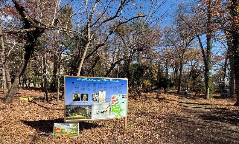
A History of 'The Beach'

• 1902 Frederick Carr and his wife Mary Wells Carr purchased 180 acres of waterfront farmland on the Annapolis Neck. The family took in boarders and hosted picnics
• 1926 Opened Carrs Beach as a Chesapeake Bay/waterfront retreat for Black families. Elizabeth Carr Smith operated Carrs Beach
• 1931 Florence Carr Sparrow, Elizabeth's younger sister, began operating the adjoining Sparrow's Beach
• 1948 Elizabeth Carr Smith died leaving her son Frederick to team up with "Li'l Willie" Adams to form the Carr's Beach Amusement Company
• 1950s Duke Ellington, Count Basie, Sarah Vaughn, Ray Charles and others made Carrs Beach a regular stop on tour
• 1956 Chuck Berry drew 70,000 to Carrs Beach (due to capacity, only about 8,000 got in to see the show)
• 1962 Last major concert at Carrs Beach with James Brown as headliner, drawing 11,000 fans
• 1973 Frank Zappa plays the last public concert at the location (Sparrows location was condemned for the wastewater treatment plant; Carrs is now Villages of Chesapeake Harbor)
• 2022 Land acquisition effort spearheaded by City of Annapolis and Blacks of the
this page online
Topics. This historical marker is listed in these topic lists: African Americans • Arts, Letters, Music • Entertainment • Parks & Recreational Areas. A significant historical year for this entry is 1902.
Location. 38° 57.72′ N, 76° 28.486′ W. Marker is in Annapolis, Maryland, in Anne Arundel County. It is in Carr's Beach. It can be reached from Bembe Beach Road north of Edgewood Road, on the right when traveling north. Touch for map. Marker is at or near this postal address: 7131 Bembe Beach Rd, Annapolis MD 21403, United States of America. Touch for directions.

Regionally, this marker is in Central Maryland. It is also in the American Mid-Atlantic, in the Chesapeake Bay Region, and on the Eastern Seaboard. Globally, it is in the North Atlantic Region, North America, the Western Hemisphere, the Western World, and the Anglosphere. Historically, it finds itself in what was once one of the original Thirteen Colonies and also the Antebellum South.
Other nearby markers. At
Credits. This page was last revised on November 16, 2025. It was originally submitted on November 16, 2025, by Devry Becker Jones of Washington, District of Columbia. This page has been viewed 74 times since then and 34 times this year. Photos: 1, 2. submitted on November 16, 2025, by Devry Becker Jones of Washington, District of Columbia.
