Nomini in Westmoreland County, Virginia — The American South (Mid-Atlantic)
Nominy Church
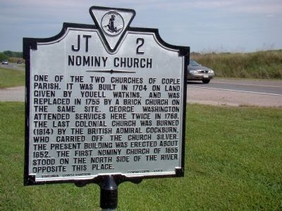
Photographed by J. J. Prats, August 30, 2009
1. Nominy Church Marker
Erected 1949 by Virginia Conservation Commission. (Marker Number JT-2.)
Topics and series. This historical marker is listed in these topic lists: Colonial Era • Religion & Religious Structures • War of 1812. In addition, it is included in the Virginia Department of Historic Resources (DHR) series list. A significant historical year for this entry is 1704.
Location. 38° 5.888′ N, 76° 43.827′ W. Marker is in Nomini, Virginia, in Westmoreland County. It is on Cople Highway (Virginia Route 202) just east of the Nomini Creek bridge, on the left when traveling east. Touch for map. Marker is at or near this postal address: 3589 Cople Hwy, Montross VA 22520, United
this page online

Regionally, this marker is on Virginia’s Northern Neck. It is also in the American South, specifically in the Upper South, in the Tidewater, in the Chesapeake Bay Region, and on the Eastern Seaboard. Globally, it is in the North Atlantic Region, North America, the Western Hemisphere, the Western World, and the Anglosphere. Historically, it finds itself in what was once the territory of the Mississippian Culture, one of the original Thirteen Colonies, one of the Confederate States of America, and the Antebellum South.
Other nearby markers. At least 8 other markers are within 4 miles of this marker, measured as the crow flies: The War of 1812 / British Landing at Nomini Ferry (here, next to this marker); Bushfield (approx. 0.8 miles away); The Glebe (approx. 0.8 miles away); Morgan Jones Kiln (approx. 0.8 miles away); Nomini Baptist Church (approx. 3.1 miles away); Nomini Hall (approx. 3.1 miles away); Armstead Tasker Johnson School (approx. 3.2 miles away); Private Tate, Buffalo Soldier (approx. 3.4 miles away).
Another marker is no longer nearby. Bushfield (was approx.
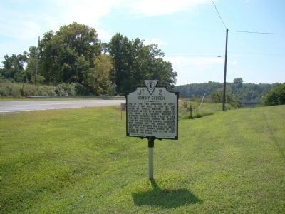
Photographed by J. J. Prats, August 30, 2009
2. Nominy Church Marker
Additional keywords. Church of England, Episcopal Church, Nomini Creek
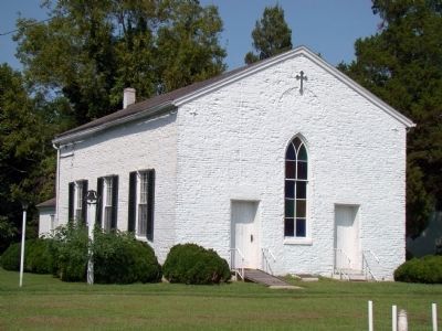
Photographed by J. J. Prats, August 30, 2009
3. Nominy Church
Credits. This page was last revised on November 20, 2025. It was originally submitted on September 11, 2009, by J. J. Prats of Powell, Ohio. This page has been viewed 2,764 times since then and 102 times this year. Last updated on November 19, 2025, by Evan Dwyer of Richmond, Virginia. Photos: 1, 2, 3. submitted on September 11, 2009, by J. J. Prats of Powell, Ohio. • Devry Becker Jones was the editor who published this page.
