
Perryville in Boyle County, Kentucky — The American South (East South Central)
Starkweather’s Hill
Perryville • The Battle For Kentucky
| — | October 8, 1862 | — |
Photographed by Bradley Owen, October 17, 2025
1. Starkweather’s Hill Marker
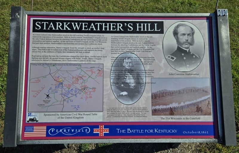
As Union Colonel John Starkweather stood on this hill, watching Terrill’s brigade retreat, he realized the importance of his position. With its twelve cannon, Starkweather’s brigade stood as the only Federal defense between the attacking Confederates and the Union wagons that carried ammunition and medical supplies. As the survivors of Terrill’s brigade and the 21st Wisconsin fled past their position, Starkweather’s men held firm and awaited the Confederate attack.
Although nearing exhaustion, Maney’s brigade found the strength to attack up another steep slope. They killed and wounded most of the Federal artillerymen and captured the enemy cannon but, in the confusion of battle, they mistakenly fell back in retreat.
Regrouping just past the road, the Confederates charged two more times. Amidst hand-to-hand fighting atop this hill, the ground became slippery with blood. Finally, Maney’s brigade, reinforced by Stewart’s Confederates, drove Starkweather’s soldiers off the ridge.
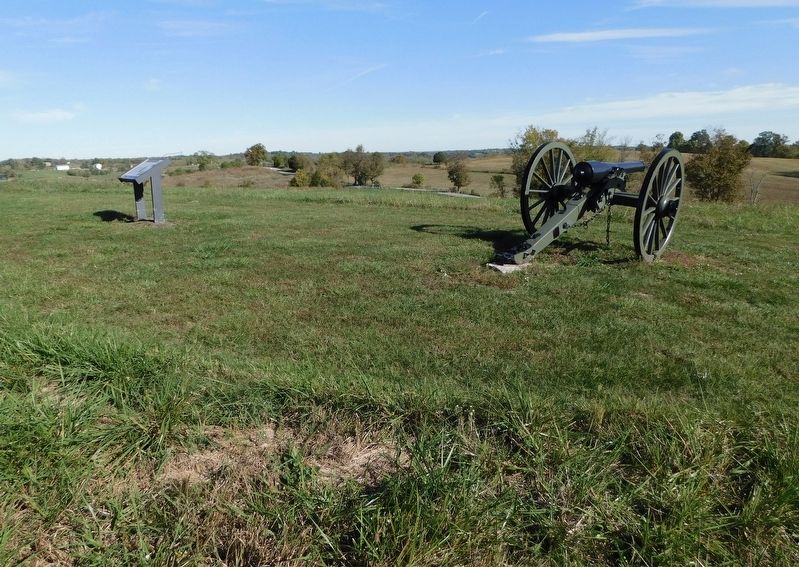
Falling back, the Federals again formed on the hill behind you.
As Union Colonel John Starkweather stood on this hill, watching Terrill’s
this page online
Although nearing exhaustion, Maney’s brigade found the strength to attack up another steep slope. They killed and wounded most of the Federal artillerymen and captured the enemy cannon but, in the confusion of battle, they mistakenly fell back in retreat.
Regrouping just past the road, the Confederates charged two more times. Amidst hand-to-hand fighting atop this hill, the ground became slippery with blood. Finally, Maney’s brigade, reinforced by Stewart’s Confederates,drove Starkweather’s soldiers off the ridge.
Falling back, the Federals again formed on the hill behind you.
. . . we were soon in a hand-to-hand fight — every man for himself — using the butts of our guns and bayonets. Such obstinate fighting I never had seen before or since. The guns were discharged so rapidly that it seemed the earth itself was in a volcanic uproar. The iron storm passed through our ranks, mangling and tearing men to pieces.
Photographed by Bradley Owen, October 17, 2025
2. Starkweather’s Hill Marker
(Captions):
John Converse Starkweather
The 21st Wisconsin in the Cornfield
Erected by American Civil War Round Table of the United Kingdom.
Topics. This historical marker is listed in this topic list: War, US Civil.
Location. 37° 40.467′ N, 84° 58.497′ W. Marker is in Perryville, Kentucky, in Boyle County. It can be reached from Park Road 0.3 miles west of Battlefield Road (Kentucky Route 1920). Marker is located on the Confederate Right Trail at the Perryville Battlefield State Historic Site. Touch for map. Marker is at or near this postal address: 1825 Battlefield Road, Perryville KY 40468, United States of America. Touch for directions.

Regionally, this marker is in Kentucky’s Bluegrass Region. It is also in the American South and specifically in the Upper South. Globally, it is in North America, the Western Hemisphere, the Western World, and the Anglosphere. Historically, it finds itself in what was once the territory of the Mississippian Culture and also the Antebellum South.
Other nearby markers. At least 8 other markers are within walking distance of this marker: A different marker also named Starkweather’s Hill (within shouting distance of this marker); a different marker also named Act of Mercy (about 300 feet away, measured in a direct line); The Cornfield (about 800 feet away); Sanctuary (approx. 0.2 miles away); Starkweather's Wall: Highwatermark of the West (approx. 0.2 miles away); Hartzell's Fence (approx. 0.2 miles away); Perryville and the Emancipation Proclamation (approx. ¼ mile away); Soldiers' Reaction to Lincoln's Emancipation (approx. ¼ mile away). Touch for a list and map of all markers in Perryville.
Other markers no longer nearby. Starkweather's Hill (was here, next to this marker but has been replaced with another marker now near it); a different marker also named Starkweather's Hill (was here, next to this marker but has been reported to have been replaced with another marker now near it); a different marker also named Starkweather’s Hill (was within shouting distance of this marker but has been reported to have been replaced with another marker now near it); Act of Mercy (was within shouting distance of this marker but has been replaced with another marker now near it); a different marker also named The Cornfield (was about 800 feet away but has been replaced with another marker now near it); Stewart's Attack (was approx. 0.2 miles away but has been confirmed missing).
Regarding Starkweather’s Hill. Main text was printed in duplicate on this marker and has been transcribed as shown in the first photo.
Marker includes a map: Battle of Perryville, October 8, 1862, 3:45 PM.
Related marker. Click here for another marker that is related to this marker. This marker has replaced another at this location.
Credits. This page was last revised on November 21, 2025. It was originally submitted on November 21, 2025, by Bradley Owen of Morgantown, West Virginia. This page has been viewed 106 times since then and 64 times this year. Photos: 1, 2. submitted on November 21, 2025, by Bradley Owen of Morgantown, West Virginia.
