
Near De Soto in Washington County, Nebraska — The American Midwest (Upper Plains)
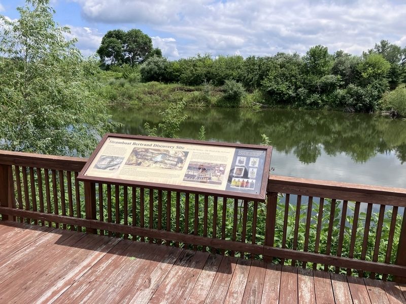
Steamboat Bertrand Discovery Site

Photographed by Barry Swackhamer, July 16, 2025
1. Steamboat Bertrand Discovery Site Marker, left half
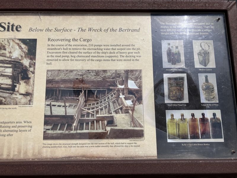
Captions:(lower left) This photograph of the ship's bow was taking after the cargo had been removed and the inter structure was revealed. The image also shows the boat's shallow draft, which was typical of steamboats that one cursed the Missouri River.; (center) This areal photograph reveals how the steamboat's hull is situated at the bottom of the pond. As you look out over the pond, the ship's bow is to the far left facing due north.; (lower right) This image shows the structural strength designed into the rear section of the hull, which had to support the churning paddlewheel. Also, built into the stern was a twin rudder assembly that allowed the ship to be steered.
Discovery
During the summers of 1968 and 1969, the Bertrand was uncovered by archaeologists at this location. The steamboat was well preserved after having spent more than a century buried under 30 feet of silt, sand and clay. However, only the lower hull of the Bertrand remained in place as the upper works, paddle wheel, stacks and boilers had been removed during salvage efforts in April of 1865.
Preserving the Hull
Artifacts recovered from the Bertrand were sent to a conservation lab established at the refuge's headquarters area. When the last cargo items wee removed, plans were made to protect what remained of the wooden hull. Raising and preserving the fragile steamboat would have been extremely expensive. The decision was made to cover it with alternating layers of sand and plastic. The pumps we're then removed and water slowly reclaimed the Bertrand. Not long after abandonment, the site became this small pond you see today.
Recovering the Cargo
In the course of the excavation, 210 pumps were installed around the steamboat's hull to remove
this page online
Topics. This historical marker is listed in these topic lists: Disasters • Waterways & Vessels. A significant historical date for this entry is April 1, 1865.
Location. 41° 31.319′ N, 96° 1.756′ W. Marker is near De Soto, Nebraska, in Washington County. It is on De Soto Lake Road near Lincoln Highway (U.S. 30). The marker is located in the De Soto Wildlife Refuge which is in Nebraska but must be accessed from the Iowa side of the Missouri River. Touch for map. Marker is in this post office area: Fort Calhoun NE 68023, United States of America. Touch for directions.

Regionally, this marker is in Eastern Nebraska and in Greater Omaha. It is also in the American Midwest, in the Lewis & Clark Corridor, in the Corn Belt, and on the prairies. Globally, it is in North America, the Western Hemisphere, the Western World, and the Anglosphere. Historically, it finds itself
Photographed by Barry Swackhamer, July 16, 2025
2. Steamboat Bertrand Discovery Site Marker, right half
Captions:(lower left) This photograph of the ship's bow was taking after the cargo had been removed and the inter structure was revealed. The image also shows the boat's shallow draft, which was typical of steamboats that one cursed the Missouri River.; (center) This areal photograph reveals how the steamboat's hull is situated at the bottom of the pond. As you look out over the pond, the ship's bow is to the far left facing due north.; (lower right) This image shows the structural strength designed into the rear section of the hull, which had to support the churning paddlewheel. Also, built into the stern was a twin rudder assembly that allowed the ship to be steered.
Other nearby markers. At least 8 other markers are within 5 miles of this marker, measured as the crow flies: April 1, 1865: The Bertrand Goes Down (here, next to this marker); Steamboat Bertrand (about 300 feet away, measured in a direct line); The Lewis and Clark Expedition (approx. 0.7 miles away); Up the Missouri (approx. 0.7 miles away); Lewis and Clark Campsite Area (approx. 1.4 miles away); DeSoto Townsite (approx. 2.7 miles away); Metz Bros. Brewing Co. (approx. 4.6 miles away); Fort Atkinson (approx. 4.6 miles away).
Photographed by Barry Swackhamer, July 16, 2025
3. Steamboat Bertrand Discovery Site Marker
Photographed by Barry Swackhamer, July 16, 2025
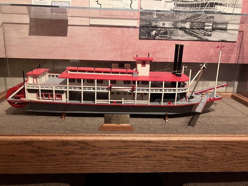
4. Model of the Steamboat Bertrand
Photographed by Barry Swackhamer, July 16, 2025
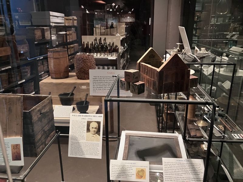
5. Recovered Steamboat Bertrand Artifacts
Photographed by Barry Swackhamer, July 16, 2025
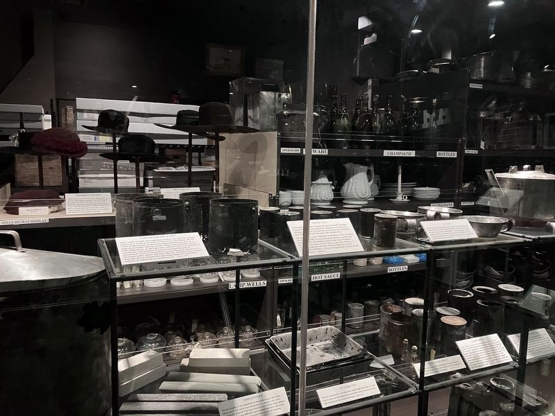
6. Recovered Steamboat Bertrand Artifacts
Credits. This page was last revised on December 11, 2025. It was originally submitted on November 22, 2025, by Barry Swackhamer of Brentwood, California. This page has been viewed 62 times since then and 27 times this year. Photos: 1, 2, 3, 4, 5, 6. submitted on November 22, 2025, by Barry Swackhamer of Brentwood, California.
