Near Charles City in Charles City County, Virginia — The American South (Mid-Atlantic)
Swineyards - Willcox Wharf
Charles City County, Virginia
Photographed by Kathy Walker, August 3, 2007
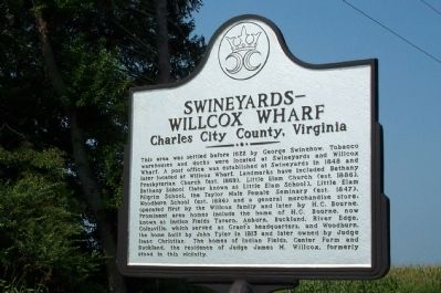
1. Swineyards - Willcox Wharf Marker
This area was settled before 1622 by George Shinehow. Tobacco warehouses and docks were located at Swineyards and Willcox Wharf. A post office was established at Swineyards in 1848 and later located at Willcox Wharf. Landmarks have included Bethany Presbyterian Church (est. 1869), Little Elam Church (est. 1886), Bethany School (later known at Little Elam School), Little Elam Pilgrim School, the Taylor Male Female Seminary (est. 1847), Woodburn School (est. 1886) and a general merchandise store, operated first by the Willcox family and later by H. C. Bourne. Prominent area homes include the home of H. C. Bourne, now known as Indian Fields Tavern, Auburn, Buckland, River Edge, Colesville, which served as Grant's headquarters, and Woodburn, the home built by John Tyler in 1813 and later owned by Judge Isaac Christian. The homes of Indian Fields, Center Farm and Buckland, the residence of Judge James M. Willcox, formerly stood in this vicinity.
Topics and series. This historical marker is listed in these topic lists: Colonial Era • Education • Religion & Religious Structures • Settlements & Settlers.
this page online
Location. 37° 19.919′ N, 77° 6.448′ W. Marker is near Charles City, Virginia, in Charles City County. It is at the intersection of John Tyler Memorial Highway (Virginia Route 5) and Wilcox Wharf Road ( Route 618), on the right when traveling east on John Tyler Memorial Highway. Touch for map. Marker is at or near this postal address: 9220 John Tyler Memorial Hwy, Charles City VA 23030, United States of America. Touch for directions.

Regionally, this marker is in Coastal Virginia. It is also in the American South, specifically in the Upper South, in the Tidewater, and on the Eastern Seaboard. Globally, it is in the North Atlantic Region, North America, the Western Hemisphere, the Western World, and the Anglosphere. Historically, it finds itself in what was once the territory of the Mississippian Culture, one of the original Thirteen Colonies, one of the Confederate States of America, and the Antebellum South.
Other nearby markers. At least 8 other markers
Photographed by Kathy Walker, August 3, 2007
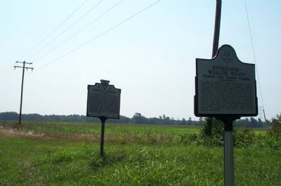
2. Swineyards - Willcox Wharf Marker
Shown alongside Grant's Crossing marker (V 9).
Another marker is no longer nearby. Greenway (was approx. 1½ miles away but has been replaced with another marker now near it).
Credits. This page was last revised on November 23, 2025. It was originally submitted on July 21, 2008, by Kathy Walker of Stafford, Virginia. This page has been viewed 2,325 times since then and 71 times this year. Last updated on November 23, 2025, by Evan Dwyer of Richmond, Virginia. Photos: 1, 2. submitted on July 21, 2008, by Kathy Walker of Stafford, Virginia. • Devry Becker Jones was the editor who published this page.
