Mangum in Greer County, Oklahoma — The American South (West South Central)
Samuel D. Rude
⎯⎯⎯
Henry Clay Sweet
Photographed by James Hulse, October 28, 2025
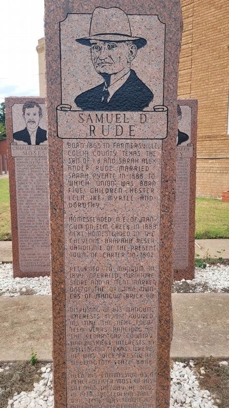
1. Samuel D. Rude Marker
Born 1865 in Farmersville, Collin County, Texas. The son of I.J. and Sarah Alexander Rude. Married Sarah Pyeatt in 1888, to which union was born five children - Hester, Lela, Ike, Myrtle and Dorothy. Homesteaded N.E. of Mangum on Elm Creek, in 1888. Next homesteaded in the Cheyenne-Arapaho Reservation N.E. of the present town of Carter in 1892. Returned to Mangum, in 1899, operated furniture store and a meat market. One of the original owners of Mangum Brick Co. Disposing of his Mangum interests in 1912, divided his time the next fourteen years ranching in the Cedar Gap country and business interests in Wellington, Texas, where he was vice-president Wellington State Bank. Held U.S. commission as a peace officer most of his life and the day he died. In 1938 the federal building flag was flown at half mast of his contribution to Mangum and Greer Ounty.
Henry Clay Sweet
Born Mar. 1, 1838, Sangamon County, Illinois, married Elizabeth Peeler, May 6, 1856. His six children Joseph Lewis, Emory Clay, Leonia, Albert Travis, Lucy, Frank Harvey. He was a Confederate Lieutenant in Civil War 18th. Calvalry Regt. Texas Volunteers. He surveyed most of Greer County in 1882 for Capt. Aarron S. Mangum who held patent to the land. In 1884, surveyed the townsite and thus named the town. The Sweet family was one of the first white families to legally settle Old Greer County, Texas. He was first postmaster of Mangum in 1886, charter member of Mangum Masonic Lodge. Passed away December 27, 1900 in Mangum, Oklahoma Territory.
Erected by Old Greer County Museum & Hall of Fame Inc.
Topics. This historical marker is listed in these topic lists: Law Enforcement • Settlements & Settlers. A significant historical date for this entry is May 6, 1856.
Location. 34° 52.406′ N, 99° 30.425′ W. Marker
this page online

Regionally, this marker is in the Kiowa Tribe, in the Comanche Nation, and in Southwest Oklahoma—Great Plains Country. It is also in the American South, specifically on the prairies, and on the Southern Plains. Globally, it is in North America, the Western Hemisphere, the Western World, and the Anglosphere. Historically, it finds itself in what was once New Spain, the Comanchería, the territory of the Mississippian Culture, the Dust Bowl, and the Louisiana Purchase.
Other nearby markers. At least 8 other markers are within walking distance of this marker: William Rush Vaughan / Edgar Lee Vaughan (here, next to this marker); George Washington Thomason / Wade Hampton Shumate (here, next to this marker); Lillie Ketchum Vaughan / Warren Joseph Radney

Photographed by James Hulse, October 28, 2025
2. Henry Clay Sweet Marker - Reverse Side
Photographed by James Hulse, October 28, 2025
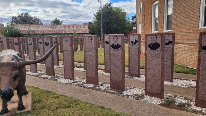
3. The marker is the seventh marker from the right side
Credits. This page was last revised on November 30, 2025. It was originally submitted on November 25, 2025, by James Hulse of Medina, Texas. This page has been viewed 51 times since then and 14 times this year. Photos: 1, 2, 3. submitted on November 30, 2025, by James Hulse of Medina, Texas.
