Chatfield in Fillmore County, Minnesota — The American Midwest (Upper Plains)
Chatfield Loses County Courthouse, Gains Its First Municipal Park
Photographed by McGhiever, October 4, 2025
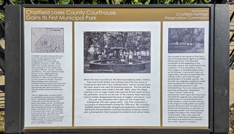
1. Chatfield Loses County Courthouse, Gains Its First Municipal Park Marker
Chatfield's founders intended the town to be the seat of government for the newly created Fillmore County, established by act of the Territorial Legislature on March 5, 1853. At the time it was created, Fillmore County encompassed all of the modern-day counties of Fillmore, Houston, Olmsted, and Winona. The parcel labeled "Public Square" on the original plat map prepared for the Chatfield Land Company in 1854 was set aside for the county courthouse and jail. However, these buildings were never built—Chatfield was the county seat for less than two years, and after the courthouse was permanently relocated in Preston in 1856 the public square remained open space.
"The U.S. legal system contains almost no regulations governing the platting of towns. Motivated individuals could plat a town site at any time and on any place they legally owned. No standards specified sizes or designs, although the plat needed legal property descriptions, streets, and blocks of lots. Accordingly, in this laisses-faire [sic] system, risk was borne by the speculators, who drew up a plat, registered the plat with the county registrar of deeds,
this page online
When the town was laid out, the block bounded by Main, Twiford, Third and Fourth Streets was nothing more than two acres of "hazel-brush land with a few scattered trees" and for several years the open space was used for pasturing livestock. The first park-like improvements were made in the late 1860s, when the village planted a row of sugar maple trees spaced 40 feet apart around the perimeter; however, by the turn of the century these trees had "almost entirely disappeared because of neglect and abuse," and the park was reforested with a grove of soft maple trees interspersed with open grassy areas. City Park underwent a succession of improvements during the 1920s and '30s, including grading, paved sidewalks, playground equipment, and electric lighting for the bandstand, creating the place of leisure, beauty and contemplation that is enjoyed by residents and visitors today.
The fountain in the center of City Park is one of the best known sights in Chatfield. Influenced by the "City Beautiful" movement at
Photographed by McGhiever, October 4, 2025
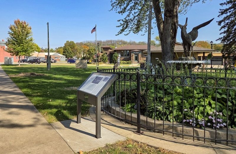
2. Marker and fountain in the center of City Park
Erected by Chatfield Heritage Preservation Commission.
Topics. This historical marker is listed in these topic lists: Charity & Public Work • Parks & Recreational Areas • Settlements & Settlers. A significant historical year for this entry is 1854.
Location. 43° 50.65′ N, 92° 11.28′ W. Marker is in Chatfield, Minnesota, in Fillmore County. It can be reached from Main Street S. (U.S. 52) south of 3rd Street SW, on the right when traveling south. The marker is in the center of City Park. Touch for map. Marker is at or near this postal address: 305 Main Street S, Chatfield MN 55923, United States of America. Touch for directions.

Regionally, this marker is in Southeast Minnesota and in Greater Rochester. It is also in the American Midwest, in the Corn Belt, and in the Driftless Area — Bluff Country. Globally, it is in North America, the Western Hemisphere, the Western World, and the Anglosphere. Historically, it finds itself in what was once Rupert’s Land, the territory of the Mississippian Culture, and the Louisiana Purchase.
Other nearby markers. At least 8 other markers are within walking distance of this marker: Chatfield (within shouting distance of this marker); Main Street—From Wilderness Trail to Modern Highway (within shouting distance of this marker); Chatfield's Legacy of Community Music (within shouting distance of this marker); Chatfield's Civic Geometry (within shouting distance of this marker); Chatfield's Historic Carnegie Library (within shouting distance of this marker); Chatfield's Public Education Legacy (within shouting distance of this marker); Chatfield High School (1916-1959) (about 300 feet away, measured in a direct line); The New Deal Comes to Chatfield (about 500 feet away). Touch for a list and map of all markers in Chatfield.
Credits. This page was last revised on November 26, 2025. It was originally submitted on November 26, 2025, by McGhiever of Minneapolis, Minnesota. This page has been viewed 78 times since then and 18 times this year. Photos: 1, 2. submitted on November 26, 2025, by McGhiever of Minneapolis, Minnesota.
