Kiowa in Elbert County, Colorado — The American Mountains (Southwest)
The Peaceful Valley of Kiowa Creek

Photographed by Cosmos Mariner, August 16, 2022
1. Peaceful Valley of Kiowa Creek Marker (panel 1)
Kiowa Creek, which runs through Kiowa (Peaceful) Valley, begins 20 miles south of here at the Platte River - Arkansas River Divide and winds north to the South Platte River.
This valley contains petrified wood from ancient forests, fossils of animals and plants now extinct, minerals carried here by ancient streams from the mountains to the west, and evidence of ancient peoples who lived here.
Spain, England, and France took turns claiming huge tracts of the Great Plains including Kiowa (Peaceful) Valley. In 1803, with the Louisiana Purchase, it became part of the United States.
In the 1800s Indian tribes, primarily Kiowa, Ute, Arapaho, Cheyenne, and Comanche, visited this valley because of ample forage for their ponies and food for themselves. Herds of the estimated 75 million buffalo in the Great Plains made this valley attractive for hunting.
During 1846-1847 the “Sick Detachment” of the Mormon Battalion of the U. S. Army, and Mormon pioneers from Mississippi, wintered at Fort Pueblo. The first Anglo children born in Colorado were to those families. In the spring they followed Trappers Trail (Jimmy Camp Trail) west of
this page online
Mountain Men and explorers, followed by others pursuing the California gold rush of 1849 and the Colorado gold rush of 1859, traveled through this area using Taos Trail, Jimmy Camp Trail, Trappers Trail, Cherokee Trail, Smoky Hill Trail, and Starvation Trail. Then came the many pioneers who settled Colorado in the latter half of the 1800s. Statehood was granted in 1876.
Fighting between settlers and Indians, the capture and hanging of outlaws, and disputes between farmers and ranchers took place near here during the latter half of the 1800s. In time the Indians, as well as the buffalo, wolves, and other wild animals, began to disappear from this area.
Kiowa became a stop on David Butterfield's stage line and a rail line ran through Elbert and Elizabeth until the mid-1930s. Trains hauled timber from Elbert County for buildings in Denver. Tree stumps of the decimated forests can still be seen in this valley.
As the forests disappeared, and grass areas were overgrazed, Kiowa Creek periodically flooded causing significant loss of property and lives in Elbert

Photographed by Cosmos Mariner, August 16, 2022
2. Peaceful Valley of Kiowa Creek Marker (panel 2)
In the 1960s the Denver Area Council of the Boy Scouts of America acquired 2,600 acres 11 miles south of Kiowa for the Peaceful Valley Scout Ranch. Today the ranch has expanded to 3,500 acres and hosts thousands of scouts each year.
This summary was compiled from “Saga of Peaceful Valley” by Albert C. Rehmer, writings of historian Lee Whiteley, “The Atlas of the North American Indian” by Carl Waldman, comments from the Church Historian's Office of the Church of Jesus Christ of Latter-day Saints, and information gathered from the Elbert County Historical Society and Museum located at 515 Comanche Street in Kiowa, Colorado.
This monument and the Veterans Memorial monument were built in July 2014 as an Eagle Scout project by Christopher Kelly of Troop 148 of the Denver Area Council of the Boy Scouts of America. It is intended to help preserve the history of the people of this valley while encouraging others who live or visit here to add their own positive chapters to it.
This project has enjoyed the support of the Elbert

Photographed by Cosmos Mariner, August 16, 2022
3. Peaceful Valley of Kiowa Creek Marker (panel 3)
Erected 2014 by Eagle Scout project by Christopher Kelly of Troop 148 of the Denver Area Council of the Boy Scouts of America.
Topics. This historical marker is listed in these topic lists: Exploration • Fraternal or Sororal Organizations • Indigenous Peoples and Communities • Settlements & Settlers.
Location. 39° 20.801′ N, 104° 28.073′ W. Marker is in Kiowa, Colorado, in Elbert County. It is on Comanche Steet (State Highway 86) just east of Arapahoe Street, on the left when traveling east. The marker is near the southwest corner of the historic Elbert County Courthouse grounds. Touch for map. Marker is at or near this postal address: 215 Comanche Street, Kiowa

Photographed by Cosmos Mariner, August 16, 2022
4. Peaceful Valley of Kiowa Creek Marker (panel 4)

Regionally, this marker is in the Eastern Plains. It is also in the American Mountain West, on the Great Plains, and specifically on the High Plains. Globally, it is in North America, the Western Hemisphere, the Western World, and the Anglosphere. Historically, it finds itself in what was once the Louisiana Purchase.
Other nearby markers. At least 8 other markers are within 7 miles of this marker, measured as the crow flies: Elbert County Veterans Memorial (within shouting distance of this marker); Pioneer Women of Colorado (within shouting distance of this marker); Kiowa (within shouting distance of this marker); Trail Under Siege / Rising to the Challenge (within shouting distance of this marker); Elizabeth Main Street (approx. 6.9 miles away); Historic Section House (approx. 6.9 miles away); First National Bank (approx. 6.9 miles away); Olde Hotel Square (approx. 6.9 miles away). Touch for a list and map of all markers in Kiowa.

Photographed by Cosmos Mariner, August 16, 2022
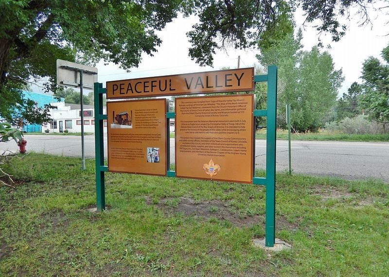
5. Peaceful Valley of Kiowa Creek Marker (south side)
Looking north from Comanche Street. Panels 1 and 2 comprise the south side of the marker.
Photographed by Cosmos Mariner, August 16, 2022
6. Peaceful Valley of Kiowa Creek Marker (north side)
Panels 3 and 4 comprise the north side of the marker. Comanche Street is in the background.
Credits. This page was last revised on November 30, 2025. It was originally submitted on November 26, 2025, by Cosmos Mariner of Cape Canaveral, Florida. This page has been viewed 175 times since then and 128 times this year. Photos: 1, 2, 3, 4, 5, 6. submitted on November 30, 2025, by Cosmos Mariner of Cape Canaveral, Florida.
