Fackler in Jackson County, Alabama — The American South (East South Central)
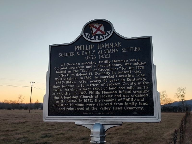
Phillip Hamman
Soldier and Early Alabama Settler
| — | (1753-1832) | — |
Photographed by Jimmy Emerson, November 27, 2025
1. Phillip Hamman Marker
Erected 2022 by Alabama Historical Association.
Topics and series. This historical marker is listed in these topic lists: Colonial Era • Patriots & Patriotism • Settlements & Settlers • War, US Revolutionary. In addition, it is included in the Alabama Historical Association series list. A significant historical year for this entry is 1778.
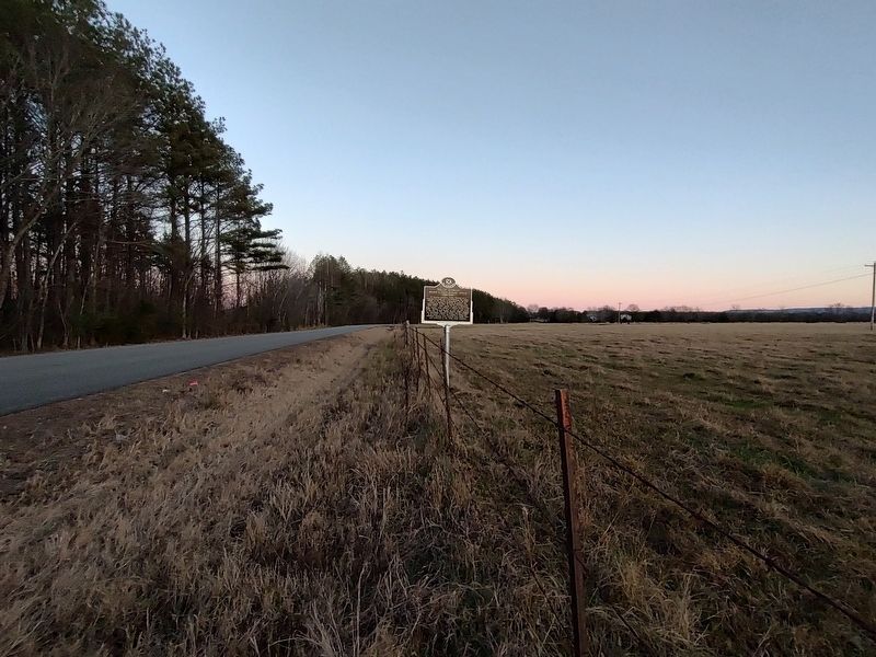
Location. 34° 48.553′ N, 85° 57.279′ W. Marker is in Fackler, Alabama, in Jackson County. It is on County Road 42 0.2 miles east
this page online

Regionally, this marker is in North Alabama. It is also in the American South, specifically in the Deep South, in Appalachia, and specifically in Southern Appalachia. Globally, it is in North America, a Gulf of Mexico state, the Western Hemisphere, the Western World, and the Anglosphere. Historically, it finds itself in what was once the original Cherokee Nation, the territory of the Mississippian Culture, one of the Confederate States of America, and the Antebellum South.
Other nearby markers. At least 8 other markers are within 8 miles of this marker, measured as the crow flies: Old Baptist Cemetery (approx. 4.7 miles away); Bellefonte Cemetery / Town of Bellefonte (approx. 6.7 miles away); Wet, Wild, and Wonderful (approx. 7.4 miles away); Fort Harker (approx. 7½ miles away); Stevenson Depot and Hotel (approx. 7.7 miles away); Flight 800 Memorial (approx. 7.8 miles away); Bennett's Cove Cabin (approx. 7.8 miles away); Crow Town
Photographed by Jimmy Emerson, November 27, 2025
2. Phillip Hamman Marker
Another marker is no longer nearby. Phillip Hammon (was about 400 feet away, measured in a direct line but has been permanently removed).
Credits. This page was last revised on November 29, 2025. It was originally submitted on November 27, 2025, by Jimmy Emerson of Dalton, Georgia. This page has been viewed 179 times since then and 134 times this year. Photos: 1, 2. submitted on November 27, 2025, by Jimmy Emerson of Dalton, Georgia. • James Hulse was the editor who published this page.
