Elora in Centre Wellington in Wellington County, Ontario — Central Canada (North America)
Lower Geddes Street
Photographed by Tim Boyd, November 24, 2025
1. Lower Geddes Street Marker
Inscription.
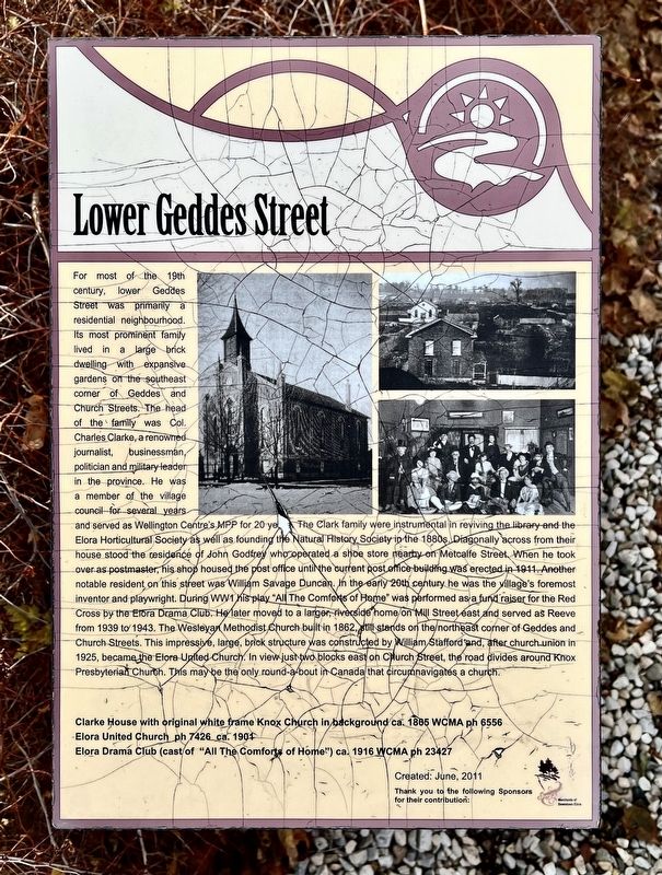
For most of the 19th century, lower Geddes Street was primarily a residential neighbourhood.
Its most prominent family lived in a large brick dwelling with expansive gardens on the southeast corner of Geddes and Church Streets. The head of the family was Col. Charles Clarke, a renowned journalist, businessman, politician and military leader in the province. He was a member of the village council for several years and served as Wellington Centre's MPP for 20 years.
The Clark family were instrumental in reviving the library and the Elora Horticultural Society as well as founding the Natural History Society in the 1880s. Diagonally across from their house stood the residence of John Godfrey who operated a shoe store nearby on Metcalfe Street When he took over as postmaster, his shop housed the post office until the current post office building was erected in 1911. Another notable resident on this street was William Savage Duncan. In the early 20th century he was the village's foremost inventor and playwright. During WW1 his play "All The Comforts of Home" was performed as a fund raiser for the Red Cross by the Elora Drama
Click or scan to see this page online
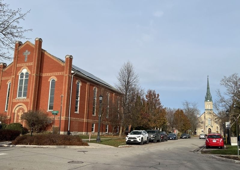
Club. He later moved to a larger, riverside home on Mill Street east and served as Reeve from 1939 to 1943. The Wesleyan Methodist Church built in 1862, still stands on the northeast corner of Geddes and Church Streets. This impressive, large, brick structure was constructed by William Stafford and, after churchunion in 1925, became the Elora United Church. In view just two blocks east on Church Street, the road divides around Knox Presbyterian Church. This may be the only round-a-bout in Canada that circumnavigates a church.
Location. 43° 40.962′ N, 80° 25.762′ W. Marker is in Centre Wellington, Ontario, in Wellington County. It is in Elora. It is at the intersection of Geddes Street and Church Street, on the right when traveling north on Geddes Street. Touch for map. Marker is at or near this postal address: 75 Geddes Street, Centre Wellington ON N0B 1S0, Canada. Touch for directions.
Regionally,
Photographed by Tim Boyd, November 24, 2025
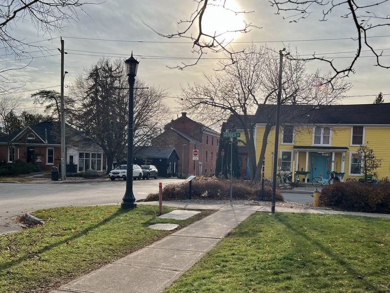
2. Lower Geddes Street Marker
Centre of photo
this marker is in the Huron-Perth-Waterloo-Wellington Area and in Southwestern Ontario. It is also in Central Canada. Globally, it is in North America, the Western Hemisphere, the Western World, and the Anglosphere. Historically, it finds itself in what was once a British colony, the Viceroyalty of New France, the Haudenosaunee (Iroquois) Confederacy, and Rupert’s Land.
3. Elora United (left) and Knox Presbyterian Churches in 2025
Credits. This page was last revised on November 28, 2025. It was originally submitted on November 28, 2025, by Tim Boyd of Hamilton, Ontario. This page has been viewed 59 times since then and 30 times this year. Photos:1, 2, 3. submitted on November 28, 2025, by Tim Boyd of Hamilton, Ontario. • Andrew Ruppenstein was the editor who published this page.