Fredericksburg, Virginia — The American South (Mid-Atlantic)
Fredericksburg
Photographed by Dawn Bowen, July 13, 2007
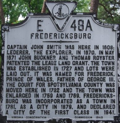
1. Fredericksburg Marker
Erected 1948 by Virginia Conservation Commission. (Marker Number E-46A.)
Topics and series. This historical marker is listed in these topic lists: Notable Events • Political Subdivisions • Settlements & Settlers. In addition, it is included in the Virginia Department of Historic Resources (DHR) series list. A significant historical month for this entry is May 1671.
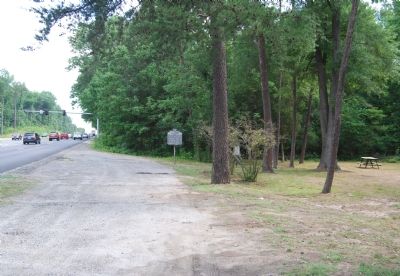
Location. 38° 17.281′ N, 77° 29.174′ W. Marker is in Fredericksburg, Virginia. It is on Richmond Highway (U.S. 1) 0.1 miles south of Idlewild Boulevard, on the right when traveling north. Touch for map. Marker is in this post office area: Fredericksburg VA 22401, United States
this page online

Regionally, this marker is in the Washington Metropolitan Area and in Northern Virginia. It is also in the American South and specifically in the Upper South. Globally, it is in North America, the Western Hemisphere, the Western World, and the Anglosphere. Historically, it finds itself in what was once the territory of the Mississippian Culture, one of the original Thirteen Colonies, one of the Confederate States of America, and the Antebellum South.
Other nearby markers. At least 8 other markers are within walking distance of this marker: Building a Railroad Through a Stream Valley (approx. 0.2 miles away); The Virginia Central Railway (approx. ¼ mile away); The Walker Landram House (approx. 0.3 miles away); This Monument Commemorates Our Local Militia Service (1675-1903) (approx. 0.4 miles away); World War I Fredericksburg National Guard Monument (approx. 0.4 miles away); Lee’s Position (approx. 0.4 miles away); The Battle of Fredericksburg from Lee's Hill, December, 1862 (approx. 0.6 miles away); Lee's Hill, the commander's lookout (approx. 0.6 miles away). Touch for a list and map
Photographed by Dawn Bowen, July 13, 2007
2. Marker along US 1
Credits. This page was last revised on November 29, 2025. It was originally submitted on July 13, 2007, by Dawn Bowen of Fredericksburg, Virginia. This page has been viewed 2,257 times since then and 85 times this year. Last updated on November 29, 2025, by John McCleary of Woodbridge, Virginia. Photos: 1, 2. submitted on July 13, 2007, by Dawn Bowen of Fredericksburg, Virginia. • Devry Becker Jones was the editor who published this page.
