
La Junta in Otero County, Colorado — The American Mountains (Southwest)
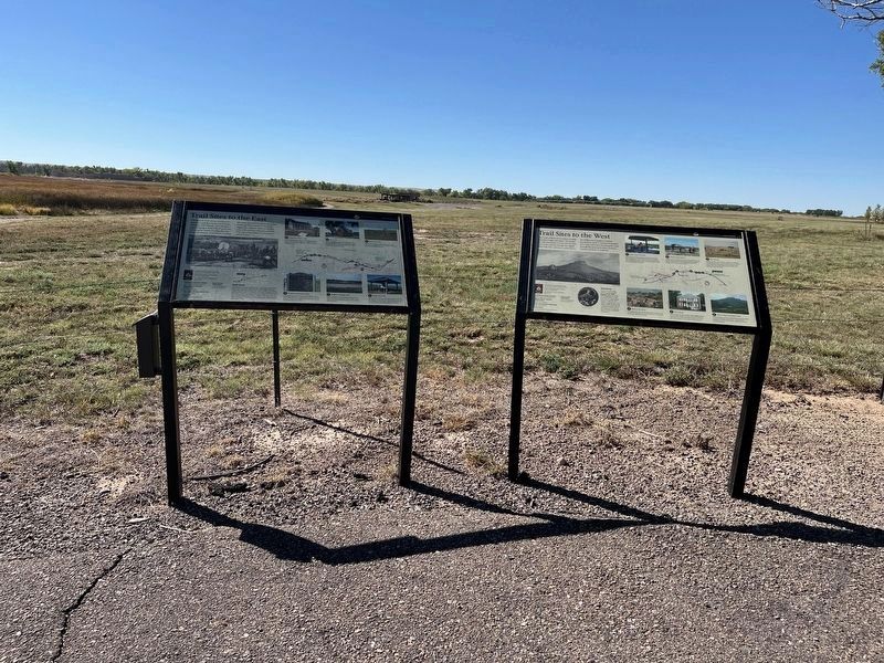
Trail Sites to the West
| — | Santa Fe National Historic Trail | — |

Photographed by Cosmos Mariner, June 13, 2012
1. Trail Sites to the West Marker
After a stay at Bent's Fort, traders heading west had a rough road ahead. The Sangre de Cristo Mountains loomed and the main route of the trail was through the rugged Raton Pass. The road was so rocky that in the 1840s a day's progress could be measured in yards. It was later developed into a toll road before becoming the route through the mountains of the Atchison, Topeka, and Santa Fe Railroad.
1 • Sierra Vista Overlook
Trail ruts can be seen crossing the grasslands towards the Rocky Mountains, 60 miles distant and four days travel for those heading west. The site of the mountains signaled the end of the long and tedious prairie crossing, but also warned of the difficult Raton Pass ahead.
2 • Timpas Stage Station
Timpas Creek was the first source of water for Santa Fe Trail traders after leaving the Arkansas River heading southwest. Between 1869 and 1871 the Metcalf Ranch, previously located here, served as a stage station.
3 • Iron Spring
Located 11 miles west of Timpas, Colorado, on Highway 350, and then one mile south on a gravel road, Iron Spring was an important water supply on the trail and a stage station. Trail ruts
this page online
4 • Hole-in-the-Rock
The headwaters of the Timpas Creek, Hole-in-the Rock was an important landmark for early trail travelers. It was a deep water source that never went dry.
5 • Baca House
Built by a Santa Fe Trail merchant, John Hough, and later sold to the Baca family, this house sits near the Santa Fe Trail and houses some furnishings brought west on the trail. The structure is now a state-operated museum.
6 • Fisher's Peak and Raton Pass
Overlooking the entrance to Raton Pass between Trinidad, Colorado, and Raton, New Mexico, this peak was a landmark for Santa Fe Trail traders, jutting out from the surrounding mesa.
Eyewitness
As one of the first Anglo-American women to travel the trail, Susan Shelby Magoffin made the Journey from Independence to Santa Fe and into Mexico in 1846, when she was newly married and just 19 years old. She traveled in relative luxury in a private carriage and was a keen observer of life on the trail and in American-occupied Santa Fe. She wrote a vivid account of the experience in a travelogue, Down the Santa Fe Trail and Into Mexico.
Erected by National

2. Marker detail: Fisher's Peak
Topics and series. This historical marker is listed in these topic lists: Industry & Commerce • Roads & Vehicles. In addition, it is included in the Santa Fe Trail series list.
Location. 38° 2.766′ N, 103° 25.856′ W. Marker is in La Junta, Colorado, in Otero County. It is on State Highway 194 ¼ mile east of County Road 35, on the right when traveling east. The marker is in a pull-out alongside the landmark Bent's Old Fort stone archway erected by the La Junta Chapter Daughters of the American Revolution in 1930. Touch for map. Marker is in this post office area: La Junta CO 81050, United States of America. Touch for directions.

Regionally, this marker is in the Arkansas River Valley and in the Eastern Plains. It is also in the American Mountain West, on the Great Plains, on the Southern Plains, on the High Plains, and on the Santa Fe Trail Corridor. Globally, it is in North America, the Western Hemisphere, the Western World, and the Anglosphere. Historically, it finds itself in what was once the Comanchería, the Dust

3. Marker detail: Santa Fe Trail Map
Other nearby markers. At least 8 other markers are within walking distance of this marker: Trail Sites to the East (here, next to this marker); Bent's Fort on Santa Fe Trail (a few steps from this marker); Santa Fe Trail (a few steps from this marker); Traveling Through History (about 400 feet away, measured in a direct line); Trading Post on the Trail (approx. 0.2 miles away); Welcome to the Borderlands (approx. 0.2 miles away); A Babel-Tongued Multitude (approx. 0.2 miles away); An Adobe Outpost (approx. 0.2 miles away). Touch for a list and map of all markers in La Junta.
Related markers. Click here for a list of markers that are related to this marker.
Also see . . . Susan Shelby Magoffin (Wikipedia).
Excerpt: Susan Shelby Magoffin (30 July 1827 – 26 October 1855) was the wife of a trader from the United States who traveled on the Santa Fe Trail in the late 1840s. The diary in which she recorded her experiences has been used extensively as a source for histories of the time. Susan Magoffin's journal covers the journey from its start until 8 September 1847. The Magoffins(Submitted on December 1, 2025, by Cosmos Mariner of Cape Canaveral, Florida.)traveled along the Santa Fe trail and down into Mexico in the wake of the invading United States army during the Mexican–American War (1846–1848). It is an invaluable source of information on the conditions of the time, the people and the events, often providing a unique woman's perspective. Susan became ill, and when they reached Bent's Fort on 27 July she took to bed in the spacious private rooms that they had reserved. Shortly after her nineteenth birthday she suffered a miscarriage, which forced them to delay their journey onward. Leaving Bent's Fort on 14 August 1846, they reached the Mexican settlement at Mora creek on 25 August, where Susan was shocked at the primitive housing, and the next day came to Las Vegas, New Mexico. They continued south to Santa Fe, which they reached on 31 August.Photographed by Leslie Eudy, October 3, 20254. Trail Sites to the West MarkerMarker on the Right
Credits. This page was last revised on February 19, 2026. It was originally submitted on November 29, 2025, by Cosmos Mariner of Cape Canaveral, Florida. This page has been viewed 74 times since then and 43 times this year. Photos: 1, 2, 3. submitted on December 1, 2025, by Cosmos Mariner of Cape Canaveral, Florida. 4. submitted on February 3, 2026, by Leslie Eudy of Golden, Colorado.
