
The Loop District in Chicago in Cook County, Illinois — The American Midwest (Great Lakes)
South Branch of the Chicago River 2000
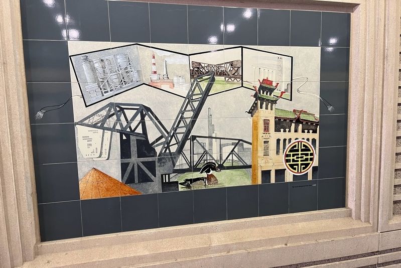
Photographed by Sean P. Flynn, September 10, 2024
1. South Branch of the Chicago River 2000 Marker
The South Branch of the River 2000
Erected 2000.
Topics. This historical marker is listed in these topic lists: Arts, Letters, Music • Waterways & Vessels. A significant historical year for this entry is 2000.
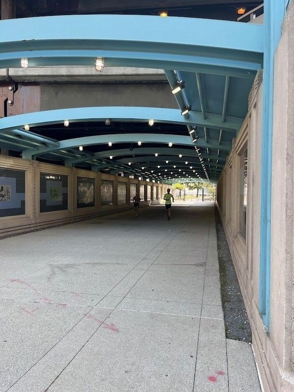
Location. 41° 53.271′ N, 87° 36.853′ W. Marker is in Chicago, Illinois, in Cook County. It is in The Loop District. It is at the intersection of Chicago Riverwalk and Jean Baptiste Pointe du Sable Lake Shore Drive (U.S. 41), on the right when traveling east on Chicago Riverwalk. The mural is in the pedestrian walkway beneath Lake Shore Drive. Touch for map. Marker is in this post office area: Chicago IL 60611, United States of America. Touch for directions.

Regionally, this marker is in the American Midwest. Globally, it is in North America, on the Great Lakes, in the Western Hemisphere, in the Western World, and in the Anglosphere. Historically, it finds itself in what was once the Viceroyalty of New France, the territory of the Mississippian Culture, and the Northwest Territory.
Other nearby markers. At least 8 other markers are within walking distance of this marker: Chicago Riverwalk 2000 (here,
this page online
More about this marker. The mural is one of several erected in the Chicago Riverwalk's tunnel beneath Lake Shore Drive, close to where the Chicago River meets Lake Michigan. Of the 16 murals, this one and two others depict Chicago in the year 2000, when they were erected.
Regarding South Branch of the Chicago River 2000. The South Branch of the Chicago River begins about 1⅓ miles west of here.
Also see . . . South Branch Chicago River Region. A description of the Chicago River's South Branch and the area around it. (Submitted on December 2, 2025, by Sean P. Flynn of Oak Park, Illinois.)
Photographed by Sean P. Flynn, September 10, 2024
2. The Riverwalk Gateway
Several murals adorn the walls of this walkway beneath Du Sable Lake Shore Drive.

Photographed by Sean P. Flynn, February 28, 2025
3. South Branch of the Chicago River in 2025
The photo was taken at Ping Tom Memorial Park, located near the Chinatown neighborhood on Chicago's South Side. The city's skyline is about 1½ miles in the distance.
Credits. This page was last revised on December 6, 2025. It was originally submitted on December 2, 2025, by Sean P. Flynn of Oak Park, Illinois. This page has been viewed 33 times since then and 14 times this year. Photos: 1, 2, 3. submitted on December 2, 2025, by Sean P. Flynn of Oak Park, Illinois.
