
Douglass in Nacogdoches County, Texas — The American South (West South Central)
Brewer Cemetery
Photographed by Jeff Leichsenring, December 1, 2025
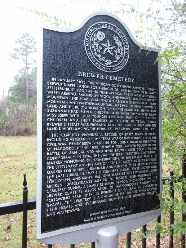
1. Brewer Cemetery Marker
The cemetery provides a record of early Texas settlers, including veterans of the Texas War of Independence and the Civil War. Henry Brewer and his son John fought in the Battle of Nacogdoches in 1832. Henry Mitchel Brewer fought in the Battle of San Jacinto and John Brewer later served in the Confederacy. In 1936, the State of Texas erected a centennial marker honoring the contributions of the Brewer family to the settlement
this page online
Erected 2010 by Texas Historical Commission. (Marker Number 17189.)
Topics. This historical marker is listed in this topic list: Cemeteries & Burial Sites. A significant historical month for this entry is January 1835.
Location. 31° 43.861′ N, 94° 50.55′ W. Marker is in Douglass, Texas, in Nacogdoches County. It can be reached from Farm to Market Road 343 0.9 miles south of County Road 850. Touch for map. Marker is at or near this postal address: 13641 FM343, Douglass TX 75943, United States of America. Touch for directions.

Regionally,
Photographed by Jeff Leichsenring, December 1, 2025
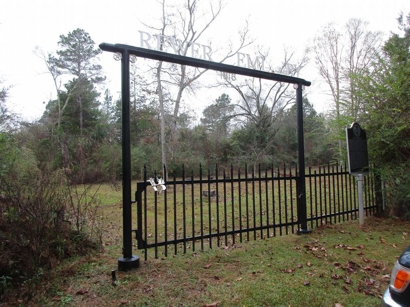
2. Brewer Cemetery and marker
Other nearby markers. At least 8 other markers are within 5 miles of this marker, measured as the crow flies: A different marker also named Brewer Cemetery (within shouting distance of this marker); Kings Highway Camino Real — Old San Antonio Road (approx. 4½ miles away); John R. Clute (approx. 4.8 miles away); Louis Juchereau de St. Denis (approx. 5 miles away); Mission Nuestra Señora de la Purísima Concepción de los Hainais (approx. 5 miles away); Presidio Nuestra Señora de los Dolores de los Tejas (approx. 5 miles away); San Patricio Rancho (approx. 5 miles away); Town of Douglass (approx. 5 miles away). Touch for a list and map of all markers in Douglass.
Credits. This page was last revised on December 4, 2025. It was originally submitted on December 3, 2025, by Jeff Leichsenring of Garland, Texas. This page has been viewed 79 times since then and 48 times this year. Photos: 1, 2. submitted on December 3, 2025, by Jeff Leichsenring of Garland, Texas. • James Hulse was the editor who published this page.
