Douglass in Nacogdoches County, Texas — The American South (West South Central)
John R. Clute
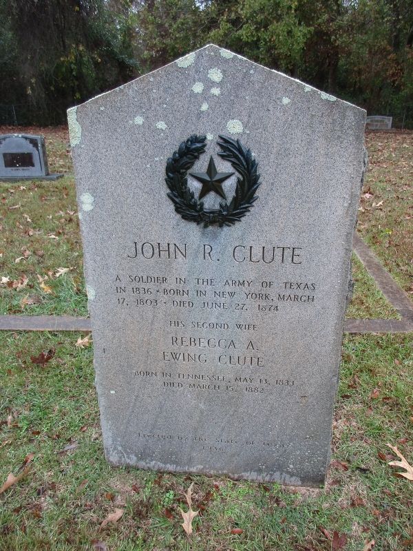
Photographed by Jeff Leichsenring, December 1, 2025
1. John R. Clute Marker
Erected 1936 by State of Texas. (Marker Number 9266.)
Topics and series. This historical marker is listed in these topic lists: Cemeteries & Burial Sites • War, Texas Independence. In addition, it is included in the Texas 1936 Centennial Markers and Monuments series list. A significant historical date for this entry is March 17, 1803.
Location. 31° 40.263′ N, 94° 52.951′ W. Marker is in Douglass, Texas, in Nacogdoches County. It is on Farm to Market Road 225 0.2 miles north of State Highway 21. The marker is located in Douglass Cemetery. Touch for map. Marker is in this post office area: Douglass TX 75943, United States of America. Touch for directions.

Regionally, this marker is in the American South, specifically in the Deep South, and in the Piney Woods. Globally, it is in North America, a Gulf of Mexico state, the Western Hemisphere, the Western World, and the Anglosphere. Historically, it finds itself in what was once New Spain,
this page online
Other nearby markers. At least 8 other markers are within 5 miles of this marker, measured as the crow flies: Louis Juchereau de St. Denis (approx. ¼ mile away); Mission Nuestra Señora de la Purísima Concepción de los Hainais (approx. ¼ mile away); Presidio Nuestra Señora de los Dolores de los Tejas (approx. ¼ mile away); San Patricio Rancho (approx. ¼ mile away); Town of Douglass (approx. ¼ mile away); Kings Highway Camino Real — Old San Antonio Road (approx. 0.3 miles away); Angelina River (approx. 4.6 miles away); Site of Linwood (approx. 4.6 miles away). Touch for a list and map of all markers in Douglass.
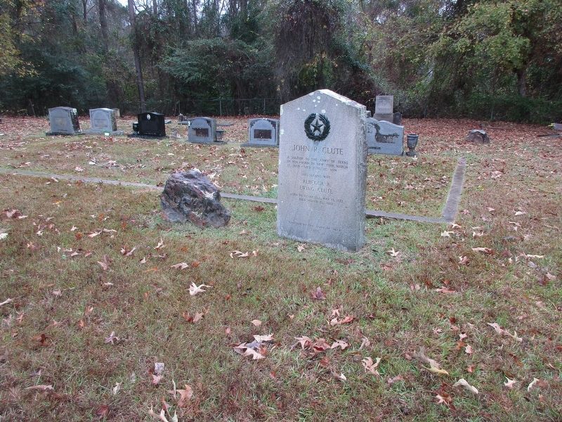
Photographed by Jeff Leichsenring, December 1, 2025
2. John R. Clute Marker
Credits. This page was last revised on December 4, 2025. It was originally submitted on December 3, 2025, by Jeff Leichsenring of Garland, Texas. This page has been viewed 65 times since then and 41 times this year. Photos: 1, 2. submitted on December 3, 2025, by Jeff Leichsenring of Garland, Texas. • James Hulse was the editor who published this page.
