Holly in Prowers County, Colorado — The American Mountains (Southwest)
Santa Fe Trail Scenic and Historic Byway — Colorado
The Mountain Branch
Photographed by Cosmos Mariner, July 25, 2023
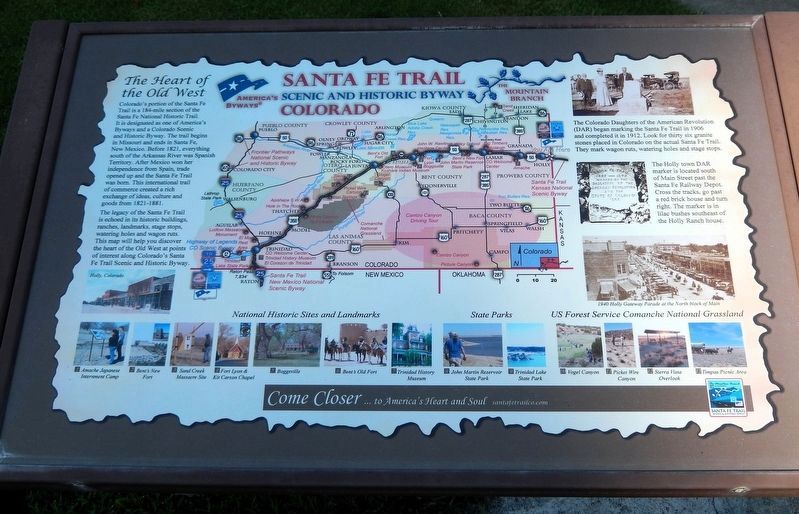
1. Santa Fe Trail Scenic and Historic Byway Marker
The Heart of the Old West
Colorado's portion of the Santa Fe Trail is a 184-mile section of the Santa Fe National Historic Trail. It is designated as one of America's Byways and a Colorado Scenic and Historic Byway. The trail begins in Missouri and ends in Santa Fe, New Mexico. Before 1821, everything south of the Arkansas River was Spanish Territory. After Mexico won her independence from Spain, trade opened up and the Santa Fe Trail was born. This international trail of commerce created a rich exchange of ideas, culture and goods from 1821-1881.
The legacy of the Santa Fe Trail is echoed in its historic buildings, ranches, landmarks, stage stops, watering holes and wagon ruts. This map will help you discover the heart of the Old West at points of interest along Colorado's Santa Fe Trail Scenic and Historic Byway.
The Colorado Daughters of the American Revolution (DAR) began marking the Santa Fe Trail in 1906 and completed it in 1912. Look for thirty six granite stones placed in Colorado on the actual Santa Fe Trail. They mark wagon ruts, watering holes and stage stops.
The Holly town DAR marker is located south of Main
this page online
National Historic Sites and Landmarks
1 — Amache Japanese Internment Camp
2 — Bent’s New Fort
3 — Sand Creek Massacre Site
4 — Fort Lyon & Kit Carson Chapel
5 — Boggsville
6 — Bent’s Old Fort
7 — Trinidad History Museum
State Parks
8 — John Martin Reservoir State Park
9 — Trinidad Lake State Park
US Forest Service Comanche National Grassland
10 — Vogel Canyon
11 — Picket Wire Canyon
12 — Sierra Vista Overlook
13 —Timpas Picnic Area
Erected by Santa Fe Trail Scenic and Historic Byway.
Topics and series. This historical marker is listed in these topic lists: Forts and Castles • Industry & Commerce • Roads & Vehicles. In addition, it is included in the Santa Fe Trail series list. A significant historical year for this entry is 1821.
Location. 38° 2.965′ N, 102° 3.082′ W. Marker is in Holly, Colorado, in Prowers County. It can be reached from Santa Fe Trail Scenic Byway (U.S. 50/400 at milepost 467.4), half a mile west of the Colorado/Kansas state border, on the left when traveling
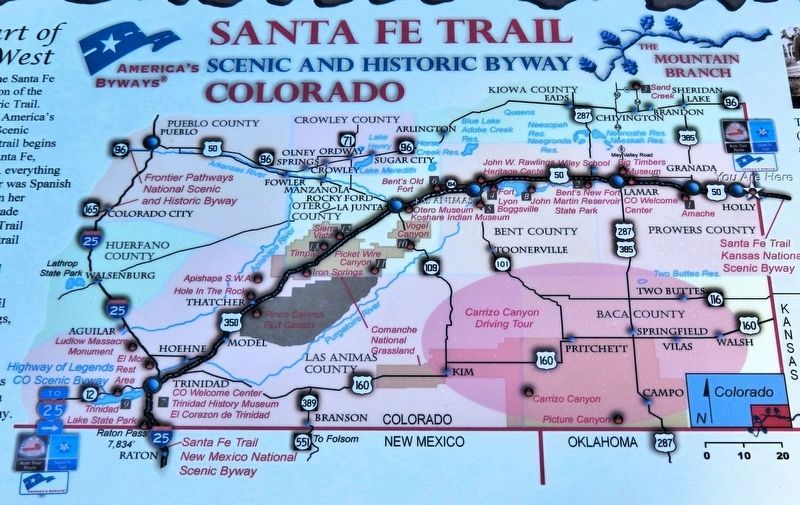
2. Marker detail: Santa Fe Trail Map

Regionally, this marker is in the Eastern Plains. It is also in the American Mountain West, on the Great Plains, on the Southern Plains, on the High Plains, and on the Santa Fe Trail Corridor. Globally, it is in North America, the Western Hemisphere, the Western World, and the Anglosphere. Historically, it finds itself in what was once New Spain, the Comanchería, the Dust Bowl, and the Republic of Texas.
Other nearby markers. At least 4 other markers are within 3 miles of this marker, measured as the crow flies: Trail City (here, next to this marker); Arkansas River (here, next to this marker); Explore Santa Fe Trail History (a few steps from this marker); Santa Fe Trail (approx. 2½ miles away in Kansas).
Related markers. Click here for a list of markers that are related to this marker.
Also see . . . The Santa Fe Trail Interactive Map — Sites to Visit in Colorado (National Park Service).
Excerpt: Here's(Submitted on December 6, 2025, by Cosmos Mariner of Cape Canaveral, Florida.)a fun, exciting way to find places to visit. Zoom in to find a location in Colorado, then click on the yellow balloon of your choice to see the site name, address, access, image, and website. You'll find museums, interpretive centers, and historic sites that provide information and interpretation for the Santa Fe National Historic Trail.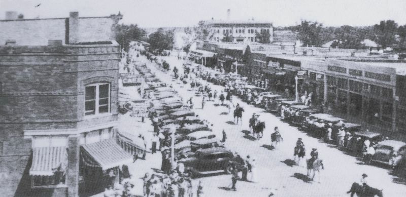 3. Marker detail: 1940 Holly Gateway Parade at the North block of Main
Photographed by Cosmos Mariner, July 25, 2023
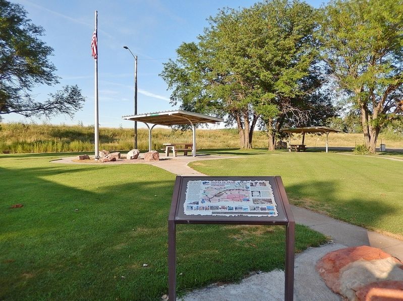
4. Santa Fe Trail Scenic and Historic Byway Marker
Looking northeast through the Holly Rest Stop grounds.
Credits. This page was last revised on December 6, 2025. It was originally submitted on December 5, 2025, by Cosmos Mariner of Cape Canaveral, Florida. This page has been viewed 117 times since then and 71 times this year. Photos: 1, 2, 3, 4. submitted on December 5, 2025, by Cosmos Mariner of Cape Canaveral, Florida.
