
Brandon, Manitoba — Canada’s Prairie Region (North America)
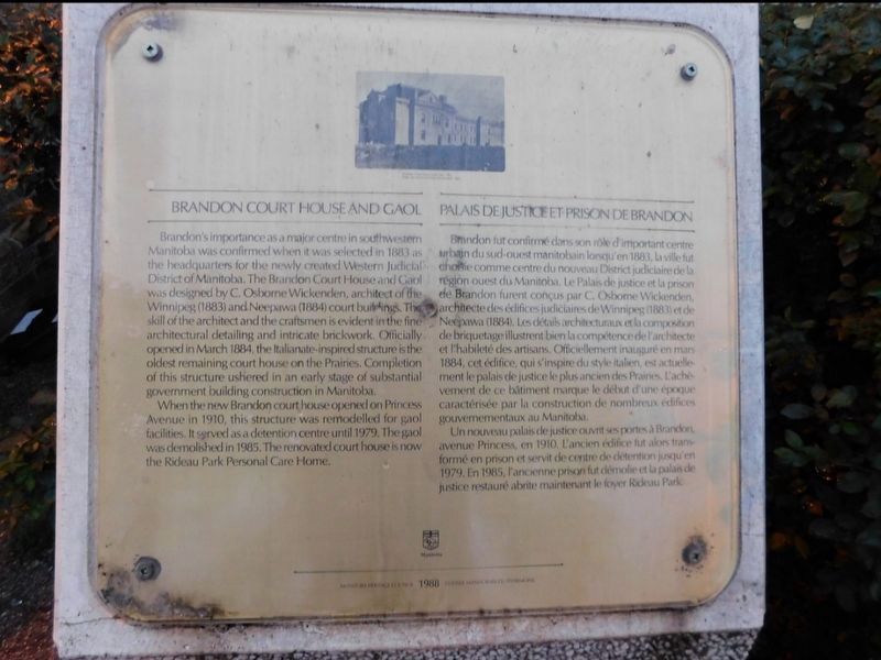
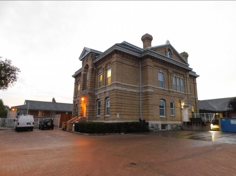
Brandon Courthouse and Gaol
Palais de Justice et Prison de Brandon
Photographed by Jimmy Emerson, Sept 2023
1. Brandon Courthouse and Gaol Marker

Brandon's importance as a major centre in southwestern Manitoba was confirmed when it was selected in 1883 as the headquarters for the newly created Western Judicial District of Manitoba. The Brandon Court House and Gaol was designed by C. Osborne Wickenden, architect of the Winnipeg (1883) and Neepawa (1884) court buildings. The skill of the architect and the craftsmen is evident in the fine architectural detailing and intricate brickwork. Officially opened in March 1884, the Italianate-inspired structure is the oldest remaining court house on the Prairies. Completion of this structure ushered in an early stage of substantial government building construction in Manitoba.
When the new Brandon court house opened on Princess Avenue in 1910, this structure was remodelled for gaol facilities. It served as a detention centre until 1979. The gaol was demolished in 1985. The renovated court house is now the Rideau Park Personal Care Home.
Brandon fut confirmé dans son rôle d'important centre urban du sud-ouest manitobain lonqu'en
this page online
Un nouveau palais de justice ouvrit ses portes à Brandon avenue Princess, en 1910, L'ancien édifice fut alors trans formé en prison et servit de centre de détention jusqu'en 1979. En 1985, l'ancienne prison fut démolie et la palais de justice restauré abrite maintenant le foyer Rideau Park.
Erected 1988 by Manitoba Heritage Council.
Topics. This historical marker is listed in these topic lists: Architecture • Law Enforcement. A significant historical year for this entry is 1884.
Location. 49° 50.593′ N,
Photographed by Jimmy Emerson, Sept 2023
2. Brandon Courthouse and Gaol
Marker is beside the stairs in the shrubs.

Regionally, this marker is in Southwest Manitoba. It is also in the Prairies. Globally, it is in North America, the Western Hemisphere, the Western World, and the Anglosphere. Historically, it finds itself in what was once a British colony, the Viceroyalty of New France, and Rupert’s Land.
Other nearby markers. At least 8 other markers are within 3 kilometers of this marker, measured as the crow flies: Central Fire Station #1 (approx. 1.2 kilometers away); Sir Clifford Sifton (approx. 1.3 kilometers away); Burchill & Howey Block (approx. 1.5 kilometers away); Paterson-Matheson House (approx. 1.5 kilometers away); Former Merchants Bank Building / Édifice de L'ancienne Merchants Bank (approx. 1.6 kilometers away); Prairie College (approx. 2.2 kilometers away); Brandon College (approx. 2.2 kilometers away); Thomas Mayne Daly (approx. 2.3 kilometers away). Touch for a list and map of all markers in Brandon.
Credits. This page was last revised on December 17, 2025. It was originally submitted on December 9, 2025, by Jimmy Emerson of Dalton, Georgia. This page has been viewed 48 times since then and 14 times this year. Photos: 1, 2. submitted on December 9, 2025, by Jimmy Emerson of Dalton, Georgia. • Andrew Ruppenstein was the editor who published this page.
