Near Dolphin in Brunswick County, Virginia — The American South (Mid-Atlantic)
Smoky Ordinary
“Rebel cavalry”
| — | Wilson-Kautz Raid | — |
Photographed by Bernard Fisher, June 21, 2009
1. Smoky Ordinary CWT Marker
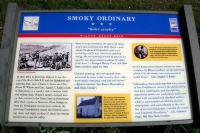
In June 1864, to deny Gen. Robert E. Lee the use of the South Side R.R. and the Richmond and Danville R.R., Gen. Ulysses S. Grant sent Gen. James H. Wilson and Gen. August V. Kautz south of Petersburg on a cavalry raid to destroy track and rolling stock. Wilson’s raiders camped here on their retreat to the Union lines at Petersburg after their repulse at Staunton River Bridge on June 25. Participant recollections indicate the pursuing Confederates struck the Federals morning, noon, and night on June 27. Soon the retreat turned into a race for safety.
“Here it is my birthday, 20 years old today and I am watching the Rebs there...and about 80 showed themselves and were watching while our column is passing along. We are making tracks as fast as we can for our lines which is about 51 miles from here.” - Trooper Henry Carr, 8th New York Cavalry, June 27, 1864
“Toward evening, the rear-guard were attacked by some rebel cava1ry, but...they were easily repulsed, and did not harm.” - Quartermaster Sgt Roger Hannaford, 2nd Ohio Cavalry “As the head of the column moved out after crossing the Meherrin River on the morning of the 27th the enemy was encountered in small force.”- Gen. August V. Kautz
Click or scan to see
this page online
“Although we had easily repulsed every attack of the Confederate cavalry, the skirmishing had been continuous, and the fighting, sometimes severe; our ambulance train was filled with wounded and disabled soldiers while a vast number of vehicles of every description, and contrabands to the number of several thousands, crowded the roads and hindered the column.” - Col. Edmund Pope, 8th New York Cavalry
(sidebar)
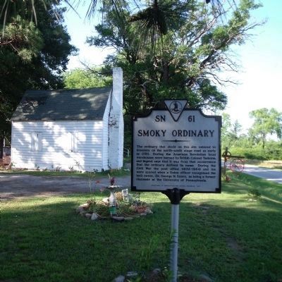
The ordinary that stood one-quarter mile north catered to travelers on the north-south stage road as early as 1750. During the Civil War the inn and post office were spared when a Union officer recognized the inn’s owner, Dr. George M. Raney, as being a former classmate at the University of Pennsylvania.
In July 1781 during the Revolutionary War, British Lt. Col. Banastre Tarleton burned local warehouses while leading a cavalry foray through southside Virginia. Legend says it was from that occurrence that the ordinary derived its name.
Erected by Virginia Civil War Trails.
Topics and series. This historical marker is listed in these topic lists: Industry & Commerce • Railroads & Streetcars
Photographed by Bernard Fisher, June 21, 2009
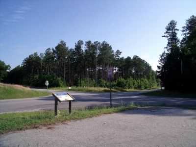
2. Liberty Rd & Old Stage Rd (facing south).
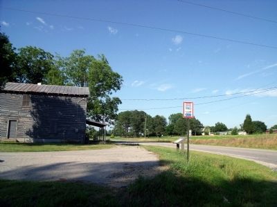
Location. This marker has been replaced by another marker nearby. It was located near 36° 49.773′ N, 77° 44.333′ W. Marker was near Dolphin, Virginia, in Brunswick County. It was at the intersection of Liberty Road and Old Stage Road, on the left when traveling east on Liberty Road. Touch for map. Marker was at or near this postal address: 10422 Liberty Rd, Dolphin VA 23843, United States of America. Touch for directions.

Regionally, this marker was in Southern Virginia, specifically in the Piedmont, and in Southside Virginia. It was also in the American South and specifically in the Upper South. Globally, it was in North America, the Western Hemisphere, the Western World, and the Anglosphere. Historically, it found itself in what was once the territory of the Mississippian Culture, one of the original Thirteen Colonies, one of the Confederate States of America, and the Antebellum South.
Other nearby markers. At least 8 other markers are within 7
Photographed by Bernard Fisher, June 21, 2009
3. Liberty Rd & Old Stage Rd (facing north).
Another marker is no longer nearby. Smoky Ordinary (was approx. 0.4 miles away but has been replaced with another marker now near it).
More about this marker. On the left is an "Etching by Edwin Forbes." In the center sidebar is a photo of the "Smoky Ordinary." On the upper right sidebar is a painiting of "British Lt. Col. Banastre Tarleton."
Also see . . . Wilson–Kautz Raid. Wikipedia entry (Submitted on April 23, 2022, by Larry Gertner of New York, New York.)
Photographed by Bernard Fisher, June 21, 2009
4. Smoky Ordinary stands one-quarter mile north (private residence).
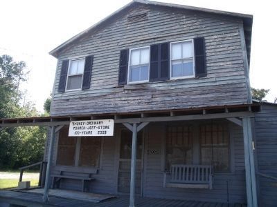
Photographed by Bernard Fisher, June 21, 2009
5. Nearby Smoky Ordinary General Store.
Credits. This page was last revised on September 6, 2026. It was originally submitted on June 22, 2009, by Bernard Fisher of Richmond, Virginia. This page has been viewed 4,299 times since then and 126 times this year. Last updated on December 10, 2025, by Evan Dwyer of Richmond, Virginia. Photos: 1, 2, 3, 4, 5. submitted on June 22, 2009, by Bernard Fisher of Richmond, Virginia. • Devry Becker Jones was the editor who published this page.
