Near Wickliffe in Ballard County, Kentucky — The American South (East South Central)
Blandville Courthouse
Photographed by Duane and Tracy Marsteller, November 30, 2025
1. Blandville Courthouse Marker
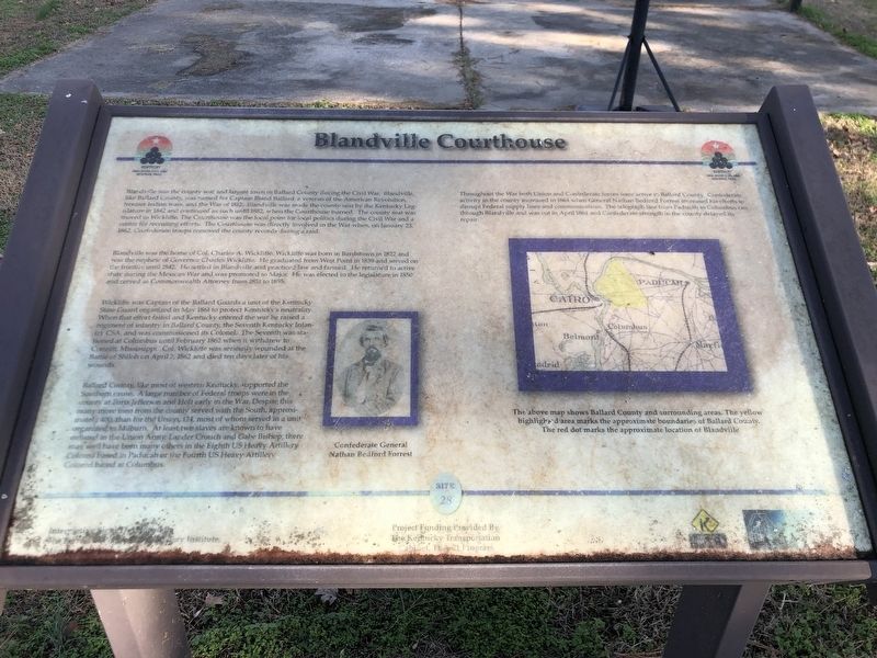
Blandville was the home of Col. Charles A. Wickliffe. Wickliffe was born in Bardstown in 1822 and was the nephew of Governor Charles Wickliffe. He graduated from West Point in 1839 and served on the frontier until 1842. He settled in Blandville and practiced law and farmed. He returned to active duty during the Mexican War and was promoted to Major. He was elected to the legislature in 1850 and served as Commonwealth Attorney from 1851 to 1855.
Wicklifte was Captain
this page online
Ballard County, like most of western Kentucky, supported the Southem cause. A large number of Federal troops were in the county at Forts Jefferson and Holt early in the War. Despite this many more men from the county served with the South, approxi-mately 400, than for the Union, 124, most of whom served in a unit organized in Mildburn. At least two slaves are known to have enlisted in the Union Army, Lander Crouch and Gabe Bishop; there well have been many others in the Eighth US Heavy Artillery Colored based in Paducah or the Fourth US Heavy Artillery Colored based at Columbus.
Throughout the War both Union and Confederate forces were
Photographed by Duane and Tracy Marsteller, November 30, 2025
2. Blandville Courthouse Marker
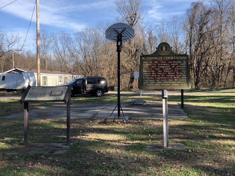
Featured marker is on the left.
Captions
(Photo #1) Confederate General Nathan Bedford Forrest
(Photo #2) The above map shows Ballard County and surrounding areas. The yellow highlighed area marks the approximate boundaries of Ballard County. The red dot marks the approximate location of Blandville
Erected by Kentucky Ohio River Civil War Heritage Trail. (Marker Number 28.)
Topics. This historical marker is listed in this topic list: War, US Civil. A significant historical month for this entry is February 1862.
Location. 36° 56.588′ N, 88° 57.832′ W. Marker is near Wickliffe, Kentucky, in Ballard County. It is at the intersection of Blandville Road (Kentucky Route 1837) and Pepper Drive, in the median on Blandville Road. Touch for map. Marker is in this post office area: Wickliffe KY 42087, United States of America. Touch for directions.

Regionally, this marker is in the Jackson Purchase. It is also in the American Midwest, in the South, in the Upper South, in the Ohio River Valley, and in the Great River Road Region. Globally, it is in North America, the Western Hemisphere, the Western World, and the Anglosphere. Historically, it finds itself in what was once the territory of the Mississippian Culture and also the Antebellum South.
Other nearby markers. At least 8 other markers are within 7 miles of this marker, measured as the crow flies: A different marker also named Blandville Courthouse (a few steps from this marker); County Named, 1886 (approx. 4.6 miles away); Demonstration - 1862 (approx. 5.3 miles away); Private First Class Robert Monroe Hammonds (approx. 7.1 miles away); County Named, 1842 (approx. 7.1 miles away); Lewis and Clark in Kentucky Fort Jefferson (approx. 7.1 miles away); Fort Jefferson Site / Indian Massacre (approx. 7.1 miles away); Fort Jefferson (approx. 7.1 miles away). Touch for a list and map of all markers in Wickliffe.
Credits. This page was last revised on June 10, 2026. It was originally submitted on December 11, 2025, by Duane and Tracy Marsteller of Murfreesboro, Tennessee. This page has been viewed 82 times since then and 43 times this year. Photos: 1, 2. submitted on December 11, 2025, by Duane and Tracy Marsteller of Murfreesboro, Tennessee. • James Hulse was the editor who published this page.
