Near Bastrop in Bastrop County, Texas — The American South (West South Central)
Alum Creek Cemetery
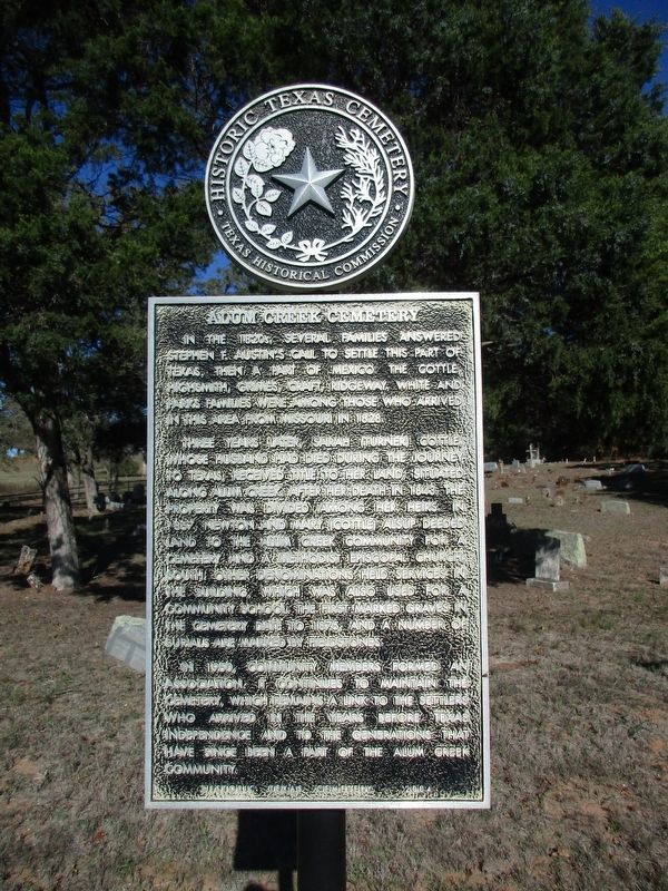
Photographed by Jeff Leichsenring, December 8, 2025
1. Alum Creek Cemetery Marker
Three years later, Sarah (Turner) Cottle, whose husband had died during the journey to Texas, received title to her land, situated along Alum Creek. After her death in 1843, the property was divided among her heirs. In 1857, Newton and Mary (Cottle) Alsup deeded land to the Alum Creek community for a cemetery and a Methodist Episcopal Church, South. Other denominations held services in the building, which was also used for a community school. The first marked graves in the cemetery date to 1875, and a number of burials are marked by fieldstones.
In 1950, community members formed an association. It continues to maintain the cemetery, which remains a link to the settlers who arrived in the years before Texas Independence and to the generations that have since been a part of the Alum Creek community.
Erected 2004 by Texas Historical
this page online
Topics. This historical marker is listed in these topic lists: Cemeteries & Burial Sites • Settlements & Settlers. A significant historical year for this entry is 1828.
Location. 30° 3.934′ N, 97° 12.897′ W. Marker is near Bastrop, Texas, in Bastrop County. It is at the intersection of State Highway 71 and Cottletown Road (County Road 154), on the right when traveling north on State Highway 71. Touch for map. Marker is at or near this postal address: 1191 State Hwy 71, Bastrop TX 78602, United States of America. Touch for directions.

Regionally, this marker is in Central Texas and in the Austin Metropolitan Area. It is also in the American South. Globally, it is in North America, a Gulf of Mexico state, the Western Hemisphere, the Western World, and the Anglosphere. Historically, it finds itself in what was once New Spain, the Republic of Texas, one of the Confederate States of America, and the Antebellum South.
Other nearby markers. At least 8 other markers are within 6 miles of this marker, measured as the crow flies: Captain John Campbell Hunt (approx. 3 miles away); Antioch Cemetery

Photographed by Jeff Leichsenring, December 8, 2025
2. Alum Creek Cemetery and marker
Credits. This page was last revised on December 12, 2025. It was originally submitted on December 11, 2025, by Jeff Leichsenring of Garland, Texas. This page has been viewed 108 times since then and 72 times this year. Photos: 1, 2. submitted on December 11, 2025, by Jeff Leichsenring of Garland, Texas. • James Hulse was the editor who published this page.
