
Orange in Orange County, Virginia — The American South (Mid-Atlantic)
Gen. R.E. Lee
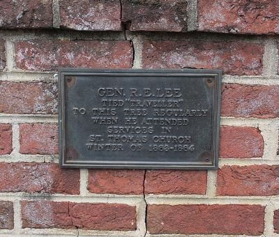
Photographed by Evan Dwyer, November 15, 2025
1. Gen. R.E. Lee Marker
Topics. This historical marker is listed in these topic lists: Animals • Religion & Religious Structures • War, US Civil. A significant historical year for this entry is 1863.
Location. 38° 14.635′ N, 78° 6.803′ W. Marker is in Orange, Virginia, in Orange County. It is on Caroline Street (Virginia Route 20) south of West Main Street, on the right when traveling north. Touch for map. Marker is at or near this postal address: 119 Caroline Street, Orange VA 22960, United States of America. Touch for directions.

Regionally, this marker is in Northern Virginia and in the Piedmont. It is also in the American South and specifically in the Upper South. Globally, it is in North America, the Western Hemisphere, the Western World, and the Anglosphere. Historically, it finds itself in what was once the territory of the Mississippian Culture, one of the original Thirteen Colonies, one of the Confederate States of America, and the Antebellum South.
Other nearby markers. At least 8 other markers
this page online
More about this marker. The marker is on the brick wall between the property of St. Thomas Episcopal Church and the private residence at 109 Caroline Street. It is on the church side of the wall.
Regarding Gen. R.E. Lee. The tree indicated by the marker likely no longer stands - the parish history says “Lee is known to have tied his horse, Traveller, to a locust tree on the church grounds when attending St. Thomas’s, and a locust continues to stand at that spot today" - language which, when coupled with the small size of the gnarled locust tree just beyond the marker, does not lend confidence
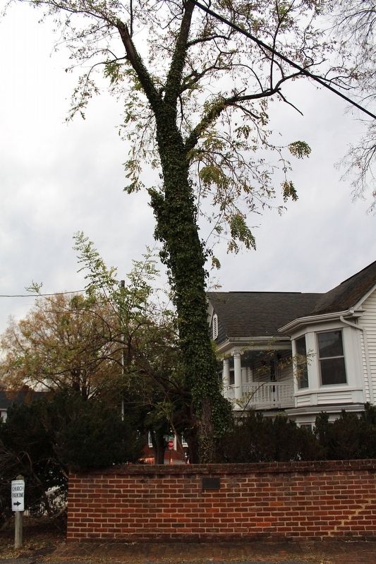
Photographed by Evan Dwyer, November 15, 2025
2. Gen. R.E. Lee Marker
Marker is on the wall with the subject locust tree "Lee's Locust" - or rather its descendant - immediately beyond in the neighboring yard.
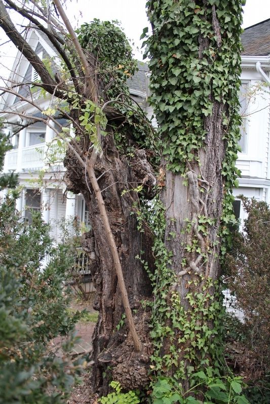
Photographed by Evan Dwyer, November 15, 2025
3. "Lee's Locust"
This is the tree referenced by the marker, though, as noted elsewhere on this page, it is more likely a descendant of the tree that Traveller was physically hitched to - it was noted as being "massive" in 1965 and this tree is decidedly not massive, though it is gnarled and seems to have had a rough go of it.
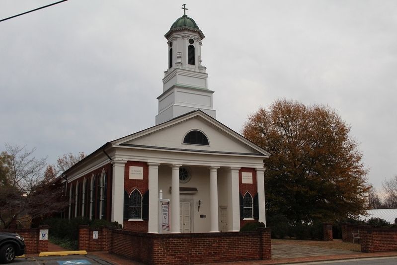
Photographed by Evan Dwyer, November 15, 2025
4. St. Thomas Episcopal Church
The marker and tree are just out of frame to the left of the parking area at lower left. The church itself was completed in 1834 and hosted Confederate Generals Robert E. Lee, A.P. Hill, and Robert Rhodes, among others, in the winter of 1863-64 while the Army of Northern Virginia was camped in Orange County. Jefferson Davis also attended once. Following the battles of Cedar Mountain, Chancellorsville, The Wilderness, and Spotsylvania Courthouse, the church was used as a temporary hospital.
Credits. This page was last revised on December 19, 2025. It was originally submitted on December 12, 2025, by Evan Dwyer of Richmond, Virginia. This page has been viewed 61 times since then and 25 times this year. Photos: 1, 2, 3, 4. submitted on December 12, 2025, by Evan Dwyer of Richmond, Virginia. • Bernard Fisher was the editor who published this page.
