Ocean Springs in Jackson County, Mississippi — The American South (East South Central)
The Lover's Lane Historic District

Photographed by Mark Hilton, December 10, 2025
1. The Lover's Lane Historic District Marker
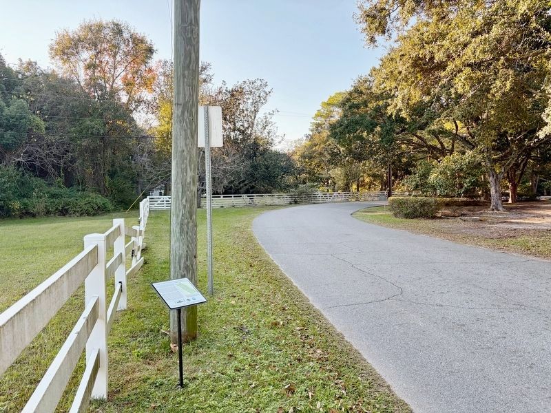
The Lover's Lane Historic District occupies the western shore of a small peninsula separating the back bay of Biloxi from the mouth of the Old Fort Bayou. Turn-of-the-century, grand summer estates reflect the development and, popularity of Ocean Springs as a resort community.
As the name Fort Bayou suggests, many historians believe the peninsula was the site of Fort Maurepas, the original French settlement in the colony of Louisiana founded by Pierre LeMoyne d'Iberville on April 8, 1699. Lover's Lane, a very narrow roadway flanked by thick foliage, bisects the peninsula, establishing the eastern boundary of the district. Evidence of a seventeenth-century European settlement and the presence of a silt-entombed ship from the same era indicate the archeological potential of the area.
Dwellings within the Lover's Lane Historic District exhibit examples of Greek Revival, Queen Anne, and Spanish Colonial revival, and date from the 1870s through the 1920s. There are several exceptional homes designed and built by Carroll Ishee (1921-1982), a Mississippi builder recognized as an artist whose medium was
this page online
Information from Ocean Springs Historic District Design Guidelines
Local historic districts were designated by the City in 1990. Each of the eight recognized districts captures a unique and important historic contribution to the rich history of the community.
This informational sign is part of a community project led by the Historic Ocean Springs Association, and is made possible by a grant from the Mississippi Gulf Coast National Heritage Area.
We thank the City of Ocean Springs for their support of this project.
Erected 2022 by Historic Ocean Springs Association, Mississippi Gulf Coast National Heritage Project, Mississippi Department of Marine Resources.
Photographed by Mark Hilton, December 10, 2025
2. The Lover's Lane Historic District and Marker.
Topics and series. This historical marker is listed in these topic lists: Architecture • Roads & Vehicles. In addition, it is included in the National Register of Historic Places (NRHP) series list. A significant historical date for this entry is April 8, 1699.
Location. 30° 24.817′ N, 88° 50.393′ W. Marker is in Ocean Springs, Mississippi, in Jackson County. It is on Lovers Lane west of Cherokee Boulevard, on the left when traveling west. Touch for map. Marker is in this post office area: Ocean Springs MS 39564, United States of America. Touch for directions.

Regionally, this marker is in the American South, specifically in the Deep South, and on the Gulf Coast. Globally, it is in North America, a Gulf of Mexico state, the Western Hemisphere, the Western World, and the Anglosphere. Historically, it finds itself in what was once New Spain, the Viceroyalty of New France, the territory of the Mississippian Culture, one of the Confederate States of America, and the Antebellum South.
Other nearby markers. At least 8 other markers are within walking distance of this marker: Ocean Springs Tree Tales... (about 700 feet away, measured in a direct line); Crooked Feather (approx. 0.3 miles away); The Growth of Ocean Springs (approx. 0.3 miles away); The Roost (approx. 0.4 miles away); The Austin House (approx. half a mile away); a different marker also named Ocean Springs Tree Tales... (approx. half a mile away); St. John's Episcopal Church (approx. half a mile away); The Robert A. Friar House (approx. 0.6 miles away). Touch for a list and map of all markers in Ocean Springs.
Credits. This page was last revised on December 13, 2025. It was originally submitted on December 13, 2025, by Mark Hilton of Montgomery, Alabama. This page has been viewed 92 times since then and 56 times this year. Photos: 1, 2. submitted on December 13, 2025, by Mark Hilton of Montgomery, Alabama.
