Potter Hill near Hoosick Falls in Rensselaer County, New York — The American Northeast (Mid-Atlantic)
Potter Hill

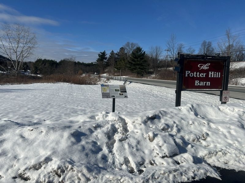
Photographed by Steve Stoessel, December 15, 2025
1. Potter Hill Marker
Potter Hill acquired Its name after an accident that killed 53-year-old Captain John Potter Esq. On the evening of June 24, 1806, Potter was killed when he fell off his wagon and was crushed by a barrel of cider that fell off as well after his horses were spooked. It is said he was "subjected to the stroke of Instantaneous Death" '. A three-sided monument stands alongside the creek, in a gully, close to the junction of Rt 7 and 22 telling his story. Potter's house and tavern that he ran still stands at the comer of Rt 7 and Spicer Rd.
Roads:
The first roads in this area followed the "Eastern Trail" of the Horigan and Mohican Indians. This trail ran the base of the Petersburg Mountain Range. The first established road was the Old Hosick Road (1742-1833) Please note that "Hosick" was the spelling used in the act for this road. The Old Hosick Road was established by an act of the New York Legislature concerning Albany County Roads in 1742. This road ran close to the stream in the “hollow". The first bridge was built in 1785 and over this road practically all the produce of western Vermont and Massachusetts passed on
this page online
The use of the Old Hosick Road made easier transport for mail and stage coaches as well, There were three stage coach taverns, about 3 miles apart. The notorious Shingle Hollow Tavern, at the junction of Rt 7 and Rt. 22, kept by Edward Jones, had a reputation for "being one of the most loathsome headquarters of licentiousness, debauchery and crime to be found outside of the city" as told in a newspaper article about a fatal shooting in the early 1800s.
In 1833 the 30 mile stretch of road from Troy to Bennington was straightened and grated to make a more direct course, It was laid with field stone, giving it the name the Stone Road. In 1914 the road was blacktopped and became referred to as the Troy & Bennington Turnpike.
Also, in the main hamlet of Potter Hill a few generations of Agan's ran the Post Office and a general store. The Potter Hill Barn sits in the same spot where a 270-year-old barn sat. The original barn was struck by lightning and burned in 2002.
Santus' Tea House, now the Man of Kent, was a popular spot for travelers and locals alike. The spot
Photographed by Steve Stoessel, December 15, 2025
2. Potter Hill Marker
School house
The first school in Potter Hill was established in 1796. The school was located across the road from the intersection of Old Hoosick Rd. (Rt. 7) and Tory Hill Road. The Stone School house, pictured, was built by the Tibbets family to educate the youth of their tenant farmers. This sits at the intersection of Rt. 22 and Rt. 7.
[ Left Inset: ]
Use the map above to visit each of the various locations located throughout the Town and Village of Hoosick Falls.
The Eye on History interpretive panel project was supported through funding from the Town of Hoosick and the Village of Hoosick Falls through an American Rescue Plan Act grant awarded to the Hoosick Township Historical Society and Hoosick Rising.
Erected by Hoosick Township Historical Society, Hoosick Rising.
Topics. This historical marker is listed in these topic lists: Education • Industry & Commerce • Roads & Vehicles • Settlements & Settlers. A significant historical date for this entry is June 24, 1806.
Location. 42° 50.936′ N, 73° 24.717′ W. Marker is near Hoosick Falls, New York, in Rensselaer County. It is in Potter Hill. It is on Route 7 east of Tory Hill Road, on the right when traveling east. Marker is in the Potter Hill Barn parking lot. Touch for map. Marker is at or near this postal address: 3862 NY-7, Hoosick Falls NY 12090, United States of America. Touch for directions.

Regionally, this marker is in Upstate New York, in the Capital District, and in the Albany Metropolitan Area. It is also in the American Northeast and in the Mid-Atlantic. Globally, it is in North America, the Western Hemisphere, the Western World, and the Anglosphere. Historically, it finds itself in what was once New Netherland and also one of the original Thirteen Colonies.
Other nearby markers. At least 8 other markers are within 5 miles of this marker, measured as the crow flies: West Hoosick (approx. 3.6 miles away); Medal of Honor (approx. 4.2 miles away); Old Maple Grove (approx. 4.3 miles away); Early Tavern (approx. 4.3 miles away); Hoosick WW I & II Memorial (approx. 4.4 miles away); Chester A. Arthur (approx. 4.4 miles away); Tubular Steel Mower (approx. 4½ miles away); Grandma Moses (approx. 4½ miles away). Touch for a list and map of all markers in Hoosick Falls.
Credits. This page was last revised on December 16, 2025. It was originally submitted on December 15, 2025, by Steve Stoessel of Niskayuna, New York. This page has been viewed 135 times since then and 98 times this year. Photos: 1, 2. submitted on December 15, 2025, by Steve Stoessel of Niskayuna, New York.
