
Leitchfield in Grayson County, Kentucky — The American South (East South Central)
Grayson Springs
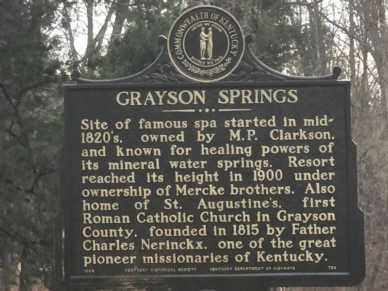
Photographed by Duane and Tracy Marsteller, December 1, 2025
1. Grayson Springs Marker
Site of famous spa started in mid-1820's, owned by M. P. Clarkson, and known for healing powers of its mineral water springs. Resort reached its height in 1900 under ownership of Mercke brothers. Also home of St. Augustine's, first Roman Catholic Church in Grayson County, founded in 1815 by Father Charles Nerinckx, one of the great pioneer missionaries of Kentucky.
Erected 1964 by Kentucky Historical Society • Kentucky Department of Highways. (Marker Number 768.)
Topics and series. This historical marker is listed in these topic lists: Industry & Commerce • Parks & Recreational Areas • Religion & Religious Structures. In addition, it is included in the Kentucky Historical Society series list. A significant historical year for this entry is 1900.
Location. 37° 27.619′ N, 86° 13.492′ W. Marker is in Leitchfield, Kentucky, in Grayson County. It is on Grayson Springs Road (Kentucky Route 1214) west of Route 88, on the right when traveling east. Touch for map. Marker is at or near this postal address: 3287 Grayson Springs Rd, Leitchfield KY 42754, United States of America. Touch for directions.

Regionally,
this page online
Other nearby markers. At least 8 other markers are within 4 miles of this marker, measured as the crow flies: “The Cedars” (approx. 2 miles away); Shaw's Station / Beaver Dam Creek Baptist Church (approx. 3.3 miles away); Leitchfield Landmarks (approx. 3.9 miles away); Jack Thomas House (approx. 3.9 miles away); Grayson County WWI War Memorial (approx. 4 miles away); Grayson County Korean War Memorial (approx. 4 miles away); Grayson County World War II Memorial (approx. 4 miles away); County Named, 1810 (approx. 4 miles away). Touch for a list and map of all markers in Leitchfield.
Another marker is no longer nearby. Courthouse Burned (was approx. 4 miles away but has been confirmed missing).

Photographed by Duane and Tracy Marsteller, December 1, 2025
2. Grayson Springs Marker

Photographed by Duane and Tracy Marsteller, December 1, 2025
3. Grayson Springs Marker
Credits. This page was last revised on December 22, 2025. It was originally submitted on December 15, 2025, by Duane and Tracy Marsteller of Murfreesboro, Tennessee. This page has been viewed 64 times since then and 35 times this year. Photos: 1, 2, 3. submitted on December 15, 2025, by Duane and Tracy Marsteller of Murfreesboro, Tennessee. • Devry Becker Jones was the editor who published this page.
