Old Town North in Alexandria, Virginia — The American South (Mid-Atlantic)
Northern Alexandria: From Agriculture to Industry
City of Alexandria Est. 1749
| — | Alexandria Heritage Trail | — |
By Devry Becker Jones (CC0), December 16, 2025
1. Northern Alexandria: From Agriculture to Industry Marker
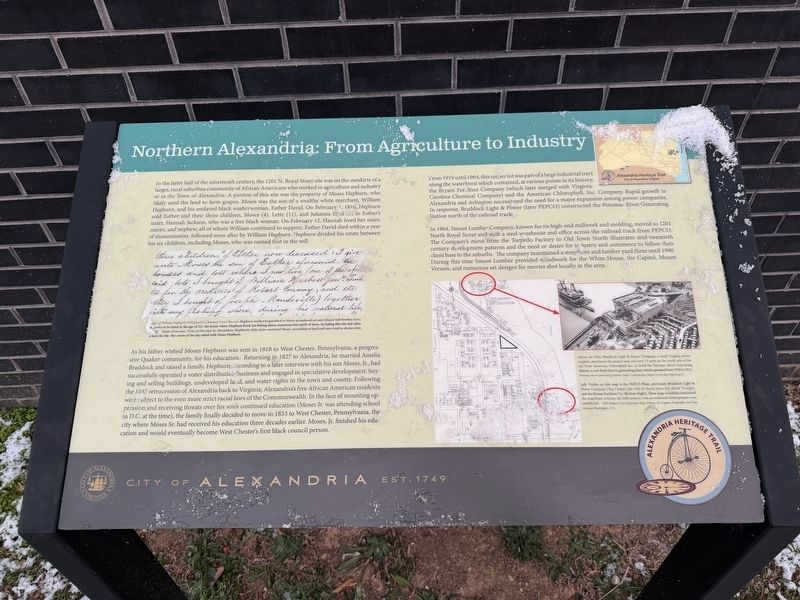
In the latter half of the nineteenth century, the 1201 N. Royal Street site was on the outskirts of a larger, rural suburban community of African Americans who worked in agriculture and industry or in the Town of Alexandria. A portion of this site was the property of Moses Hepburn, who likely used the land to farm grapes. Moses was the son of a wealthy white merchant, William Hepburn, and his enslaved black washerwoman, Esther David. On February 1, 1816, Hepburn sold Esther and their three children, Moses (4), Letty (11), and Julianna Eliza (1) to Esther's sister, Hannah Jackson, who was a free black woman. On February 12, Hannah freed her sister, nieces, and nephew, all of whom William continued to support. Esther David died within a year of Manumission, followed soon after by William Hepburn. Hepburn divided his estate between his six children, including Moses, who was named first in the will.
As his father wished Moses Hepburn was sent in 1818 to West Chester, Pennsylvania, a progressive Quaker community, for his education. Returning in 1827 to Alexandria, he married Amelia Braddock and raised a family. Hepburn,
this page online
From 1919 until 1964, this corner lot was part of a large industrial tract along the waterfront which contained, at various points in its history, the Bryant Fertilizer Company (which later merged with Virginia-Carolina Chemical Company) and the American Chlorophyll, Inc. Company. Rapid growth in Alexandria and Arlington necessitated the need
Photographed by Devry Becker Jones (CC0), December 16, 2025
2. Northern Alexandria: From Agriculture to Industry Marker
In 1964, Smoot Lumber Company, known for its high-end millwork and molding, moved to 1201 North Royal Street and built a steel warehouse and office across the railroad track from PEPCO. The Company's move from the Torpedo Factory to Old Town North illustrates mid-twentieth century development patterns and the need or desire for industry and commerce to follow their client base to the suburbs. The company maintained a storefront and lumber yard there until 1990. During this time Smoot Lumber provided woodwork for the White House, the Capitol, Mount Vernon, and numerous set designs for movies shot locally in the area.
[Captions:]
Copy of William Hepburn's Will found in Chancery Court Records. Hepburn further bequeathed to Moses an enslaved servant (Moses' half-brother Jerry), who was to be freed at the age of 21), the house where Hepburn lived; his fishing shore; numerous lots north of town, including this site and other known means of income. Twice in his time in Alexandria, Hepburn's white heirs contested Moses' ownership of land and once tried to declare him a slave for life. The courts of the day sided with Moses Hepburn.
Above: In 1944, Braddock Light & Power Company, a small Virginia power supplier, purchased the project area and over 15 acres on the north side of the rail from American Chlorophyll Inc. to build the Potomac River Generating Station, a coal-fired electric generating plant, which operated from 1949 to 2012. Potomac River Generating Station Under Construction (https://deq.virginia.gov).
Left: Visible on this map is the PEPCO Plant, previously Braddock Light & Power Company (Top Center), the 1201 N. Royal Street Site (Black Triangle) and the Black Fertilizer Co. (Bottom Right). These large industries dominated the waterfront well into the 20th century, even as residential developments were established. 1959 Sanborn Fire Insurance Map, Library of Congress Geography and Map Division Washington, D.C.
Erected by City of Alexandria, Virginia.
Topics and series. This historical marker is listed in these topic lists: African Americans • Agriculture • Industry & Commerce. In addition, it is included in the Quakerism, and the Virginia, The City of Alexandria series lists. A significant historical date for this entry is February 1, 1816.
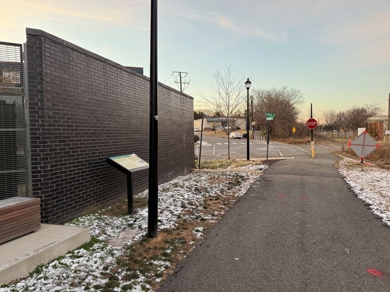
Location. 38° 49.067′ N, 77° 2.436′ W. Marker is in Alexandria, Virginia. It is in Old Town North. It is at the intersection of Mt. Vernon Trail and North Royal Street, on the right when traveling east on Mt. Vernon Trail. Touch for map. Marker is at or near this postal address: 1201 N Royal St, Alexandria VA 22314, United States of America. Touch for directions.

Regionally, this marker is in the Washington Metropolitan Area and in Northern Virginia. It is also in the American South, specifically in the Upper South, in the Mid-Atlantic, and on the Eastern Seaboard. Globally, it is in the North Atlantic Region, North America, the Western Hemisphere, the Western World, and the Anglosphere. Historically, it finds itself in what was once the territory of the Mississippian Culture, one of the original Thirteen Colonies, one of the Confederate States of America, and the Antebellum South.
Other nearby markers. At least 8 other markers are within walking distance of this marker: Cross Canal Neighborhood, 1860s - 1960s (approx. ¼ mile away); The Tale of Spa Spring (approx. ¼ mile away); Alexandria Canal (1843 - 1886) (approx. ¼ mile away); Remnants of Lock #4 of the Alexandria Canal (approx. ¼ mile away); The Alexandria Canal Company, 1830 - 1886 (approx. ¼ mile away); Cross Canal (approx. 0.3 miles away); Alexandria Canal Turning Basin (approx. 0.3 miles away); The Old Dominion Glass Company (approx. 0.3 miles away). Touch for a list and map of all markers in Alexandria.
Credits. This page was last revised on December 16, 2025. It was originally submitted on December 16, 2025, by Devry Becker Jones of Washington, District of Columbia. This page has been viewed 71 times since then and 40 times this year. Photos: 1, 2. submitted on December 16, 2025, by Devry Becker Jones of Washington, District of Columbia.
