Near Red Cliff in Eagle County, Colorado — The American Mountains (Southwest)
Forces Converge in the Eagle River Valley
Camp Hale

Photographed by Cosmos Mariner, July 27, 2025
1. Forces Converge in the Eagle River Valley Marker
1870s – 1880s
The Denver & Rio Grande Railroad (D&RGW) begins building the highest rail line route over Tennessee Pass (10,240 feet) to transport timber, coal, gold, and silver between Denver and Salt Lake City, Utah. A railway stop located in Eagle Park (present day Camp Hale) is completed in Pando.
1890s
White River Plateau Timberland Reserve, precursor of the White River National Forest, is set aside by executive order of President Benjamin Harrison. Covering over 1.1 million acres of prime timberland, it is the first preserve in Colorado and second in the nation.
Timber, cut and cleared for ranching, is shipped from the Pando rail stop.
1900s – 1910s
President Theodore Roosevelt reduces the size of the reserve by 220,000 acres from 1902-1904.
Following an Act of Congress in 1905, the name "forest reserves" is changed to "national forests" to indicate the resources of these areas are not locked up for a distant future.
1920s – 1930s
Pando Sheep and Land Company uses Eagle Park (Eagle River Valley) as grazing land; and the Isabell Ranch grows lettuce and spinach.
Ice ponds on the Frank Byer's Ranch supply ice to the D&RGW
this page online
1940s
Eagle River Valley site is chosen for Mountain Winter Warfare Training Center by the U.S. military.
Construction of Camp Hale begins — completed in 7 months.
10th Mountain Division Soldiers train at Camp Hale from 1942-1944.
Following the defeat of Germany in World War II, Camp Hale is dismantled.
1950s – 1960s
Central Intelligence Agency secretly trains Tibetan soldiers at Camp Hale for incursions into China from 1959 to 1965.
Camp Hale facilities deactivated; control of area returned to the U.S. Forest Service; Forest Service continues to authorize mountain training exercises in the area.
The U.S. Army selected this site, with its 9,200-foot elevation, water source, railway and roadway access, high altitude climate,
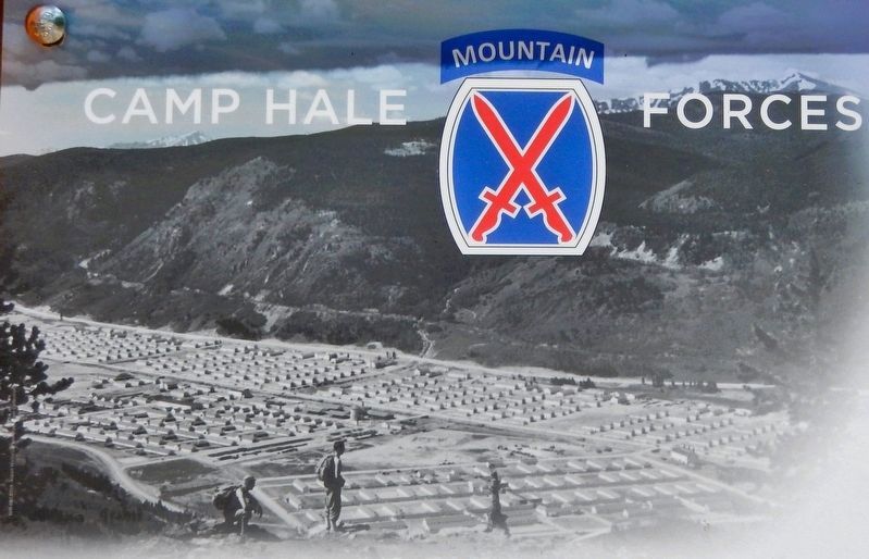
2. Marker detail: 10th Mountain soldiers above Camp Hale, 1943
The Field House is in the lower left quadrant of the photo. Mount Elbert is visible in the distance on the left and Homestake Peak is on the far right.
10th Mountain soldiers tested themselves and their military equipment during skiing, rock climbing, and winter survival skill maneuvers within the Camp's boundaries and forest terrain. In 2022 to honor these men and the Sawatch to Tenmile Range landscape, President Biden established the 53,804-acre Camp Hale-Continental Divide National Monument on National Forest System lands.
Erected by Forest Service, United States Department of Agriculture.
Topics and series. This historical marker is listed in these topic lists: Parks & Recreational Areas • Railroads & Streetcars • War, World II. In addition, it is included in the Former U.S. Presidents: #23 Benjamin Harrison, the Former U.S. Presidents: #26 Theodore Roosevelt, and the Former U.S. Presidents: #46 Joseph R. Biden series lists. A significant historical year for this entry is 1942.
Location. 39° 26.175′ N, 106° 19.516′ W. Marker

Denver Public Library
3. Marker detail: Firing line at Camp Hale firing range, ca 1944

Regionally, this marker is in the Colorado High Rockies. It is also in the American Mountain West. Globally, it is in North America, the Rocky Mountains, the Western Hemisphere, the Western World, and the Anglosphere.
Other nearby markers. At least 8 other markers are within walking distance of this marker: Your Path Here Intersects with 10th Mountain Soldiers (here, next to this marker); Camp Hale (here, next to this marker); Camp Hale-Continental Divide National Monument (about 400 feet away, measured in a direct line); Construction of Camp Hale (approx. 0.2 miles away); Entertainment Camp Hale (approx. 0.2 miles away); Preparing for War in the Eagle River Valley (approx. 0.4 miles away); Tracing the Terrain of War Training
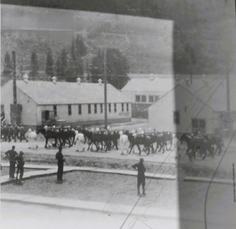
Denver Public Library
4. Marker detail: Mule formation, Camp Hale, ca 1943
Also see . . .
1. Camp Hale (Wikipedia).
Excerpt: Camp Hale was a U.S. Army training facility in the western United States, constructed in 1942 for what became the 10th Mountain Division. Located in central Colorado between Red Cliff and Leadville in the Eagle River Valley at an elevation of 9,238 feet, it was named for General Irving Hale. Onslow S. Rolfe, who had developed mountain warfare techniques as commander of the 87th Mountain Infantry Regiment, was selected to command Camp Hale.(Submitted on December 19, 2025, by Cosmos Mariner of Cape Canaveral, Florida.)Soldiers were trained in mountain climbing, Alpine and Nordic skiing, cold-weather survival, and various weapons and ordnance. When it was in full operation, approximately 15,000 soldiers were housed there.
2. Camp Hale-Continental Divide National Monument (US Forest Service). (Submitted on December 19, 2025, by Cosmos Mariner of Cape Canaveral, Florida.)
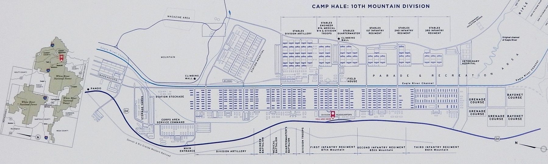
circa 1945
5. Marker detail: Camp Hale
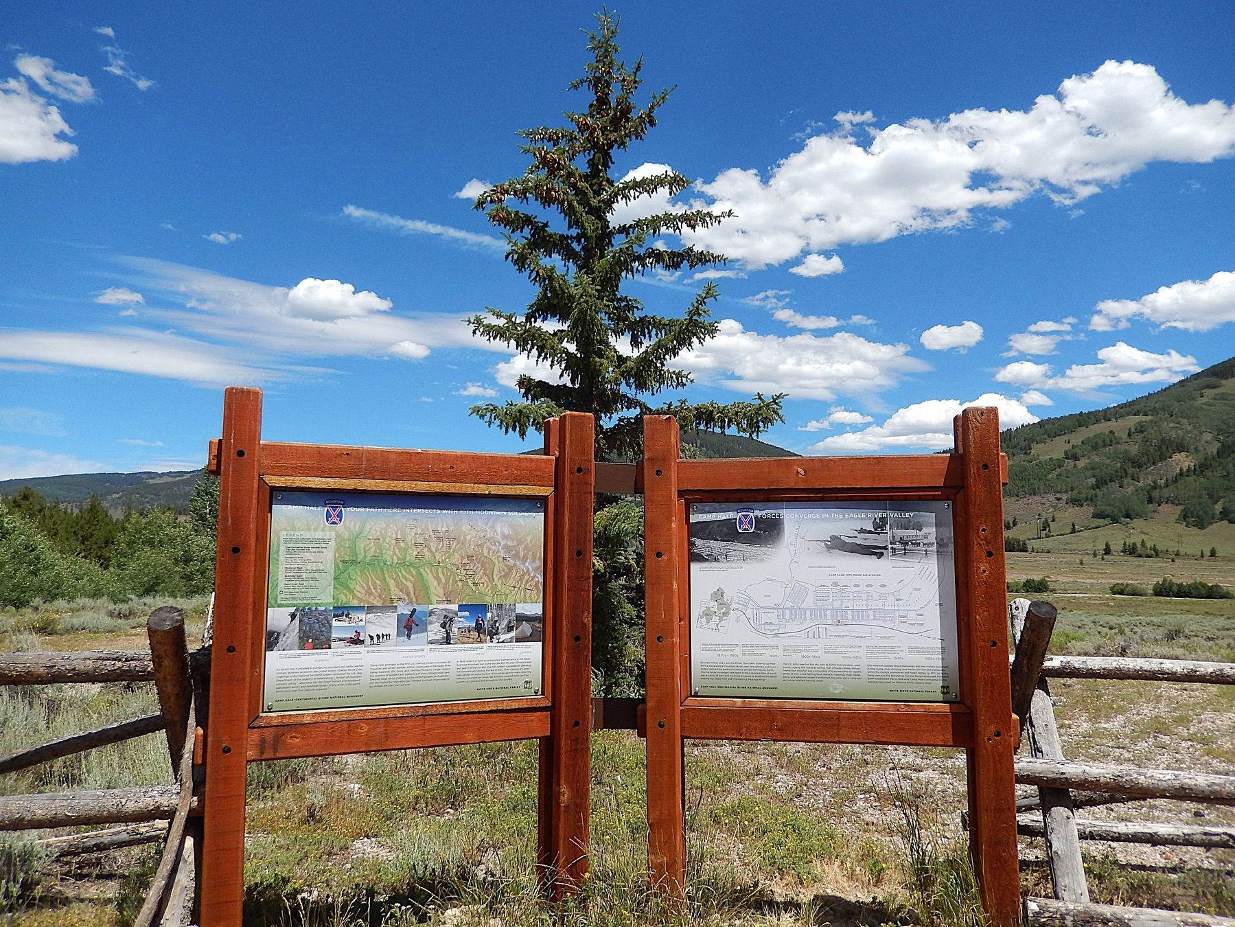
Photographed by Cosmos Mariner, July 27, 2025
6. Forces Converge in the Eagle River Valley Marker
Looking northeast from the wayside near US Highway 24. This is the rightmost of two historical markers in this interpretive kiosk. Camp Hale-Continental Divide National Monument is in the background.
Credits. This page was last revised on December 19, 2025. It was originally submitted on December 17, 2025, by Cosmos Mariner of Cape Canaveral, Florida. This page has been viewed 125 times since then and 94 times this year. Photos: 1, 2, 3, 4, 5, 6. submitted on December 19, 2025, by Cosmos Mariner of Cape Canaveral, Florida.
