Ho'olehua in Maui County, Hawaii — Hawaiian Island Archipelago (Pacific Ocean)
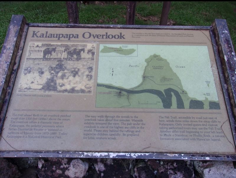
Kalaupapa Overlook
Photographed by Jimmy Emerson, Sept 2016
1. Kalaupapa Overlook Marker
The trail ahead leads to an overlook perched more than 1500 feet (450m) above the ocean. The overlook offers a dramatic view of Kalaupapa, the isolated peninsula where Father Damien de Veuster ministered to sufferers of leprosy from 1873-1889. Today Kalaupapa is a National Historical Park.
The easy walk through the woods to the overlook takes about five minutes. Wayside exhibits interpret the view. The pali under the overlook is one of the highest sea cliffs in the world. Please stay behind the railings and supervise children carefully. Be prepared for brisk onshore winds.
The Pali Trail, accessible by road just east of here, winds three miles down the steep cliffs to Kalaupapa. Only invited guests and visitors taking anthorized tours may use the Pali Trail. Another short trail beginning to your left leads to Kaule o Nanahoa, or Phallic Rock, a natural formation associated with Hawaiian legend.
Erected by National Park Service, U.S. Department of the Interior.
Topics. This historical marker is listed in these topic lists: Religion & Religious Structures • Science & Medicine. A significant historical year for this entry is 1873.
Location. 21° 10.533′ N,
this page online

Regionally, it is in North America, in Polynesia, in the Pacific Ocean, in North Pacific, on the Pacific Rim, in the Western Hemisphere, in the Western World, and in the Anglosphere.
Other nearby markers. At least 4 other markers are within 4 miles of this marker, measured as the crow flies: Kalaupapa (about 500 feet away, measured in a direct line); Mother Marianne Cope's Grave & Monument (approx. 1.7 miles away); The Baldwin Home (approx. 3.7 miles away); St. Philomena Church and Cemetery (approx. 3.7 miles away).
Credits. This page was last revised on January 20, 2026. It was originally submitted on December 19, 2025, by Jimmy Emerson of Dalton, Georgia. This page has been viewed 55 times since then and 22 times this year. Photo 1. submitted on December 19, 2025, by Jimmy Emerson of Dalton, Georgia. • Devry Becker Jones was the editor who published this page.
