Nome in Nome Census Area, Alaska — Northwest (North America)
Iditarod National Historic Trail
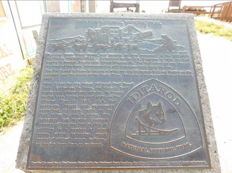
Photographed by Jimmy Emerson, July 2019
1. Iditarod National Historic Trail Marker
Running down Front Street and passing this monument to the Iditarod National Historic Trail--Authorized By the US Congress 1978, the Trail begins in Seward, Alaska with Tripod Milepost #0. The trail winds its way through the heart of the state, interconnecting with numerous trails along the way.
The Trail's end in Nome is located at what was the Wildgoose Railroad Station on the sandspit near the mouth of the Snake River. This site is marked with Tripod Milepost #938.
Were it not for the famed "Iditarod Trail Race" from Anchorage to Nome, the Historic Trail might have slipped into oblivion, its heyday having been during the gold strike on the Iditarod River in 1910. U.S. Mail contracts, freight, and passengers comprised the main traffic on the Trail, primarily used in winter. The legendary dog musher Leonhard Seppala utilized the Trail in 1925, in addition to a number of relay teams while delivering much needed diphtheria serum to Nomex saving the town from an epidemic. Funded in part by a Challenge Grant with the National Park Service, the City of Nome and the work of local volunteers
Topics. This historical
this page online
Location. 64° 29.887′ N, 165° 24.587′ W. Marker is in Nome in Nome Census Area, Alaska. It is on Front Street west of Hunter Way, on the right when traveling west. Located in front of city hall. Touch for map. Marker is at or near this postal address: 301 Front St, Nome AK 99762, United States of America. Touch for directions.

Regionally, this marker is in the Iñupiat Region, specifically in Southwest Alaska, and in the Yup’ik & Cup’ik Region. It is also on the American Pacific Coast. Globally, it is in North America, in the Arctic, on the Pacific Rim, in the Western Hemisphere, in the Western World, and in the Anglosphere. Historically, it finds itself in what was once the Russian Empire.
Other nearby markers. At least one other marker is within walking distance of this marker: Miner's and Merchant's Bank (approx. 0.2 miles away).
Credits. This page was last revised on December 20, 2025. It was originally submitted on December 19, 2025, by Jimmy Emerson of Dalton, Georgia. This page has been viewed 84 times since then and 44 times this year. Photo 1. submitted on December 19, 2025, by Jimmy Emerson of Dalton, Georgia. • Devry Becker Jones was the editor who published this page.
