Upperville in Fauquier County, Virginia — The American South (Mid-Atlantic)
Battle of Unison
Foiling the Trap
Photographed by Craig Swain, May 15, 2011
1. Battle of Unison Marker
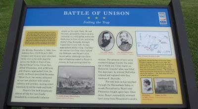
After the Battle of Antietam in September 1862, Gen. Robert E. Lee's Army of Northern Virginia escaped to Virginia. President Abraham Lincoln repeatedly urged Union Gen. George B. McClellan to pursue and attack. Following a plan that Lincoln devised to trap Lee's army in the Shenandoah Valley, McClellan finally got his Army of the Potomac moving. On November 1, Union cavalry Gen. Alfred Pleasonton began leading the advance from Philomont toward Upperville. Gen. J.E.B. Stuart's cavalry delayed him for three days. On November 5, learning that Lee's army had evaded the trap and reached Culpeper County, Lincoln ordered McClellan relieved of command.
On Monday, November 3, 1862, Confederate Gen. J.E.B. Stuart's 900 troopers and 12 guns were stretched thinly over a two-mile-long line across the fields in front of you. Beyond Stuart's line, Union Gen. Alfred Pleasonton, with 4,000 men and 18 guns, approached from the north. As Stuart described the scene, "About 9 A.M. the enemy advanced on our new position with cavalry, infantry and artillery, moving simultaneously by all the roads and fords."
Stuart's line held tenaciously
this page online
The next year, as Lee marched through the Shenandoah Valley to invade Pennsylvania, Stuart and Pleasonton fought again here. Once more, Stuart successfully screened Lee's army from Pleasonton's cavalry.
(Sidebar):
Ida Dulany watched the day's action from Oakley Plantation, about half a mile to your right. She wrote in her diary, "We could see from the location of the batteries that they approached us. … Soon there were no more Southerners in sight and the house was surrounded by Yankees. … We watched the battery pouring out shells against our battery which was in the vineyard. … The shells from both batteries burst in full sight of us."
Erected 2011
Photographed by Craig Swain, May 15, 2011
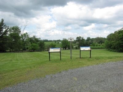
2. Markers at the Upperville Park
Topics and series. This historical marker is listed in this topic list: War, US Civil. In addition, it is included in the Virginia Civil War Trails series list. A significant historical month for this entry is September 1862.
Location. Marker has been permanently removed. It was located near 38° 59.431′ N, 77° 52.331′ W. Marker was in Upperville, Virginia, in Fauquier County. It was on John S Mosby Highway (U.S. 50) west of Dunvegan Drive, on the right when traveling east. The marker on Vineyard Hill, in Upperville Park. The park is located across the highway from Ivy Hill Cemetery. Touch for map. Marker was at or near this postal address: 8585 John S Mosby Hwy, Upperville VA 20184, United States of America.
We have been informed that this marker is no longer there and will not be replaced. This page is an archival view of what was.
Regionally, this marker was in the Washington Metropolitan Area and in Northern Virginia. It was also in the American South, specifically in the Upper South, and in the Mid-Atlantic. Globally, it was in North America, the Western Hemisphere, the Western World, and the Anglosphere.

Photographed by Craig Swain, May 15, 2011
3. Confederate Retreat on the Turnpike
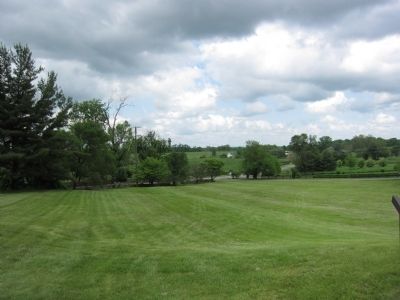
Looking east over the modern US Highway 50. Confederate cavalry retreated past this point and toward Ashby's Gap during the concluding phases of the battle. Collapsing from positions on the north and south of the highway, Stuart's men made additional rearguard stands to the west of town.
Other nearby markers. At least 8 other markers are within walking distance of this location: Upperville (here, next to this marker); a different marker also named Battle of Unison (within shouting distance of this marker); The Smith House (approx. ¼ mile away); The Gibson House (approx. 0.4 miles away); The Armistead House (approx. half a mile away); The Upperville Library (approx. half a mile away); This Stone (approx. 0.6 miles away); Mary Elizabeth Conover Mellon (approx. 0.6 miles away). Touch for a list and map of all markers in Upperville.
Credits. This page was last revised on December 20, 2025. It was originally submitted on May 15, 2011, by Craig Swain of Leesburg, Virginia. This page has been viewed 1,804 times since then and 79 times this year. Last updated on December 20, 2025, by Mike McKeown of Baltimore, Maryland. Photos: 1, 2, 3. submitted on May 15, 2011, by Craig Swain of Leesburg, Virginia. • Devry Becker Jones was the editor who published this page.
