Appomattox in Appomattox County, Virginia — The American South (Mid-Atlantic)
"By Loyalty and Bravery"
Appomattox Court House National Historical Park
| — | National Park Service, U.S. Department of the Interior | — |

Photographed by Mike McKeown, April 25, 2025
1. "By Loyalty and Bravery" Marker
Federal infantry pushed across these fields on the morning of April 9, 1865. A column of 15,000 infantry of the Army of the James, including more than 5,000 United States Colored Troops (USCT), blocked retreating Confederate forces. A Federal soldier wrote the infantry advanced in "two columns - black and white - side-by-side - in a regular checkerboard."
More than 180,000 African Americans served in the United States Army during the Civil War. Despite initial opposition, the US Army began enlisting African Americans in late 1862. Over half of the recruits were formerly enslaved. Seven USCT infantry regiments helped to defeat Lee's Army of Northern Virginia here, leading to the emancipation of over 250,000 enslaved Virginians.
A More Perfect Union
The United States Colored Troops present at Appomattox Court House came from various backgrounds:
Henry Crenshaw- 20, Private, free man from Lynchburg, VA, enlisted in the 8th USCT in November 1864 in Washington, DC as a substitute, mustered out November 1865.
Alexander Dennis- 35, Private, born enslaved in Prince Edward County, VA, volunteered in the 45th USCT inJuly 1864 in Wheeling, WV, died of pneumonia at Fort Monroe in August 1865.
Click or scan to see
this page online
Nelson C. Davis- 21, Private, formerly enslaved man from North Carolina, drafted into the 8th USCT in September 1863 in Utica, NY, mustered out in November 1865, later married Harriet Tubman.
Abe Dola- 26, Private, sailor from China, volunteered in the 31st USCT in January 1864 in Norwich, CT, deserted in July 1865.
John Peck- 35, Sergeant, free man from Venango County, PA, and a barber by occupation, was drafted into the 8th USCT in August 1863, mustered out in November 1865.
"We, the colored soldiers, have fairly won our rights by loyalty and bravery"
-Sergeant Major William McCoslin, 29th USCT
Erected 2025 by National Park Service, U.S. Department of the Interior.
Topics. This historical marker is listed in these topic lists: African Americans • War, US Civil. A significant historical date for this entry is April 9, 1865.
Location. 37° 22.307′ N, 78° 48.913′ W. Marker is in Appomattox, Virginia, in Appomattox County. It can be reached from Old Courthouse Road (Route 24) 0.7 miles west of Gordon Drive, on the left when traveling west. The marker

Photographed by Mike McKeown, April 25, 2025
2. "By Loyalty and Bravery" Marker

Regionally, this marker is in the Piedmont and in Central Virginia. It is also in the American South and specifically in the Upper South. Globally, it is in North America, the Western Hemisphere, the Western World, and the Anglosphere. Historically, it finds itself in what was once the territory of the Mississippian Culture, one of the original Thirteen Colonies, one of the Confederate States of America, and the Antebellum South.
Other nearby markers. At least 8 other markers are within walking distance of this marker: “Message of Peace” (about 700 feet away, measured in a direct line); Grant’s Pursuit (about 700 feet away); Battle of Appomattox Station (about 700 feet away); U.S. Colored Troops At Appomattox (approx. 0.2 miles away); "They Showed No Flinching" (approx. 0.2 miles away); Shattered Home (approx. 0.2 miles away); The 24th Corps "Flying Hospital" (approx. 0.2 miles away);
Photographed by Mike McKeown, April 25, 2025
3. "By Loyalty and Bravery" Marker
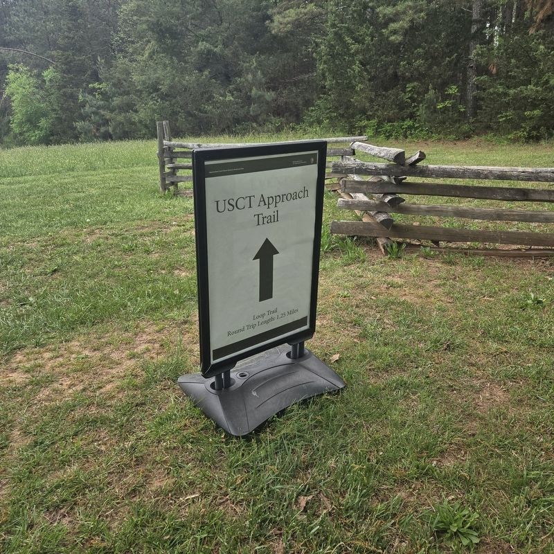
Sign in parking lot for Grant's HQ for trail to sign
Also see . . . United States Colored Troops at Appomattox. National Park Service (Submitted on April 26, 2025.)

Photographed by Evan Dwyer, December 20, 2025
4. "By Loyalty and Bravery" Marker & Battlefield
The marker is just visible in the distance on the far ridge, before the thick stand of trees at left. These are the fields referenced in the marker that the USCTs advanced across. The new (in 2025) USCT Approach Trail is faintly visible as the close-mown trail at bottom left of the frame, snaking out towards the center of the image and crossing over the ridge at the marker's position.
Credits. This page was last revised on January 21, 2026. It was originally submitted on April 25, 2025, by Mike McKeown of Baltimore, Maryland. This page has been viewed 217 times since then and 41 times this year. Last updated on December 20, 2025, by Evan Dwyer of Richmond, Virginia. Photos: 1, 2. submitted on April 25, 2025, by Mike McKeown of Baltimore, Maryland. 3. submitted on April 29, 2025, by Mike McKeown of Baltimore, Maryland. 4. submitted on January 20, 2026, by Evan Dwyer of Richmond, Virginia. • Devry Becker Jones was the editor who published this page.
