Appomattox in Appomattox County, Virginia — The American South (Mid-Atlantic)
Battle of Appomattox Station
Prelude to Surrender
Photographed by Mike McKeown, April 25, 2025
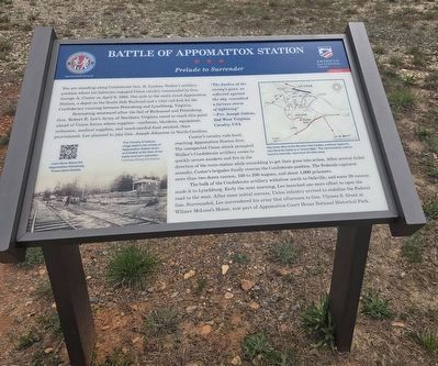
1. Battle of Appomattox Station Marker
You are standing along Confederate Gen. R. Lindsay Walker's artillery position where his batteries engaged Union cavalry commanded by Gen. George A. Custer on April 8, 1865. One mile to the south stood Appomattox Station, a depot on the South Side Railroad and a vital rail link for the Confederacy running between Petersburg and Lynchburg, Virginia.
Retreating westward after the fall of Richmond and Petersburg, Gen. Robert E. Lee's Army of Northern Virginia raced to reach this point ahead of Union forces where supplies—uniforms, blankets, equipment, ordnance, medical supplies, and much-needed food awaited. Once provisioned, Lee planned to join Gen. Joseph Johnston in North Carolina.
Custer's cavalry rode hard, reaching Appomattox Station first. The unexpected Union attack prompted Walker's Confederate artillery crews to quickly secure muskets and fire in the direction of the train station. After several failed assaults, Custer's brigades finally overran the Confederate position. The Federals captured more than two dozen cannon, 150 to 200 wagons, and about 1,000 prisoners.
The bulk of the Confederate artillery
this page online
"The flashes of the enemy's guns, as reflected against the sky, resembled a furious storm of lightning" —Pvt. Joseph Sutton 2nd West Virginia USA
(captions)
This Timothy O'Sullivan image depicts the vicinity of Appomattox Station much as it looked at the time of the battle and Lee's surrender. Courtesy Library of Congress
Maj. James Bliss of the 8th New York Cavalry, a veteran regiment, described the battle as a "severe fight." The cannonading could be heard in Farmville, more than 30 mites away.
Erected 2025 by Appomattox-Petersburg Preservation Society and American Battlefield Trust.
Topics. This historical marker is listed in this topic list: War, US Civil. A significant historical date for this entry is April 8, 1865.
Location. 37° 21.933′ N,
Photographed by Mike McKeown, April 25, 2025
2. Battle of Appomattox Station Marker
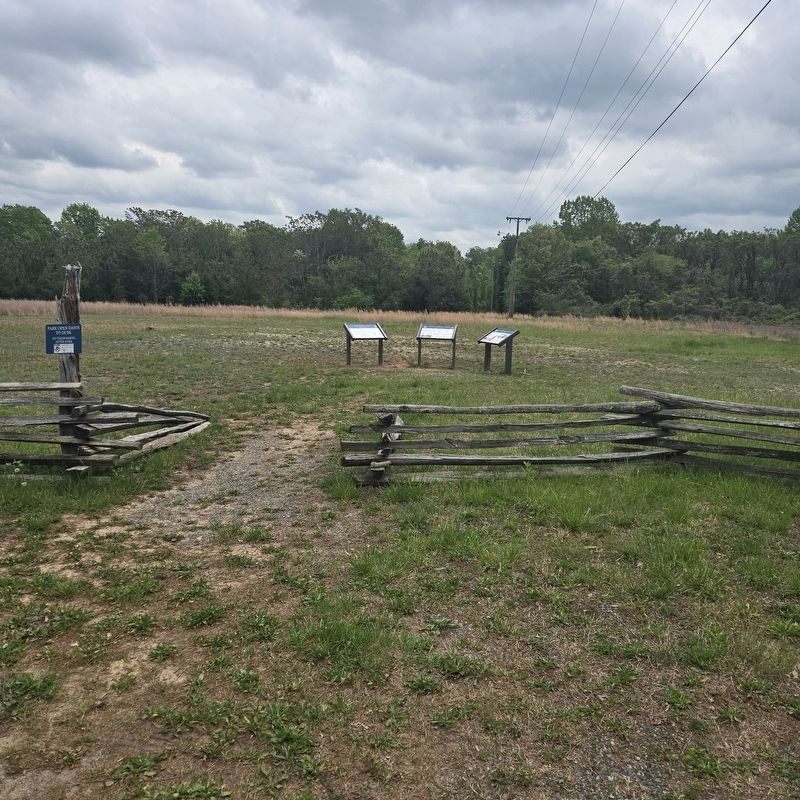
marker is in the middle of the three new markers

Regionally, this marker is in the Piedmont and in Central Virginia. It is also in the American South and specifically in the Upper South. Globally, it is in North America, the Western Hemisphere, the Western World, and the Anglosphere. Historically, it finds itself in what was once the territory of the Mississippian Culture, one of the original Thirteen Colonies, one of the Confederate States of America, and the Antebellum South.
Other nearby markers. At least 8 other markers are within walking distance of this marker: Appomattox Campaign (here, next to this marker); a different marker also named Battle of Appomattox Station (here, next to this marker); Walker's Last Stand (within shouting distance of this marker); Confederate Artillery Position (within shouting distance of this marker); Carver-Price School (approx. 0.4 miles away); Winonah Camp / Mozella Price Home (approx. 0.4 miles away); Heritage Garden (approx. 0.4 miles away); Fighting to the End (approx. 0.4 miles away). Touch for a list and map of all markers in Appomattox.
Other markers no longer nearby. Custer's Third Brigade (was within shouting distance of this marker but has been permanently removed); a different marker also named Winonah Camp / Mozella Price Home (was approx. 0.4 miles away but has been replaced with another marker now near it); a different marker also named Carver-Price School (was approx. 0.4 miles away but has been replaced with another marker now near it).
Also see . . .
1. Appomattox Station Battlefield. American Battlefield Trust (Submitted on May 7, 2025.)
2. Appomattox-Petersburg Preservation Society. Website homepage (Submitted on May 7, 2025.)
Credits. This page was last revised on December 21, 2025. It was originally submitted on May 5, 2025, by Mike McKeown of Baltimore, Maryland. This page has been viewed 236 times since then and 53 times this year. Last updated on December 20, 2025, by Evan Dwyer of Richmond, Virginia. Photos: 1, 2. submitted on May 5, 2025, by Mike McKeown of Baltimore, Maryland. • Devry Becker Jones was the editor who published this page.
