Westville in New Haven in South Central Region, Connecticut — The American Northeast (New England)
Westville Soldiers' Memorial
Photographed by Michael Herrick, March 11, 2010
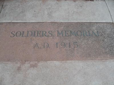
1. Westville Soldiers' Memorial
Set in the broad step between the two columns
A.D. 1915
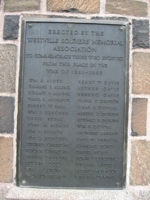
[ left plaque ]
Westville Soldiers' Memorial
Association
To Commemorate Those Who Enlisted
From This Place In The
War of 1861 – 1865
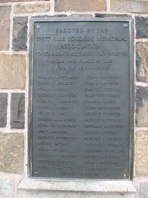
[ right plaque ]
Westville Soldiers' Memorial
Association
To Commemorate Those Who Enlisted
From This Place In The
War of 1861 – 1865
this page online
Erected 1915 by Westville Soldiers' Memorial Association.
Topics. This historical marker and memorial is listed in this topic list: War, US Civil. A significant historical year for this entry is 1915.
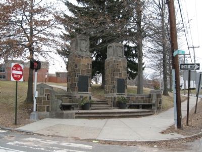
Location. 41° 19.664′ N, 72° 57.654′ W. Marker is in New Haven in South Central Region, Connecticut. It is in Westville. It is at the intersection of Whalley Avenue (Connecticut Route 63) and Phillip Street, on the left when traveling north on Whalley Avenue. Located at the southeast corner of Beecher Park, in front of the Mitchell Branch of the New Haven Public Library. Touch for map. Marker is in this post office area: New Haven CT 06515, United States of America. Touch for directions.

Regionally, this marker and memorial is in the Connecticut River Valley and on the Connecticut Shoreline. It is also in the
Photographed by Michael Herrick, March 11, 2010
2. Westville Soldiers' Memorial
Other nearby markers. At least 8 other markers are within 2 miles of this marker, measured as the crow flies: Holocaust Memorial Place (approx. half a mile away); Judges Cave (approx. 0.8 miles away); Robert Gardner Anderson Award (approx. 1.2 miles away); George Trevor (approx. 1.2 miles away); Walter Camp Memorial (approx. 1.2 miles away); Corporal Timothy Francis Ahearn (approx. 1.3 miles away); Cornelius S. Bushnell Memorial (approx. 1.3 miles away); Sherman Ave (approx. 1.4 miles away). Touch for a list and map of all markers in New Haven.
Photographed by Michael Herrick, March 11, 2010
3. Westville Soldiers' Memorial
Photographed by Michael Herrick, March 11, 2010
4. Westville Soldiers' Memorial
Credits. This page was last revised on May 19, 2026. It was originally submitted on March 24, 2010, by Michael Herrick of Southbury, Connecticut. This page has been viewed 1,400 times since then and 28 times this year. Photos: 1, 2, 3, 4. submitted on March 24, 2010, by Michael Herrick of Southbury, Connecticut.
