Near Mechanicsville in Hanover County, Virginia — The American South (Mid-Atlantic)
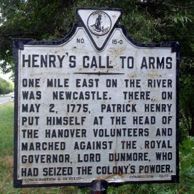
Henry's Call to Arms
Photographed by Bernard Fisher, September 6, 2009
1. Henry's Call to Arms Marker
Erected 1927 by Conservation & Development Commission. (Marker Number O-15.)
Topics and series. This historical marker is listed in these topic lists: Colonial Era • Patriots & Patriotism • War, US Revolutionary. In addition, it is included in the Virginia Department of Historic Resources (DHR) series list. A significant historical month for this entry is May 1781.
Location. Marker is missing. It was located near 37° 40.885′ N, 77° 11.302′ W. Marker was near Mechanicsville, Virginia, in Hanover County. It was on Mechanicsville Turnpike (U.S. 360) 1.2 miles east of River Road, on the right when traveling east. Touch for map. Marker was at or near this postal address: 2397 Mechanicsville Tpke, Mechanicsville VA 23111, United States of America. Touch for directions.

Regionally, this marker was in the Piedmont, in Central Virginia, and in the Richmond Metropolitan Area. It was also in the American
this page online
Other nearby markers. At least 8 other markers are within 3 miles of this location, measured as the crow flies: Cornwallis's Route (here, next to this marker); "Old Virginia Barn" (approx. 0.7 miles away); "Prestley Barn" (approx. 0.7 miles away); Edmund Ruffin's Grave (approx. 2.7 miles away); Headquarters of Opechancanough (approx. 2.9 miles away); Pamunkey Indians In The Civil War (approx. 3 miles away); Robert Mush (approx. 3 miles away); Stuart's Ride (approx. 3 miles away). Touch for a list and map of all markers in Mechanicsville.
Photographed by Bernard Fisher, September 6, 2009
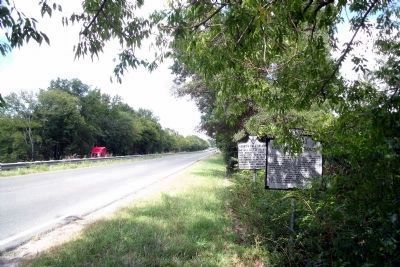
2. Henry's Call to Arms Marker on Rte 360 (facing east).
Credits. This page was last revised on December 23, 2025. It was originally submitted on September 11, 2009, by Bernard Fisher of Richmond, Virginia. This page has been viewed 1,625 times since then and 127 times this year. Last updated on December 22, 2025, by Evan Dwyer of Richmond, Virginia. Photos: 1, 2. submitted on September 11, 2009, by Bernard Fisher of Richmond, Virginia. • Devry Becker Jones was the editor who published this page.
