Thomaston in DeWitt County, Texas — The American South (West South Central)
Thomaston Cemetery
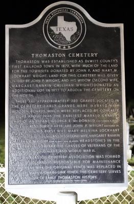
Photographed by Dave W, March 12, 2022
1. Thomaston Cemetery Marker
Thomaston was established as De Witt County's first railroad town in 1872, with much of the land for the townsite donated by John P. and Mary M. Lockhart Wright. Land for this cemetery was given in 1886 by John P. Wright, and his widow (second wife, Margaret Rankin Calliham Wright) donated an additional lot in 1917 to adjoin the cemetery on the north.
There are approximately 283 graves located in the cemetery. Early graves were marked with wooden boards, which were replaced by concrete blocks about 1946. The earliest marked grave is that of an infant, George E. McDonald (October 1, 1870 - March 8, 1871). Also buried here are John P. Wright (October 29, 1829 - June 12, 1897), his first wife, Mary Melvina Lockhart Wright (Sept. 21, 1841 - Feb. 16, 1875), and his second wife, Margaret Rankin Calliham Wright (Feb. 5, 1847 - Feb. 15, 1921). Headstones in the cemetery also mark the graves of veterans of the Civil War, World War I, and World War II.
The Thomaston Cemetery Association was formed in the 1930s, and is responsible for maintenance of the cemetery. The original fence was replaced in the 1940s with a chain-link fence. The cemetery serves as a reminder of early Thomaston history.
Erected 1986 by Texas Historical Commission. (Marker Number 5477.)
Topics. This historical marker is listed in this topic list: Cemeteries & Burial Sites. A significant historical year for this entry is 1886.
Location. 28° 59.935′ N, 97° 9.125′ W. Marker is in Thomaston, Texas, in DeWitt County. It is on Fordtran Road. Touch for map. Marker is at or near this postal address: 242 Fordtran Rd, Cuero TX 77954, United States of America. Touch for directions.

Regionally, this marker is in the Hill Country. It is also in the American South. Globally, it is in North America, a Gulf of Mexico state, the Western Hemisphere,
this page online
Other nearby markers. At least 8 other markers are within 8 miles of this marker, measured as the crow flies: Thomaston (approx. ¼ mile away); Burns Station Cemetery (approx. 4.4 miles away); Gilbert Onderdonk and Nursery, Texas (approx. 6.3 miles away); Nursery School and Nursery Independent School District (approx. 6.4 miles away); Murphy Home (approx. 6.8 miles away); Arneckeville (approx. 7 miles away); Josiah Taylor (approx. 7.2 miles away); Hephzibeth Looker Taylor (approx. 7.2 miles away).
Credits. This page was last revised on December 28, 2025. It was originally submitted on December 1, 2022, by Dave W of Co, Colorado. This page has been viewed 337 times since then and 43 times this year. Last updated on December 26, 2025, by Joe Lotz of Flower Mound, Texas. Photo 1. submitted on December 1, 2022, by Dave W of Co, Colorado. • Devry Becker Jones was the editor who published this page.
