Brady in McCulloch County, Texas — The American South (West South Central)
Western Trail
Photographed by Richard Denney, March 23, 2015
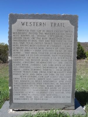
1. Western Trail Marker
Through this gap in hills called "Brady Mountains" passed the western cattle trail, also known as "Dodge City Trail", "Fort Griffin Trail", or "The Beef Trail". Said to have originated in 1876, this was the last of the old-time Texas cattle trails, those east of here having been closed by farmers. Large numbers of cattle were driven up this trail 1876 to 1886--over 200,000 head in 1881 alone. This trail started near Brownsville and came up to San Antonio, then northwest through or near Uvalde and Kerrville. Skirting the Nueces River, it came over the divide, crossing headwaters of the South Llano River, fording San Saba River at Pegleg Crossing, going downriver about six miles, then turning north. Near Brady, feeder trails came from Fort McKavett and points west, and from San Saba, to the east.
After leaving Cow Gap (likely so named from Cow Creek, about 500 yards west of this marker), it went northwest and over the Colorado at "Beef Crossing" in Waldrip's Bend, then to Coleman, Baird, Fort Griffin and Vernon, spanning Red River at Doan's Crossing. Northward through Indian country it went to Dodge City, Kansas, and
this page online
This trail was of great worth to the territories it traversed.
Erected 1970 by Texas Historical Commission. (Marker Number 5765.)
Topics. This historical marker is listed in these topic lists: Animals • Industry & Commerce • Roads & Vehicles. A significant historical year for this entry is 1876.
Location. 31° 15.521′ N, 99° 22.77′ W. Marker is in Brady, Texas, in McCulloch County. It is on U.S. 283 0.2 miles north of County Route 304, on the left when traveling north. Touch for map. Marker is in this post office area: Brady TX 76825, United States of America. Touch for directions.

Regionally, this marker is in Big Country. Globally, it is in North America, a Gulf of Mexico state, the Western Hemisphere, the Western World, and the Anglosphere. Historically, it finds itself in what was once New Spain, the Republic of Texas, and one of the Confederate States of America.
Other nearby markers. At least 8 other markers are within 10 miles of this marker, measured as the crow flies: Lohn Cemetery (approx. 4.7 miles away); Curtis Airfield (approx. 6.7 miles away); Union Passenger Depot
Photographed by Richard Denney, March 23, 2015
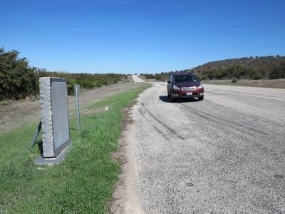
2. Western Trail Marker
Looking north, view of marker, on left, with gap in hills in distance.
Also see . . . Western Trail. The Handbook of Texas, Texas State Historical Association (Submitted on March 25, 2015.)
Photographed by Richard Denney, March 23, 2015
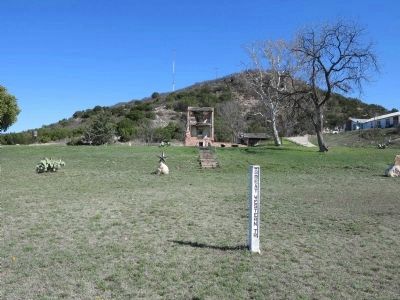
3. Western Trail, Santa Anna, Texas
Western Trail signpost type marker 35 miles north in Santa Anna, Texas, at the base of the Santa Anna peaks.

Photographed by Richard Denney, March 23, 2015
4. Western Trail Marker, Crossing of the Colorado
View of general area where trail would have crossed the Colorado River, about 12 miles north of marker.
Credits. This page was last revised on December 28, 2025. It was originally submitted on March 24, 2015, by Richard Denney of Austin, Texas. This page has been viewed 2,505 times since then and 232 times this year. Last updated on December 26, 2025, by Joe Lotz of Flower Mound, Texas. Photos: 1, 2, 3, 4. submitted on March 24, 2015, by Richard Denney of Austin, Texas. • Devry Becker Jones was the editor who published this page.
