Greenvine in Washington County, Texas — The American South (West South Central)
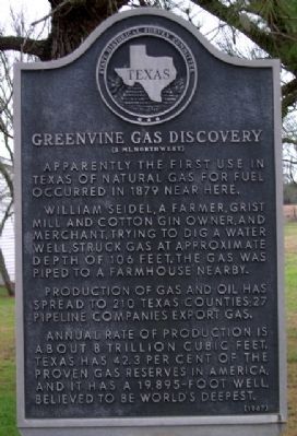
Greenvine Gas Discovery
(2 mi. Northwest)
Photographed by Gregory Walker, February 5, 2010
1. Greenvine Gas Discovery Marker
Erected 1967 by State Historical Survey Committee. (Marker Number 8342.)
Topics. This historical marker is listed in these topic lists: Industry & Commerce • Natural Resources • Notable Events. A significant historical year for this entry is 1879.
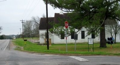
Location. 30° 6.89′ N, 96° 33.517′ W. Marker is in Greenvine, Texas, in Washington County. It is at the intersection of Farm to Market Road 2052 and County Road 2, on the right when traveling south on Road 2052. Touch for map. Marker is in this post office area: Burton TX 77835, United States of America. Touch for directions.

Regionally, this marker is in the American South and on the Gulf Coast. Globally, it is in North America, a Gulf of Mexico state, the Western Hemisphere, the Western World, and the Anglosphere. Historically, it finds itself in what was once New Spain, the Republic of Texas, one of the Confederate States of America, and the Antebellum South.
Other nearby markers. At least 8 other markers are within 5 miles of this marker, measured as the crow flies: Greenvine Baptist Church (within shouting distance of this marker); Greenvine Schools (about 500 feet away, measured in a direct line); Bethlehem Cemetery (approx. 2½ miles away); Sacred Heart Catholic Church (approx. 2.8 miles away);
this page online
Photographed by Gregory Walker, February 5, 2010
2. Greenvine Gas Discovery Marker location.
Credits. This page was last revised on December 28, 2025. It was originally submitted on March 7, 2010, by Gregory Walker of La Grange, Texas. This page has been viewed 1,226 times since then and 33 times this year. Last updated on December 27, 2025, by Joe Lotz of Flower Mound, Texas. Photos: 1, 2. submitted on March 7, 2010, by Gregory Walker of La Grange, Texas. • Devry Becker Jones was the editor who published this page.
