
Near Mechanicsville in Hanover County, Virginia — The American South (Mid-Atlantic)
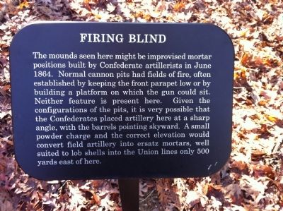
Firing Blind
November 28, 2014
1. Firing Blind Marker
Erected 2014 by National Park Service, U.S. Department of the Interior.
Topics. This historical marker is listed in this topic list: War, US Civil. A significant historical month for this entry is June 1864.
Location. 37° 35.539′ N, 77° 17.547′ W. Marker is near Mechanicsville, Virginia, in Hanover County. It can be reached from the intersection of Anderson-Wright Drive and Cold Harbor Road (Virginia Route 156) when traveling west. Touch for map. Marker is at or near this postal address: 5515 Anderson-Wright Drive, Mechanicsville
this page online

Regionally, this marker is in Virginia’s Piedmont, in Central Virginia, and in the Richmond Metropolitan Area. It is also in the American South, specifically in the Upper South, and on the Eastern Seaboard. Globally, it is in the North Atlantic Region, North America, the Western Hemisphere, the Western World, and the Anglosphere. Historically, it finds itself in what was once the territory of the Mississippian Culture, one of the original Thirteen Colonies, one of the Confederate States of America, and the Antebellum South.
Other nearby markers. At least 8 other markers are within walking distance of this marker: Between the Lines (approx. 0.2 miles away); The Tramp of Marching Feet (approx. 0.2 miles away); Confederate Fortifications (approx. ¼ mile away); Confederate Position (approx. ¼ mile away); Confederate Breastworks (approx. ¼ mile away); Grant's Grand Assault (approx. 0.3 miles away); The Cold Harbor Killing Fields (approx. 0.3 miles away); The Waters Ran Red (approx. 0.4 miles away). Touch for a list and map of all markers in Mechanicsville.
Another
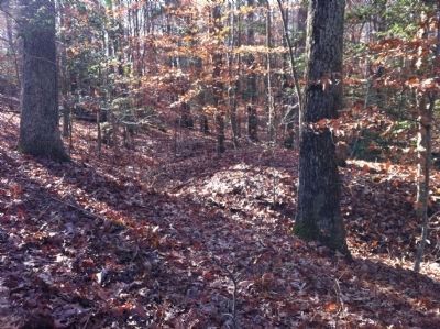
2. Confederate cannon position behind the "Firing Blind" marker.
More about this marker. This trail side marker is part of the new 0.9 mile walking trail on the western end of the Cold Harbor battlefield park.
Also see . . . Richmond National Battlefield Park. National Park Service (Submitted on December 6, 2014.)

Photographed by Evan Dwyer, December 27, 2025
3. Firing Blind Marker
With earthworks beyond.
Credits. This page was last revised on April 20, 2026. It was originally submitted on December 6, 2014, by Shane Oliver of Richmond, Virginia. This page has been viewed 625 times since then and 34 times this year. Last updated on December 27, 2025, by Evan Dwyer of Richmond, Virginia. Photos: 1. submitted on December 6, 2014, by Shane Oliver of Richmond, Virginia. 2. submitted on December 21, 2014. 3. submitted on April 16, 2026, by Evan Dwyer of Richmond, Virginia. • Devry Becker Jones was the editor who published this page.
