Mechanicsville in Hanover County, Virginia — The American South (Mid-Atlantic)
The Tramp of Marching Feet
November 28, 2014
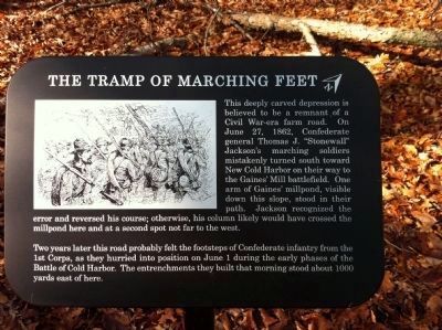
1. The Tramp of Marching Feet Marker
This deeply carved depression is believed to be a remnant of a Civil War-era farm road. On June 27, 1862, Confederate general Thomas J. "Stonewall" Jackson's marching soldiers mistakenly turned south toward New Cold Harbor on their way to the Gaines' Mill battlefield. One arm of Gaines' millpond, visible down this slope, stood in their path. Jackson recognized the error and reversed his course; otherwise his column likely would have crossed the millpond here and at a second spot not far to the west.
Two years later this road probably felt the footsteps of Confederate infantry from the 1st Corps, as they hurried into position on June 1 during the early phases of the Battle of Cold Harbor. The entrenchments they built that morning stood about 1000 yards east of here.
Erected 2014 by National Park Service, U.S. Department of the Interior.
Topics. This historical marker is listed in this topic list: War, US Civil. A significant historical month for this entry is June 1837.
Location. 37° 35.531′ N, 77° 17.754′ W. Marker is in Mechanicsville, Virginia, in Hanover County. It can be reached from the intersection of Anderson-Wright
this page online

Regionally, this marker is in the Piedmont, in Central Virginia, and in the Richmond Metropolitan Area. It is also in the American South, specifically in the Upper South, and on the Eastern Seaboard. Globally, it is in the North Atlantic Region, North America, the Western Hemisphere, the Western World, and the Anglosphere. Historically, it finds itself in what was once the territory of the Mississippian Culture, one of the original Thirteen Colonies, one of the Confederate States of America, and the Antebellum South.
Other nearby markers. At least 8 other markers are within walking distance of this marker: Firing Blind (approx. 0.2 miles away); Between the Lines (approx. 0.4 miles away); Confederate Breastworks (approx. 0.4 miles away); Confederate Fortifications (approx. 0.4 miles away); Confederate Position (approx. 0.4 miles away); Gaines' Mill (approx. half a mile away); The Cold Harbor Killing Fields

Photographed by Evan Dwyer, December 27, 2025
2. The Tramp of Marching Feet Marker
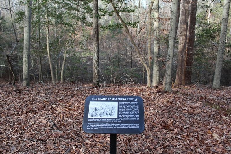
The road trace is in the background.
Another marker is no longer nearby. Seven Days Battles (was approx. half a mile away but has been replaced with another marker now near it).
More about this marker. This trail side marker is part of the new 0.9 mile walking trail on the western end of the Cold Harbor battlefield park.
Also see . . . Richmond National Battlefield Park. National Park Service (Submitted on December 6, 2014.)

Photographed by Evan Dwyer, December 27, 2025
3. Road Trace
Closer view of the depression described in the marker.
Photographed by Evan Dwyer, December 27, 2025
4. The Tramp of Marching Feet Marker
Gaines' Millpond is visible directly beyond.
Credits. This page was last revised on April 20, 2026. It was originally submitted on December 6, 2014, by Shane Oliver of Richmond, Virginia. This page has been viewed 733 times since then and 39 times this year. Last updated on December 27, 2025, by Evan Dwyer of Richmond, Virginia. Photos: 1. submitted on December 6, 2014, by Shane Oliver of Richmond, Virginia. 2, 3, 4. submitted on April 16, 2026, by Evan Dwyer of Richmond, Virginia. • Devry Becker Jones was the editor who published this page.
