Near Del Rio in Val Verde County, Texas — The American South (West South Central)
Site of Chihuahua Road
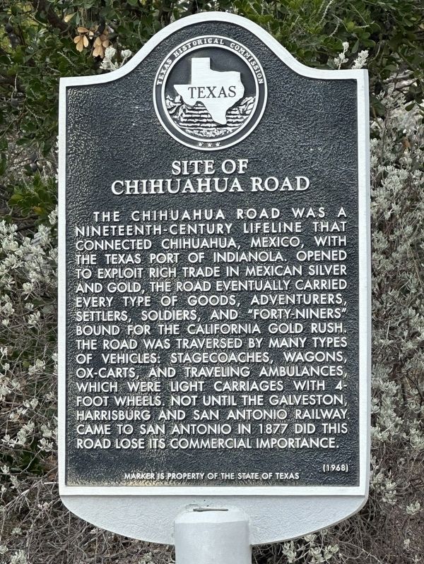
Photographed by Brian Anderson, December 30, 2025
1. Site of Chihuahua Road Marker
Erected 1968 by Texas State Historical Survey Committee. (Marker Number 4755.)
Topics. This historical marker is listed in this topic list: Roads & Vehicles.
Location. 29° 23.455′ N, 100° 42.692′ W. Marker is near Del Rio, Texas, in Val Verde County. It is on U.S. 90 6½ miles west of Ranch to Market Road 3008, on the right when traveling west. Touch for map. Marker is in this post office area: Del Rio TX 78840, United States of America. Touch for directions.

Regionally,
this page online
Other nearby markers. At least 8 other markers are within 11 miles of this marker, measured as the crow flies: Laughlin Army Air Field (approx. 5½ miles away); Lt. Jack T. Laughlin (approx. 5½ miles away); Military Aviation in Val Verde County (approx. 5½ miles away); Rudolf Anderson, Jr. (approx. 5½ miles away); San Felipe Springs (approx. 10.4 miles away); U.S. Army Camel Corps (approx. 10½ miles away); San Felipe Independent School District (approx. 10½ miles away); San Felipe High School (approx. 10½ miles away). Touch for a list and map of all markers in Del Rio.
Credits. This page was last revised on December 31, 2025. It was originally submitted on December 31, 2025, by Brian Anderson of New Albany, Ohio. This page has been viewed 77 times since then and 59 times this year. Photo 1. submitted on December 31, 2025, by Brian Anderson of New Albany, Ohio.
Editor’s want-list for this marker. A wide view photo of the marker and the surrounding area showing its location in context. • Can you help?
