Clarksville in Clark County, Indiana — The American Midwest (Great Lakes)
River Navigation
Photographed by Michael Herrick, May 20, 2017
1. River Navigation Marker
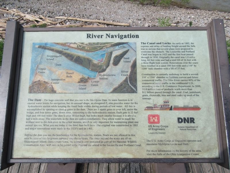
The Dam - The huge concrete wall that you see is the McAlpine Dam. Its main function is to control water levels for navigation, but its unusual shape, an elongated Z, also provides water for the hydroelectric station while keeping the fossil beds visible during periods of low water. All this is accomplished by opening or closing gates in the dam. There are 5 upper gates to your left, under the bridge, and four lower gates, down river, connecting to the hydroelectric station. Each gate is 22 feet high and 100 feet wide! The dam is over 30 feet high, but looks much smaller because it is about a half a mile away. The waterfalls in the dam are called castellations. They allow water to reach the wetland next to the dam even in the driest months, which is very important for maintaining plant and animal species. What you see today is he third dam built here. The original was constructed in 1881 and major renovations were made in the 1920's and in 1961. Behind the dam you see the headwaters for the hydroelectric station. Boats are not allowed in this area because of the dangerous current near the turbines. The trees beyond
this page online
The Canal and Locks- As early as 1802, the expense and delay of hauling freight around the falls was so serious that several plans were proposed to overcome the obstacle. The Louisville and Portland Canal was begun in 1825 and the first boat passed through in 1830. Originally the canal was 1.9 miles long, 64 feet wide and had a total lift of 26 feet with a three flight lock system. Renovations over the years have resulted in a canal 500 feet wide and a 110' by 1200' lock chamber with a lift of 37 feet. Construction is currently underway to build a second 110' x 1200' chamber to facilitate current and future commercial traffic The Ohio River carries 40% of the commercial water traffic in the continental U.S., according to the U.S. Commerce Department. In 2000, 55.8 million tons of products worth more than $12 billion passed through the canal. Coal, petroleum, grain, chemicals, iron and steel make up most of the
Photographed by Michael Herrick, May 20, 2017
2. River Navigation Marker
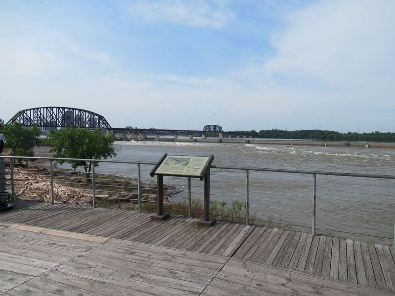
In the background is the McAlpine Dam and the railroad bridge over the Ohio River.
The U.S. Army Corps of Engineers operates and maintains the McAlpine Locks and Dam.
For more information on the history of the area, visit the Falls of the Ohio interpretive center.
Erected by U.S. Army Corps of Engineers & Indiana Department of Natural Resources.
Topics. This historical marker is listed in these topic lists: Industry & Commerce • Waterways & Vessels.
Location. Marker has been reported missing. It was located near 38° 16.586′ N, 85° 45.82′ W. Marker was in Clarksville, Indiana, in Clark County. It was at the intersection of W. Winbourne Avenue and W Riverside Drive, on the right when traveling south on W. Winbourne Avenue. Located on the viewing deck of the Falls of the Ohio State Park Interpretive Center. Touch for map. Marker was at or near this postal address: 201 W Riverside Drive, Clarksville IN 47129, United States of America. Touch for directions.

Regionally, this marker was in Southern Indiana. It was also in the American Midwest, in the Ohio River Valley, and in the Corn Belt. Globally, it was in North America, the Western
Photographed by Michael Herrick, May 20, 2017
3. The Ohio River Below the McAlpine Dam
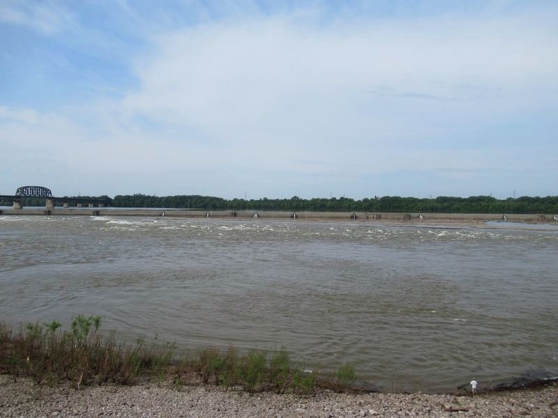
These rapids are the uppermost part of the Falls of the Ohio
Other nearby markers. At least 8 other markers are within walking distance of this location: Navigating the Falls of the Ohio (here, next to this marker); John A. Munz and Coast Guard Ohio River History (here, next to this marker); Falls of the Ohio Fossil Beds (within shouting distance of this marker); History’s Great Explorers (within shouting distance of this marker); Indiana State Parks: the First 100 Years 1916-2016 (about 500 feet away, measured in a direct line); Fossils at the Falls (approx. 0.4 miles away); Scenic Spans (approx. 0.6 miles away); Clarksville (approx. 0.7 miles away). Touch for a list and map of all markers in Clarksville.
Also see . . .
1. Falls of the Ohio Organization. (Submitted on May 29, 2017, by Michael Herrick of Southbury, Connecticut.)
2. Falls of the Ohio State Park, Indiana Department of Natural Resources. (Submitted on May 29, 2017, by Michael Herrick of Southbury, Connecticut.)
3. Falls of the Ohio State Park on Wikipedia.

Photographed by Daniel Barriball, December 27, 2025
4. River Navigation Marker
Credits. This page was last revised on January 12, 2026. It was originally submitted on May 29, 2017, by Michael Herrick of Southbury, Connecticut. This page has been viewed 455 times since then and 70 times this year. Last updated on January 1, 2026, by Daniel Barriball of Chesterton, Indiana. Photos: 1, 2, 3. submitted on May 29, 2017, by Michael Herrick of Southbury, Connecticut. 4. submitted on January 1, 2026, by Daniel Barriball of Chesterton, Indiana. • Devry Becker Jones was the editor who published this page.
