Jourdanton in McMullen County, Texas — The American South (West South Central)
San Miguel Cemetery
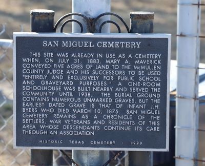
Photographed by Dave W, December 26, 2025
1. San Miguel Cemetery Marker
This site was already in use as a cemetery when, on July 31, 1883, Mary A. Maverick conveyed five acres of land to the McMullen County Judge and his successors to be used "entirely and exclusively for public school and graveyard purposes." A one-room schoolhouse was built nearby and served the community until 1938. The burial ground contains numerous unmarked graves, but the earliest dated grave is that of infant J.H. Byers who died March 10, 1875. San Miguel Cemetery remains as a chronicle of the settlers, war veterans and residents of this area whose descendants continue its care through an association. Historic Texas Cemetery
Erected 1999 by Texas Historical Commission. (Marker Number 17432.)
Topics. This historical marker is listed in this topic list: Cemeteries & Burial Sites. A significant historical date for this entry is July 31, 1883.
Location. 28° 36.215′ N, 98° 33.378′ W. Marker is in Jourdanton, Texas, in McMullen County. It is on Henry Crow 0.4 miles west of Texas Highway 16, on the left when traveling west. Touch for map. Marker is at or near this postal address: 125 Henry Crow, Jourdanton TX 78026, United States
this page online

Regionally, this marker is in South Texas. It is also in the American Borderlands. Globally, it is in North America, a Gulf of Mexico state, the Western Hemisphere, the Western World, and the Anglosphere. Historically, it finds itself in what was once New Spain, the Republic of Texas, and one of the Confederate States of America.
Other nearby markers. At least 8 other markers are within 10 miles of this marker, measured as the crow flies: Cross (approx. 0.6 miles away); Franklin Ranch (approx. 1.6 miles away); McMullen County Veterans Memorial (approx. 9.7 miles away); Camp Rio Frio, C.S.A. (approx. 9.7 miles away); San Caja Hill (approx. 9.7 miles away); Original Burial Site of Moses William Hindes (approx. 9.8 miles away); Boot Hill Cemetery, 1858-77 (approx. 9.8 miles away); Old Rock Store (approx. 9.8 miles away).
Also see . . . Information about Mary A. Maverick whom donated the land and has deep roots in Texas History. One of the early sketches of the Alamo after the siege.
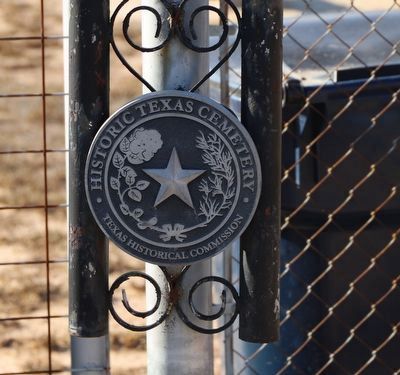
The end of the Texas Revolution brought with it an increase in immigration from the United States(Submitted on January 1, 2026, by Dave W of Co, Colorado.)to the newly formed Republic of Texas. Among these immigrants was Mary Ann (Adams) Maverick, the young wife of Samuel Maverick.Photographed by Dave W, December 26, 20252. San Miguel Cemetery MarkerHistoric Texas Cemetery medallion on other side of entrance.
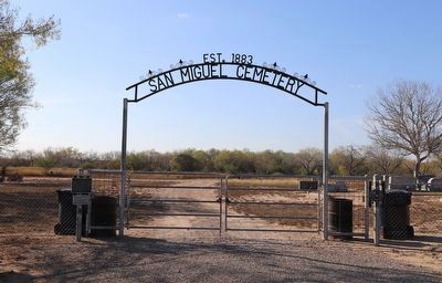
Photographed by Dave W, December 26, 2025
3. San Miguel Cemetery Marker
Entrance to cemetery with plate on left medallion on right.
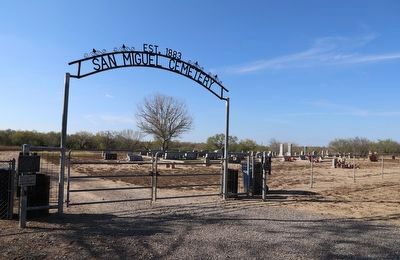
Photographed by Dave W, December 26, 2025
4. San Miguel Cemetery Marker
Looking at the cemetery from outside the entrance.
Credits. This page was last revised on January 1, 2026. It was originally submitted on January 1, 2026, by Dave W of Co, Colorado. This page has been viewed 53 times since then. Photos: 1, 2, 3, 4. submitted on January 1, 2026, by Dave W of Co, Colorado. • James Hulse was the editor who published this page.
