Rockport in Aransas County, Texas — The American South (West South Central)
Using what's Available
Photographed by Dave W, November 9, 2025
1. Using what's Available Marker
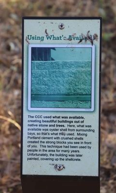
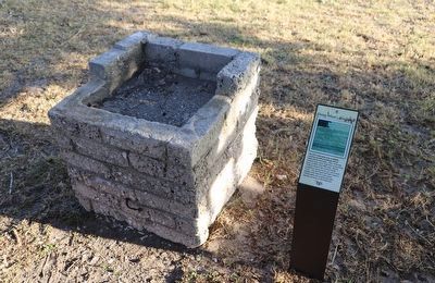
The CCC used what was available, creating beautiful buildings out of native stone and trees. Here, what was available was oyster shell from surrounding bays, so that's what they used. Mixing Portland cement with crushed shells created the strong blocks you see in front of you. This technique had been used by people in the area for many years. Unfortunately, the building was later painted, covering up the shellcrete.
Erected by Goose Island State Park.
Topics. This historical marker is listed in these topic lists: Charity & Public Work • Parks & Recreational Areas.
Location. 28° 7.815′ N, 96° 59.127′ W. Marker is in Rockport, Texas, in Aransas County. It can be reached from Park Rd 13B half a mile south of Main Street, on the left when traveling south. Touch for map. Marker is in this post office area: Rockport TX 78382, United States of America. Touch for directions.

Regionally, this marker is on the American Gulf Coast. Globally, it is in North America, a Gulf of Mexico state, the Western Hemisphere, the Western World, and the Anglosphere. Historically, it finds itself in what was once New Spain, the Republic of Texas, and one of the Confederate States of America.
Other nearby markers. At least 8 other markers are within 3 miles of this marker, measured as the crow flies: Built to Last (a few steps from this marker); Site of the Town of Lamar (approx. 0.8 miles away); Stella Maris Chapel (approx. 0.9 miles away); The Lamar Cemetery (approx. 0.9 miles away); John Fagan (approx. 0.9 miles away); Mills Wharf (approx. 1.4 miles away); Lamar Volunteer Fire Department (approx. 1½ miles away); Site of One of the Homes of James Power (approx. 3 miles away).
this page online
Photographed by Dave W, November 9, 2025
2. Using what's Available Marker
Credits. This page was last revised on January 3, 2026. It was originally submitted on January 1, 2026, by Dave W of Co, Colorado. This page has been viewed 70 times since then. Photos: 1, 2. submitted on January 1, 2026, by Dave W of Co, Colorado. • James Hulse was the editor who published this page.
